|
There was only one other car in the parking lot when I started
up the Brokeoff Mountain trail at 8:24am. The sky was completely
blue. I couldn't have picked a better day.
I crossed the road and entered the bushes at the bottom of the
trail, an elevation of about 6650 feet. Water rushes down over
the trail at one point. Even though I was close to the park road,
I soon felt very isolated. It was a very peaceful morning. It
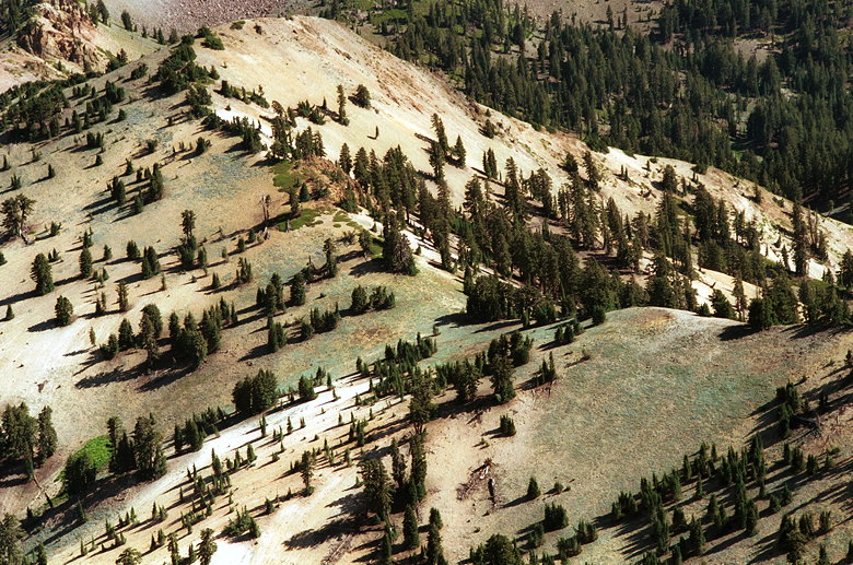
wasn't long before I had a nice view of Lassen Peak to the northeast.
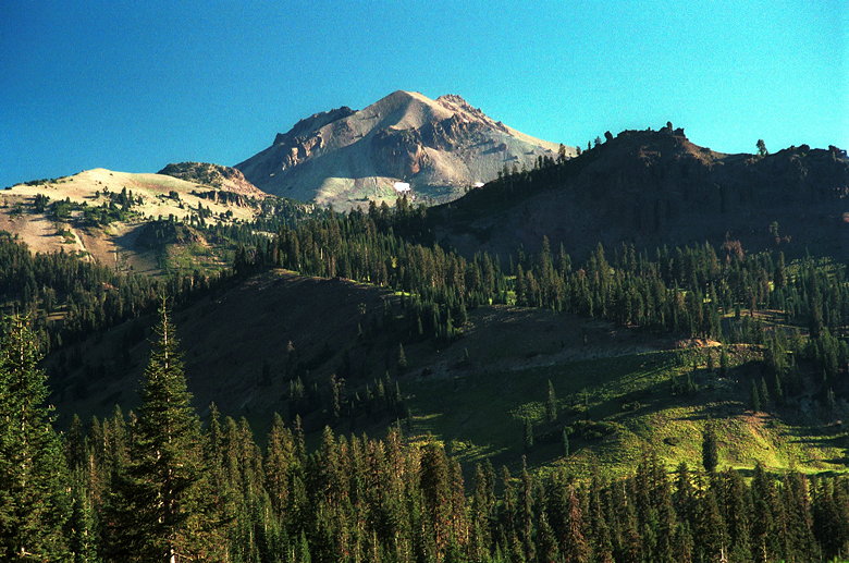
Lassen Peak from the Brokeoff Mountain trail
After the bushes come forests and small lakes. I really enjoyed
walking through some of these forests. I can't really explain
why, but they just seemed peaceful and open. Maybe it's that the
trees were light in color -- not too dark, not foreboding. I didn't
really worry that a bear would jump out from behind one. The trees
also aren't spaced too close together, and the forests are small.
Unfortunately, I didn't think I could capture the way I felt about
the forests in a photograph, so I didn't take any.
A stream flows near the trail, and a large meadowy area includes
a nice display of wildflowers, along with a view of the summit.
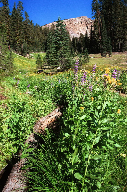
Wildflowers in front of Brokeoff Mountain
As the trail continues higher, the views get better. Soon I had
views of not only Lassen Peak, but also the green slopes in front
of it, and part of the park road.
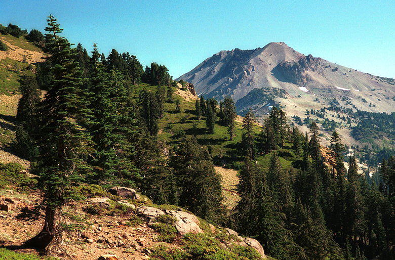
One of my favorite views of Lassen Peak, from further up the trail
I saw several deer while hiking on the trail. One of them noticed
me coming up the trail and slowly started walking over to the
shade, away from the trail, lest I bother it. He did let me take
several pictures before finding shelter, though.
At about the 8000 foot level (1200 feet from the top), I met the
owner of the other vehicle. He was coming down from the peak.
He said the views were "fabulous" and that it was a "nice little
walk." I was sure that he was right. I also knew that I'd have
the trail completely to myself now. In fact, during the entire
hike, I would only see 7 other hikers, and just the one on the
ascent.
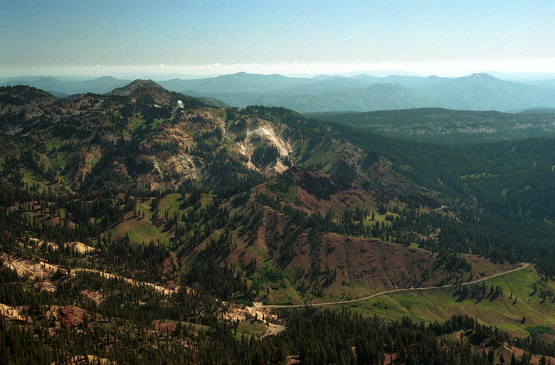
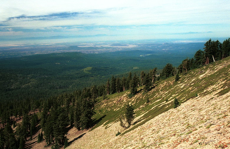
The trail curves around the southern side of the mountain. As
it does so, more views open up. The steep slopes below are covered
with greenery and thick forest. Soon I had views of the coast
range. I could see that while it had started out completely clear,
clouds were beginning to move in from the west. None of them looked
threatening, however, and it would still be hours before they
reached me.
Though I stopped several times to take pictures (even taking the
time to use my tripod), I made good time. Soon I was gawking at
the view from the ridge near the summit. From here I had an incredible
view of Lassen Peak and all the peaks in between Brokeoff Mountain
and Lassen Peak. I was looking straight down at some of the tree
tops hundreds of feet below - a bird's eye view, if you will.
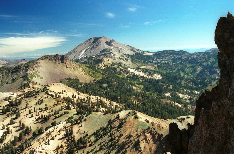
Lassen Peak as seen from ridge near summit
Closer view of the trees below
After taking numerous photographs, I made the short walk up to
the summit, reaching it at 10:30am. Brokeoff Mountain (elevation
9235) is the Tehama county highpoint. The summit is completely
flat and about the size of a very large living room. There was
nothing to sit on except the chair that I'd brought up.
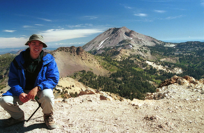
Sitting on the summit
Besides the views of Lassen Peak, I could clearly see snow-covered
Mount Shasta far to the northwest. The summit allows a complete
360-degree peak experience. Although the views to the south and
east are less compelling than those to the north and west.
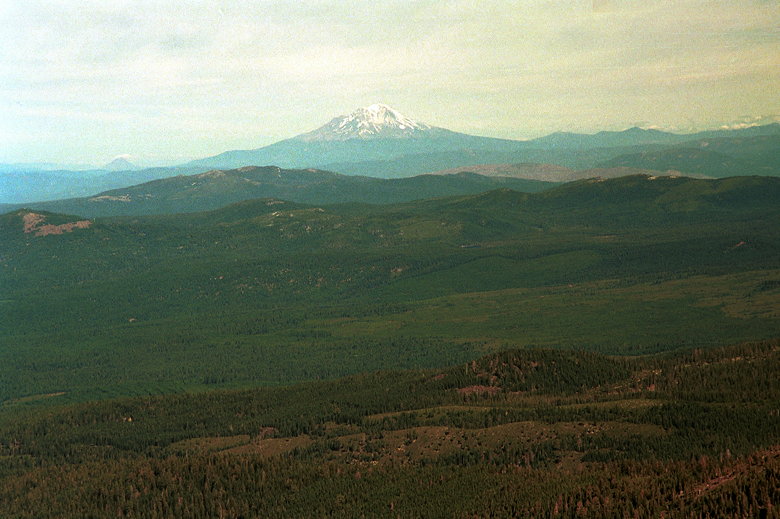
Mount Shasta
The park road as seen from the summit
While I hadn't had any weather radio reception in camp, it worked
fine at the summit. The broadcast didn't tell me anything significant.
The clouds continued to move in slowly, but I wasn't worried.
Eventually, though, I decided I would have to descend if I ever
wanted to do the other activities I'd planned for the day, so
I started my descent at 11:10am.
The sloping backside of Brokeoff Mountain; Coast Range in the
distance
Soon I ran into a pair of hikers coming up the trail. Then, at
the 8600 foot level, I met GPS man -- a hiker hauling GPS equipment
up for the NPS, mapping the trail. He mentioned something about
using a base station to compensate for the random errors of civilian
GPS. Basically, it meant the GPS he was carrying my have the altitude
off by 500 feet, but it could be corrected when he returned.
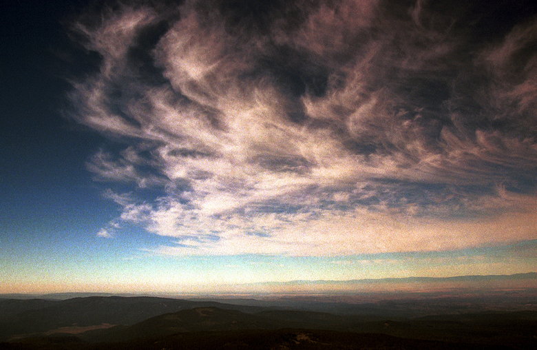
Swirling clouds making their way from west to east
At the 7900 foot level I encountered another lone hiker coming
up. After that, I figured I would have the trail all to myself
again. It was getting later in the day, and I figured not many
people would want to start this late.
Near the bottom, though, I did run into a pair of backpackers
coming up the trail. They said they were camping at Forest Lake.
I didn't mention that I hadn't seen anything that might have resembled
Forest Lake. Perhaps it was too far off trail, or it had been
overtaken by meadow.
I reached my car a little after 12:30pm. It was a thoroughly enjoyable
hike. I'd done the hike partly because it was the Tehama county
highpoint, and partly as an acclimatization hike for Lassen Peak.
However, I found that the hike was beautiful in its own right
-- one of my favorites. A hike with a memorable summit experience,
and one I'd love to do again sometime.
Return to Lassen Volcanic NP trip report.
| 

