|
Dhananjay, Lucinda, Marie, Mikee, Naoko, Reza, and I went to do
several hikes in and around the San Francisco and Marin headlands.
We parked near the Coastal Trail trailhead, on the other side of
the bridge from the Toll Plaza parking lot. We then took the Coastal
Trail south along the coast. Along the way we passed by one or two
batteries -- remnants of World War II defense. There are some really
nice views along the way, but Lincoln Blvd., which is adjacent to the
trail, detracts from it a bit. We made our way down to Baker Beach
where we were presented with some contrasting views. There a short
distance away was the Golden Gate Bridge. And there, on the beach in
front of us, were several nude men. This, apparently, isn't uncommon
on Baker Beach. Carefully avoiding them as much as we could, we
headed up a staircase back to the trail. Unfortunately, most of the
staircase was covered with sand -- making our ascent painstakingly
difficult. If you ever want a good workout, try going uphill in the
sand.
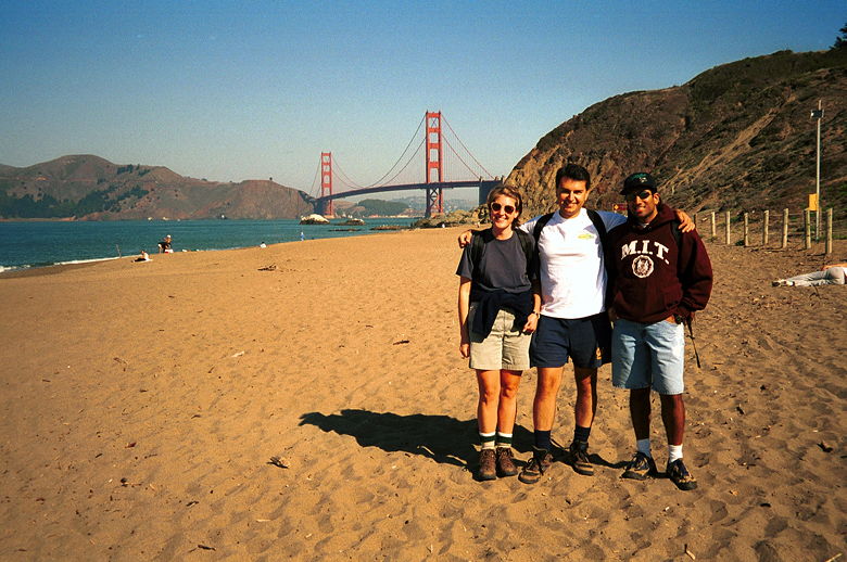
The view from Baker Beach. You probably don't want to see
the view of what's directly behind Marie, Reza, and Dhananjay.
After returning the way we came, we walked across the Golden Gate
Bridge. Along the way we (Marie, Reza, and I) crossed paths with
Lucinda, Mikee, and Naoko, who were going to drive my car over. This
was Naoko's great idea so we could all walk the length of the bridge
(which is 1.5 miles long). Dhananjay drove his own car over.
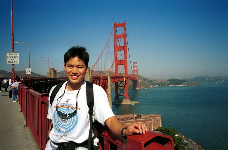
It's the wind, I swear -- my hair's not usually like that!
That's Fort Point next to my left hand.
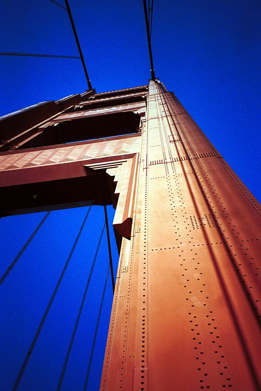
When you stand next to one of the huge towers, you can't
help but get a sense of vertigo.
At the end of the bridge we all met up again at Vista Point, where
busloads of tourists come to take pictures. We continued our hike,
walking under the bridge and down to Horseshoe Bay. We were just
talking and walking down this paved road and then I looked to my
right and the view of the bridge was incredible. Hope the pictures
turn out. We continued around Horseshoe Bay and had lunch at Cavallo
Point, which provides a great vantage point for watching the
sailboats and taking in the views of the bridge, the city, and the
bay. After lunch we wandered around Battery Yates before returning to
our cars.
Turn the corner...and this is the breathtaking view from
the northeast side of the bridge.
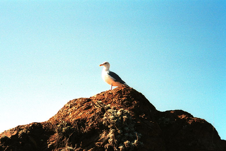
I was almost close enough to touch this seagull at Cavallo
Point before he flew away.
We drove on Conzelman Road toward Hawk Hill, but couldn't find
adequate parking so we continued along, with the plan of returning
later. We instead kept going to Point Bonita. It's a very short hike
from the parking area to the lighthouse. Along the way we could look
down the cliffs to the bay and see seals playing in the water. We
could also see what we would later learn is Black Sand Beach --
clothing optional. Marie's prodding of a park ranger at the
lighthouse provided us with that information. The lighthouse has been
in use since before the 1906 earthquake, and is still being used
(albeit with upgraded equipment).
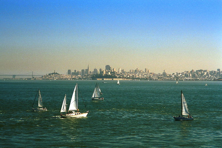
Sailboats on the bay
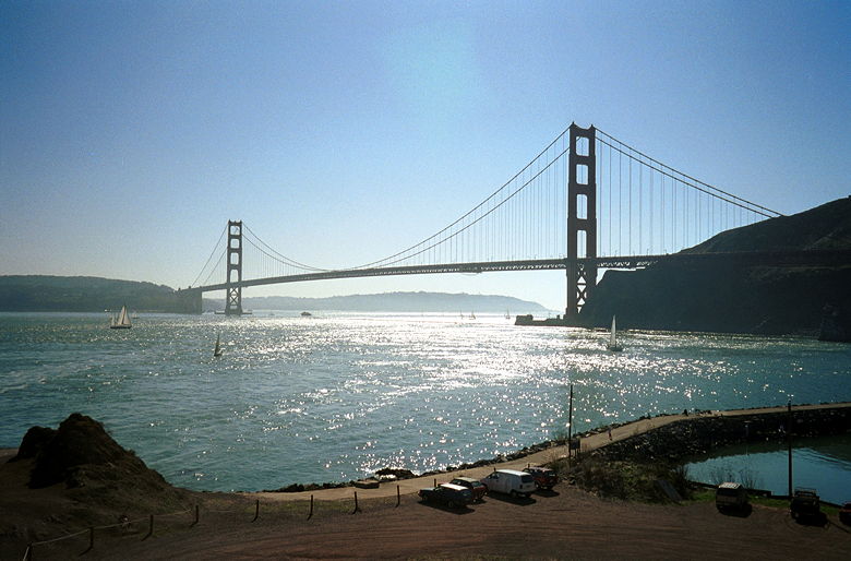
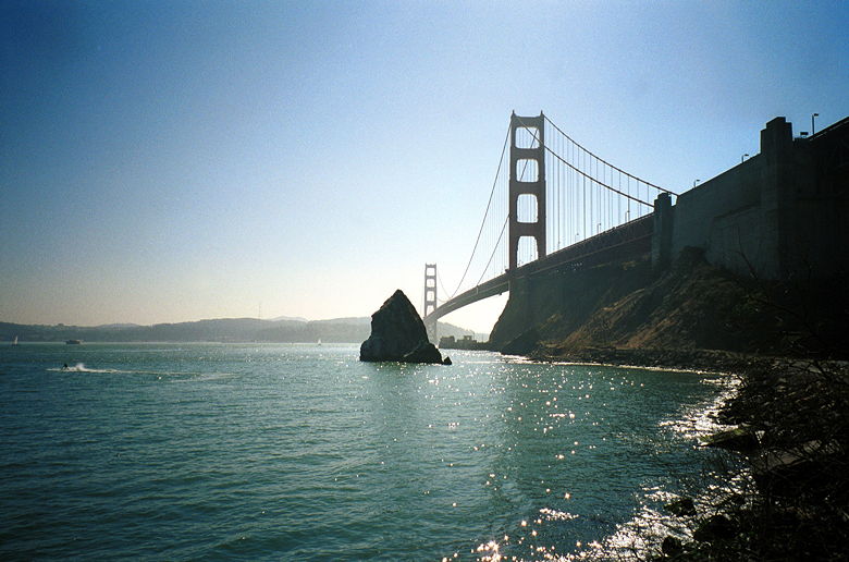
A full view of the bridge
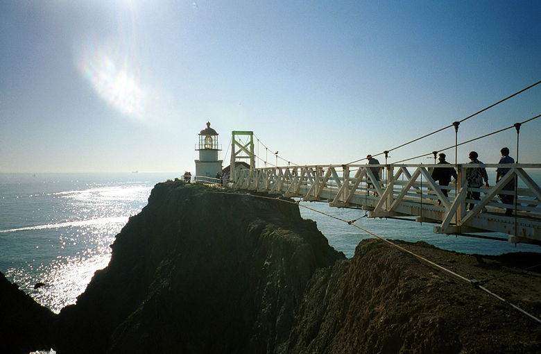
The Point Bonita lighthouse. The bridge has a maximum load
of 5 people or 950 pounds.
After returning to our cars again we made the short drive to Rodeo
Beach (at the Fort Cronkhite parking area). We were supposed to start
at Fort Barry, but there didn't appear to be parking -- instead, we
saw a sign that said "Warning: Sentry Dogs". Maybe that's near the
Nike Missile Site we didn't see. In any case, we walked along the
beach, passing a dead seal along the way (whose smell we discovered
when we walked downwind of it on the way back). Dead seal
notwithstanding, it was nice to walk along the beach with the waves
pounding on the shore. There were surfers enjoying the waves, as
well. We hiked up for more views of the ocean and beach, and also the
bridge again. Along the way we passed by Battery Alexander.
After returning to our cars yet again, we made the drive back to
Hawk Hill, where we found parking easier this time. We made the very
short hike from the parking area to the top of the hill and were met
with fantastic views of the bridge and surrounding area. At 920 feet,
it's one of the highest points along the Marin headlands.
Unfortunately, we didn't see any hawks. We did see measurements of
wingspans of various birds, but that was it. And we did see the
effects of the setting sun on distant fog.
| 

