|
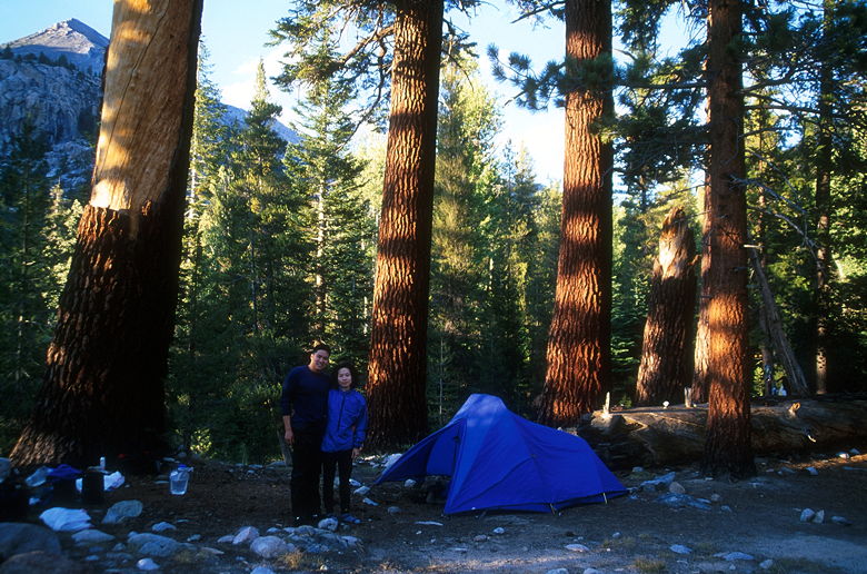
We woke up at 6:30am, had breakfast, and broke camp. We hadn't been able to fit
everything in our bear canisters, so I had put some of our overflow food and scented
items into the shared bear box by site 2. When I retrieved them, everyone else had
already taken out their items. We were the last to leave, at just past 9am, on another
perfectly clear day.
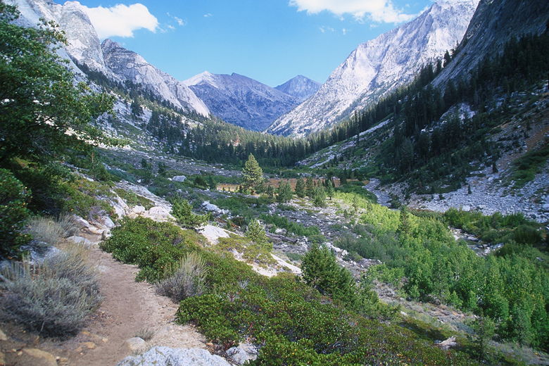
The trail goes through more beautiful forest before opening up into a meadow. Some
scattered trees here showed the effects of a past fire. More mountains lay in front
of us as we followed the river upstream. We had brief glimpses of small waterfalls
as we continued along the trail, which goes up and down toward Upper Paradise. The
Rae Lakes Loop map says it's only 1.5 miles from Middle to Upper Paradise, but I think
that's not true. It took us a long time to get there. Eventually we had to stop for
food and to apply sunscreen. When we finally arrived at Upper Paradise, the sign there
says it's 2.2 miles from Upper to Middle Paradise. I believe that more than the 1.5,
and that's what I'm basing the 7.8 miles on.
There are 6 sites and two bear boxes at Upper Paradise.
No one was camped here; in fact, we hadn't seen anyone so far today. We now had
the task of crossing the South Fork of the Kings River. Two narrow logs fed into a
very large log across to the other side. Jean began to walk on the two logs, but
soon decided she couldn't do it. She carefully backed up and decided to rock-hop
instead. She picked her way across and, with the help of her trekking poles and one
small leap, made it to the other side still dry.
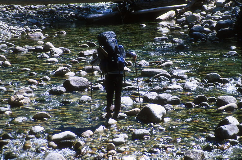
Crossing the river
After catching her in action, I put my camera away and did the same. When I reached the
other side I found I had to climb onto the large log or tear my legs up in a patch of
thorns. It was quite hard for me to get onto the log with a 58 pound pack on my back,
but somehow, after much struggling, I managed to do it. I then stood up and walked along
the large log to safe ground. We now had 5.6 miles to go, albeit mostly uphill. It would
feel like the longest 5.6 miles I've ever hiked.
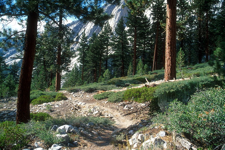
The trail heads into the forest and starts climbing immediately. After climbing for
awhile, we stopped for a break under some trees. While we were there, a group of 6 or 8
backpackers passed by in the opposite direction. Those were the only people we saw for
some time as we climbed up, above Woods Creek. While the trail parallels the creek,
it spends much of the time far above it.
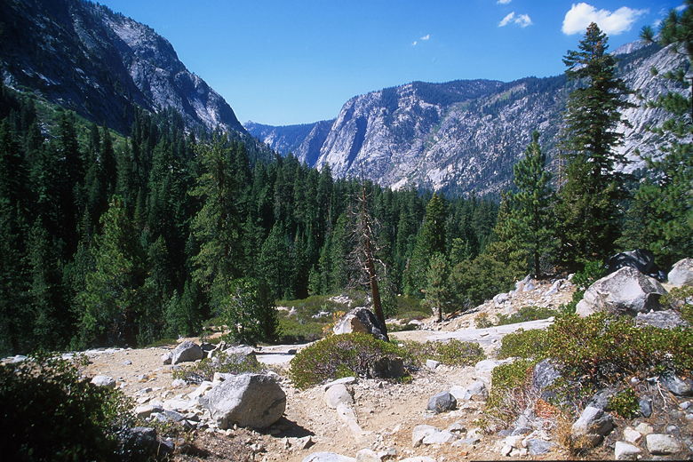
View looking back toward Paradise Valley
The trail closely approaches the creek in one spot, and we found the East Coast pair
and the pair of hikers including the woman with the bandaged knee here, resting and
filtering water. Jean and I stopped to check our water supply, and it was a good
thing we did, as I was completely out. I filtered water while Jean and the woman
discussed the merits of Luna bars.
The others left while we were still there. After our break, we continued up the
trail. Now, the map shows two creeks perpendicular to the trail where I had hoped
to filter water. But we never found them -- they must have been dried up at this
time of year. So if you go late in the year, don't count on them for water.
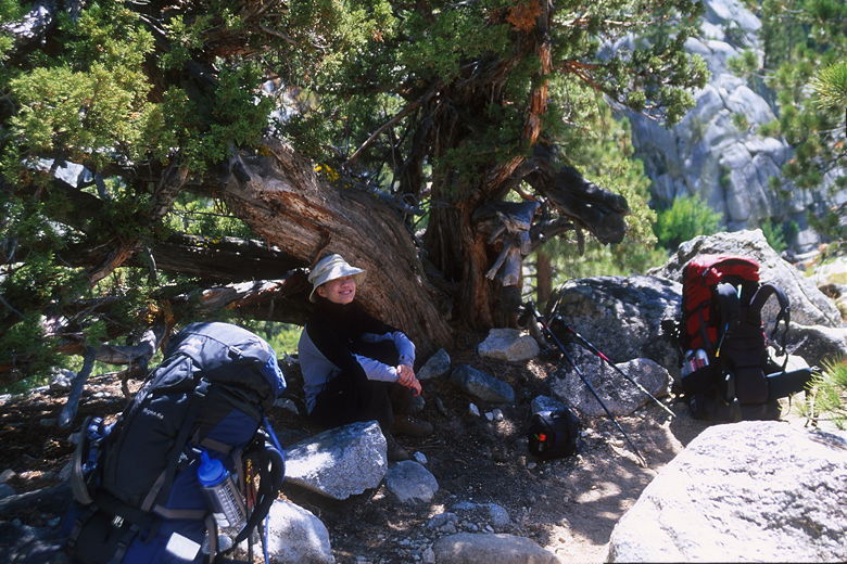
Resting by the trail
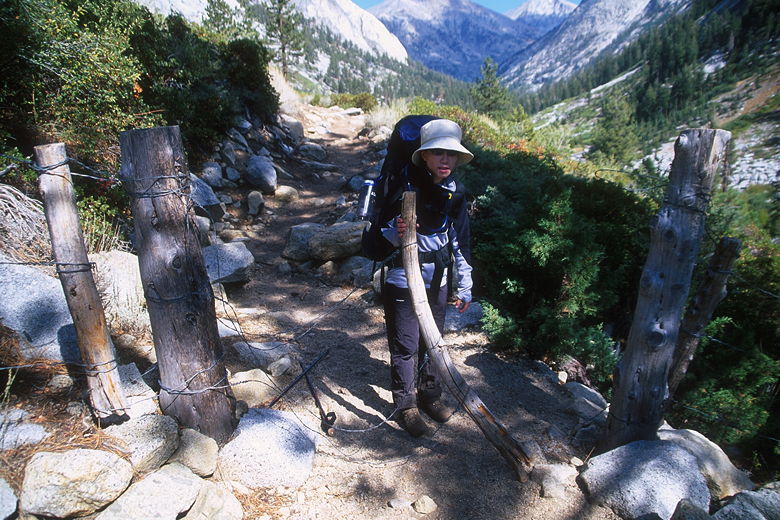
Drift fence
The valley ahead of us
Trees along the trail
The sun was hot, the trail climbed relentlessly, and seemed to stretch on forever.
Eventually we reached a drift fence which is marked on the map, so we knew approximately
where we were. We closed the gate behind us and continued on down into Castle Domes
Meadow. The meadow is filled with aspens, their leaves fluttering in the wind --
nature's wind chimes. The aspens in the meadow were twisted and short, but the ones in
the forest stood tall. I haven't seen many forests like the one we passed through - a
mixed forest of pine and aspen. The trees grew side by side, intermixed. A few of
the aspens
were showing hints of turning yellow, but most still had green leaves.
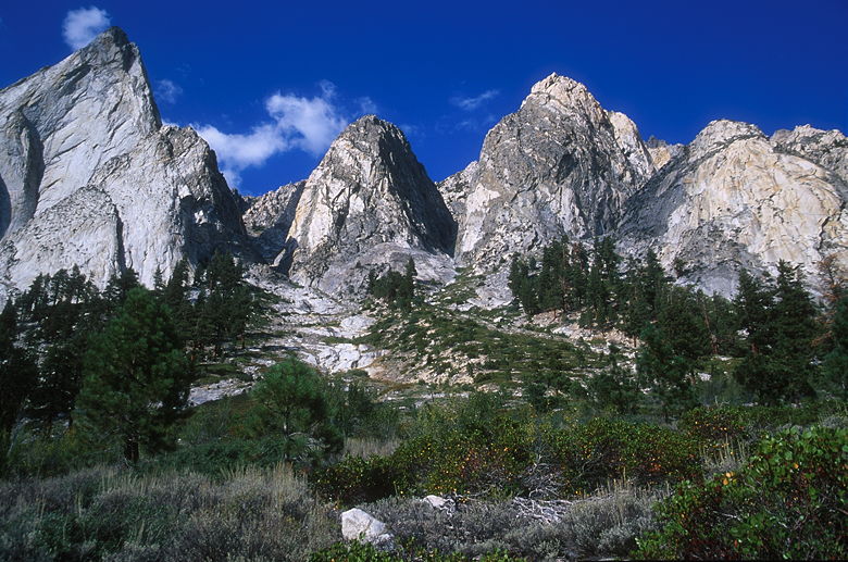
Castle Domes
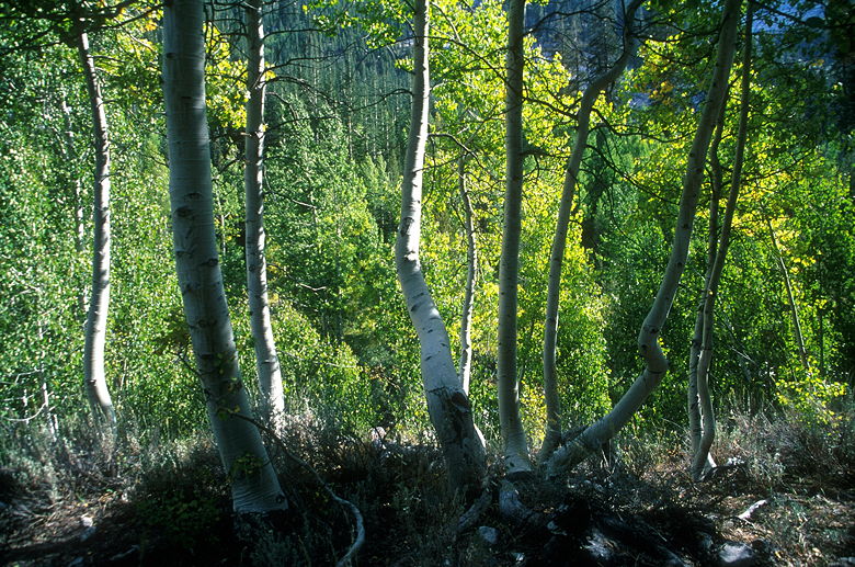
Aspens
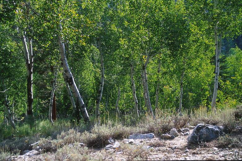
More aspens
To our left, above us, Castle Domes was clearly visible. In front of us, the valley
culminating in a set of mountains. We knew we had to reach nearly the end of the
valley, just before those mountains. At least now we knew our target. But the
trail still seemed to stretch on forever. Eventually we grew close. We passed a
second drift fence which isn't marked on the map. Soon I smelled
a campfire and we passed a set of horsepackers who had set up camp near the creek.
Soon after that we crested a short hill and descended to a trail junction -- the John
Muir Trail!
Jean crossing the bridge
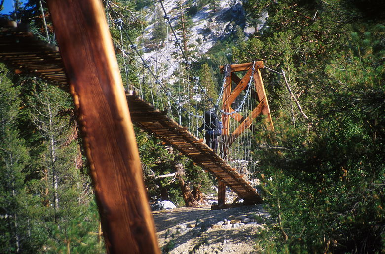
We turned right onto the JMT and then came to a bridge which crosses Woods Creek.
The bridge is a suspension bridge, held up by cables, with wooden planks along the
bottom. It sways a lot, and is meant for only one person at a time. I made the
mistake of crossing while still holding my trekking poles in one hand. If I had to
do it over again, I would have put the poles away, strapped to my pack somewhere.
But I did make it across easily enough.
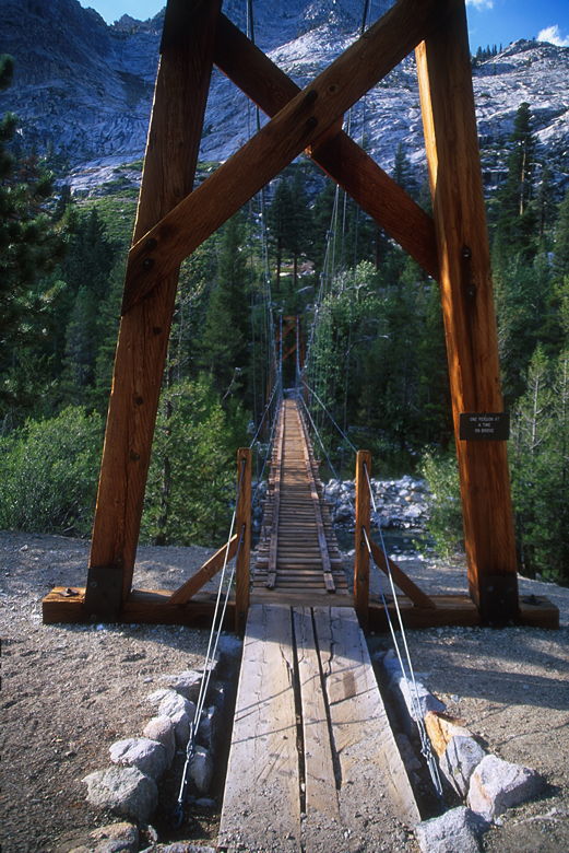
Woods Creek Crossing
On the other side, several people were talking to a stocky man who claimed he was
trying to set a record for backpacking along the JMT from Yosemite to Whitney and
back, 7 days each way (about 30 miles a day). He talked for a while, but ended up
leaving to go hike some more while there was still light. The rest of us mere mortals
set up camp for the night.
There were already several groups set up, but there weren't any
assigned sites like at Paradise Valley. I set down my pack to prepare to look around
for a camp site without it, and it was then that I noticed my squirt bottle was missing.
I brought a
small squirt bottle to help with washing dishes. I also use it for when I brush
teeth, and for general drinking around camp and in the tent, since it's more convenient
than a CamelBak for that purpose. I guess it must have popped out of my side pouch
when I'd put my
pack on after a rest stop. My guess was that it was somewhere a couple miles back on
the trail, somewhere in Castle Domes Meadow.
I was disappointed about the bottle, but put it aside and looked for a site. Eventually
I found one above the other sites. We set up camp, washed up, got more water from the creek, and I
took some pictures of the beautiful afternoon light shining on the sequoias. Then we started cooking our dinner.
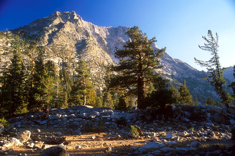
Mountain above Woods Creek camp
While
we were cooking, a group of three came up the trail and started setting up camp near us.
It was the first group we'd seen on the trail yesterday. I figured they must have been
behind us the whole way up here, so maybe they'd picked up my water bottle. On the off
chance they had, I asked them if they'd seen it. In fact, they had, and it was just on
the other side of the bridge we'd just crossed! Thankful, I finished dinner and then
walked across the bridge in my slippers, radio in one hand and headlamp in the other.
It was still light, but I couldn't see my bottle anywhere. I kept walking up the trail,
until I finally found the bottle, lying in the middle of the trail just past the JMT
junction. Perhaps I'd adjusted my pack at that point and it'd fallen off. In any case,
I retrieved the bottle and crossed the bridge for the third time.
Our camp site
There were a lot more people camped with us than the previous night -- perhaps because it
was part of the JMT. The woman with the bandaged knee invited us to a camp fire they were
setting up. There are a couple bear boxes and some fire pits here, at 8500 feet (campfires
are not allowed above 10,000 feet). Jean and I decided to join them and meet some of the people
we'd seen on the trail so far.
Around the camp fire, there was Monica (the woman with the bandaged knee), Hugh (her friend),
Martina and Hillmar (couple from Holland), Andy (experienced backpacker going solo),
and Scott (one of the three camping next to us). Scott was here with his brother-in-law Steve
and his father-in-law Kenny; they were from Virginia. Also camped in the area was the East
Coast pair, but they didn't join us at the camp fire. Interestingly enough, we didn't meet anyone
from the Bay Area on our hike. Seems like not many people in the Bay Area even know where Kings
Canyon is. It's a shame, but that's fine with me -- just means it's less crowded than better-known
Yosemite.
We talked about all sorts of things ranging from hike-related issues to the excess of Americans
(big food, big people, big cars). Scott, Steve, and Kenny had brought along their fishing rods,
and Scott talked
about going trout fishing in the lakes ahead of us. Monica said that the ranger back at
Road's End had said that there was a 2-night limit at Rae Lakes. The map I had said there was a 1-night
limit, which had been part of my decision to stay at Rae Lakes one night, and Sixty Lakes Basin the
next. But hearing this, I began to think we could stay at Rae Lakes for two nights, and do Sixty Lakes
as a day hike. That would make things more comfortable.
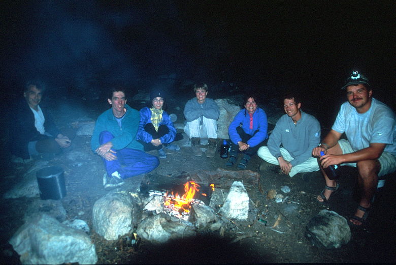
Camp fire
Everyone else had rented bear canisters at Road's End or the ranger station back at Cedar Grove. We'd
brought our own; we could have saved ourselves almost a pound each if we'd rented the lightweight
canisters. Oh well.
| 

