|
I hiked in D.L. Bliss State Park and Emerald Bay State Park.
It was a Tuesday afternoon, but the Calawee Cove parking area
at D.L. Bliss State Park was already full. Summer at Tahoe. Thankfully,
the lighthouse parking lot wasn't full, and there's a trailhead
there.
I headed north along the Lighthouse trail toward Rubicon Point.
It descends gently toward the lake, passing through fire-scarred
forest. There are peek-a-boo views of the lake along the way.
Shortly there's a path to the right toward the old lighthouse.
I instead continued north, eventually emerging from the trees
to the parking lot near Rubicon Point.
While I'd had the entire trail to myself, I could now see a few
hikers coming out of the Rubicon Trail, and I could see hordes
of people enjoying Lester Beach and Calawee Cove Beach. I snapped
some pictures and continued south on the Rubicon Trail.
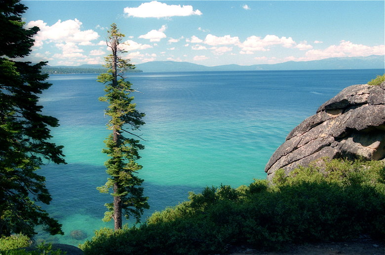
Lake Tahoe from near Rubicon Point
The trail stays close to the lake shore, with constant views of
the lake to the left. Heavenly's ski runs are clearly visible
to the south. Expect to share the trail with other hikers and
trail runners, however. It's very popular; don't even think about
doing it on a weekend. Also, there are lots of little side trails
which go down toward the lake. It may be difficult to distinguish
between the real trail and these side trails.
The water here is amazingly clear. Unfortunately, there isn't
much space on the narrow trail to stop and enjoy it. There are
steep drop-offs to the lake below (no sandy beaches).
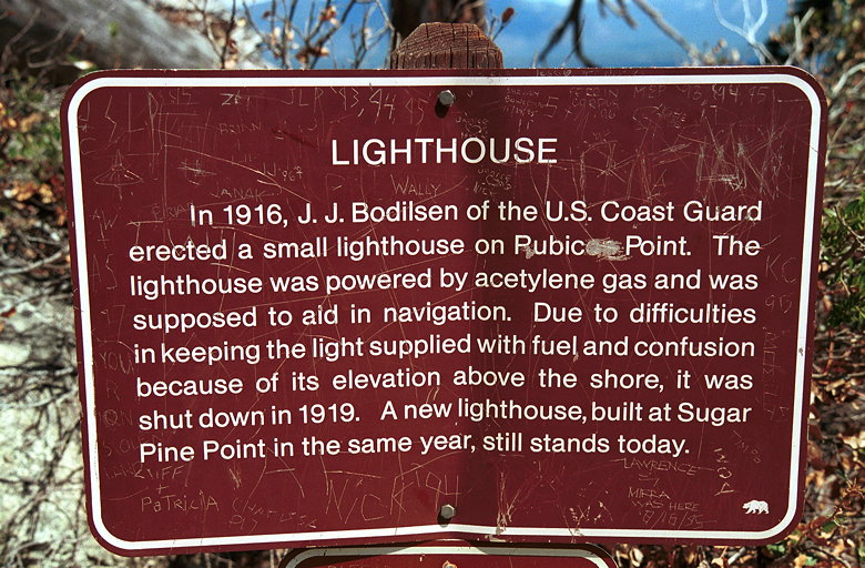
Pubic Point?
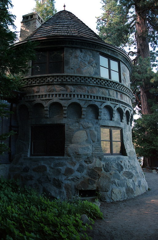
Shortly I came to the side trail which would take me up to the
old lighthouse. After a short climb and descent, I saw the lighthouse,
which looks more like an outhouse (and is about the same size).
After this disappointment, I retraced my steps and continued on
the Rubicon Trail, which starts to head uphill and inland.
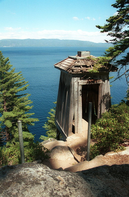
Lighthouse
There's a trail with a sign that says "nature center" that goes
to the right. I would take that later to get back to my car. For
now, however, I continued through the forest. Eventually the trail
heads downhill, back toward the lake shore. It then closely follows
the shore the rest of the way.
As I found myself alone (for a change) on the trail, I heard what
sounded like a strong wind rustling through the trees. The funny
thing was that I couldn't see evidence of such wind. Shortly I
came to the cause of the sound -- water rushing across the trail,
down to the lake. I carefully crossed two cascades of water and
continued.
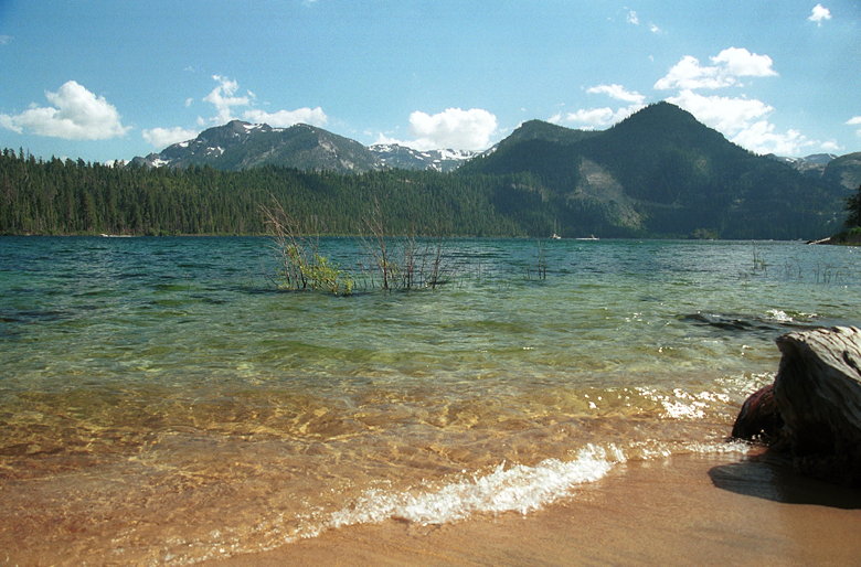
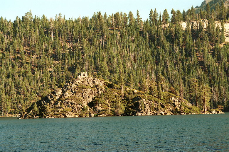
The view from Emerald Point
At one point along this section of the trail is a rock where two
people were resting, enjoying the views. It's one of the few places
on the trail which allow that. The trail touches the lake for
a brief moment. Then there's a sign at a trail junction -- Emerald
Point or the bypass. I took the trail to Emerald Point. There's
a tiny beach at Emerald Point from which Mt. Tallac is clearly
visible above Emerald Bay.
The Tea House on Fannette Island
Halfway along the shore is Boat Camp, which has campsites and
a small pier. Visible in the middle of Emerald Bay is Fannette
Island (Lake Tahoe's only natural island), upon which rests the
Tea House. All along this part of the trail are many wildflowers,
including lupine and columbine. There are also dried-up remnants
of the alien-looking red flower (which I first spotted in Sequoia
NP) I have yet to identify.
Vikingsholm
At the end of the Rubicon Trail is Vikingsholm -- "considered
the finest example of Scandinavian architecture in the Western
Hemisphere" -- a 48-room castle which was built in 1929. After
perusing the outside of the castle, I returned the way I came.
To save some time I took the bypass trail on the way back. I took
the trail toward the nature center. This dropped me off on the
road, but at the ranger kiosk, a few hundred yards from my car.
I walked down the road, passing a trailhead on my right which,
presumably, is the one I really wanted to take. Oh well.
| 

