|
Once again, the directions weren't clear. The California Hiking book states that the hike
to the top of Sierra Buttes is 5 miles and starts at 6000 feet elevation. We followed
the driving directions, but soon found ourselves climbing well above 6000 feet. We turned
around as I looked in another book, which described the hike starting at 6000 feet but
being 7 miles. Eventually, by analyzing the USGS Sierra City map, I realized the
problem. There's a road which climbs to 7000 feet. The hike from there starts at 7000
feet and is about 5 miles. The hike from 6000 feet is in fact 7 miles. The California
Hiking book mixed the two.
So to make a long story somewhat shorter, we drove toward Packer Lake, took a left, went
up the winding narrow road to the top, made a left, and parked at the parking lot where
the pavement ends. There were several other cars here in the dirt lot, most of them
mountain bikers.
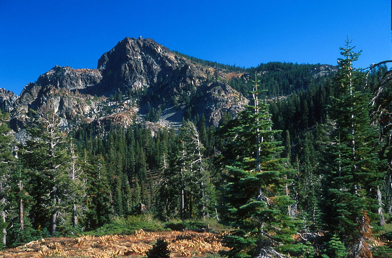
We could clearly see the lookout tower atop Sierra Buttes from the parking lot as we
prepared for the hike. We hiked down the gravel road to discover that there's another
parking lot by the trailhead about a tenth of a mile down the road. Well, at least
we didn't have to drive on gravel. Beyond this lot, the road becomes an off-road
4-wheel-drive road.
We wouldn't be walking on the road, thankfully. We slipped beyond a gate and started
our hike on a section of the Pacific Crest Trail. The trail starts climbing immediately,
slowly switchbacking up along a wide dirt trail that's probably a former logging road.
In fact, evidence of logging abounds. Some sections of forest are noticeably thinner,
and there are patches filled with 5-20 year old trees which were clearly planted to
replace the ones that were cut down. It was clear we were hiking in a National Forest
and not a National Park. At least there are no visible patches of clear cut to truly
ruin the experience.
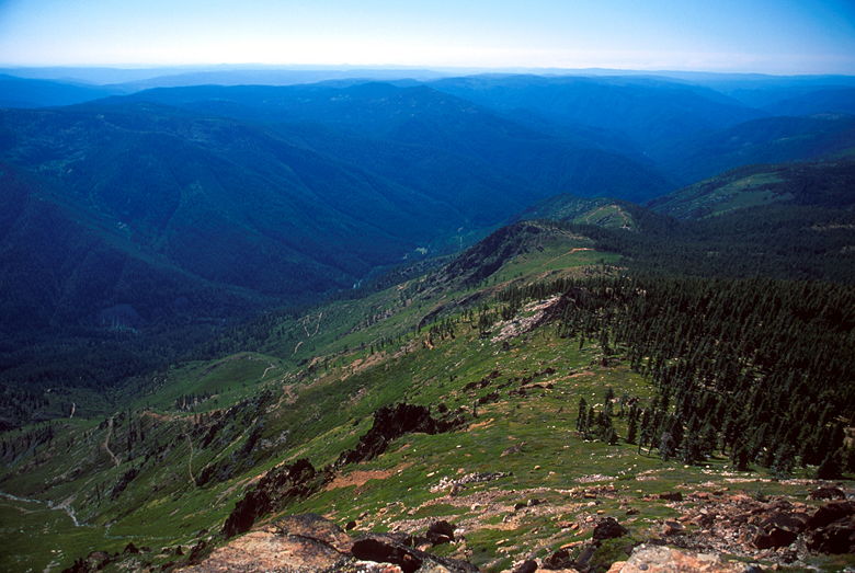
After about 400 feet of climbing, the trail levels out for a stretch. There are views
to the west and east. Range after range of mountains stretch off toward the horizon
to the west. To the east, one range stands tall on the edge of the Lakes Basin
to mostly block our view of what lies beyond.
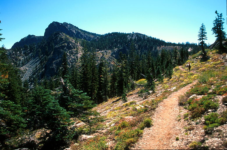
The trail leading toward Sierra Buttes
The trail skirts the rim above Tamarack Lakes. The two lakes were clearly different --
one was blue, and one was green. It seemed more of a murky green than the clear green
of Jennie Lake, however. Soon we reached an intersection with
the trail we could have taken from further down, up past Tamarack Lakes. We continued
straight on toward Sierra Buttes. As a reminder of all the 4WD roads, we passed a parked
car. It had a mountain bike strapped to its back. It was hard to imagine a car coming
up the sorry excuse for a road to where it now sat.
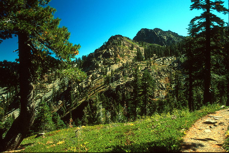
A little further up the trail
It would get worse, though. We soon passed through a big dirt parking lot where there
were a couple of cars. Shortly beyond that, a huge group of teenagers wrestling with
their trucks hopped up with huge tires came roaring up the road to our right. They
parked among the trees as we shook our heads and started our final ascent. The trail
up to the top was crowded with too many people. To make matters worse, these cheating
teenagers showed no respect for the trail, cutting switchbacks and scrambling over rocks
apparently just to show each other up. At least I figured they would get to the top
and lose interest quickly before turning around.
The trail switchbacks up before joining the remnants of the dirt 4WD road, which doesn't
appear to be used anymore, or at least used rarely. The road then switchbacks up until
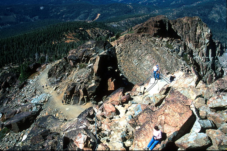
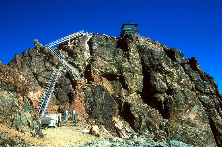
reaching a large flat area below the lookout tower. Above us were now some of the steepest
stairs I've ever seen. Apparently the stairs were constructed sometime in the 1960's.
There's a plaque at the bottom acknowledging those who help construct the stairs. I'm
not sure if the stairs were replaced at some point, or if they're the original stairs.
In any case, they're scary. Much scarier than Half Dome. At least there your feet are
always on solid ground. Here, you're standing on a metal staircase suspended 20 feet
above the ground, with a precipitous fall of 1000 feet on one side, and another drop
on the other. We tucked our trekking poles away to free both hands to hold onto the
railings.
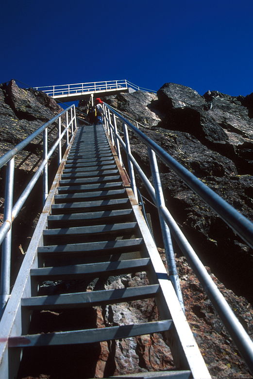
One of the staircases leading to the top
There are three staircases, totaling about 60 vertical feet. Eventually we made it to
the top and then made our way up another 10 feet of stairs to the top of the lookout
tower. The tower is about 12 feet to a side, with metal walkways all the way around.
The whole structure shakes noticeably in the howling wind at the top. Jean stayed up
for just a minute or two before heading down, while I stayed and took some photographs.
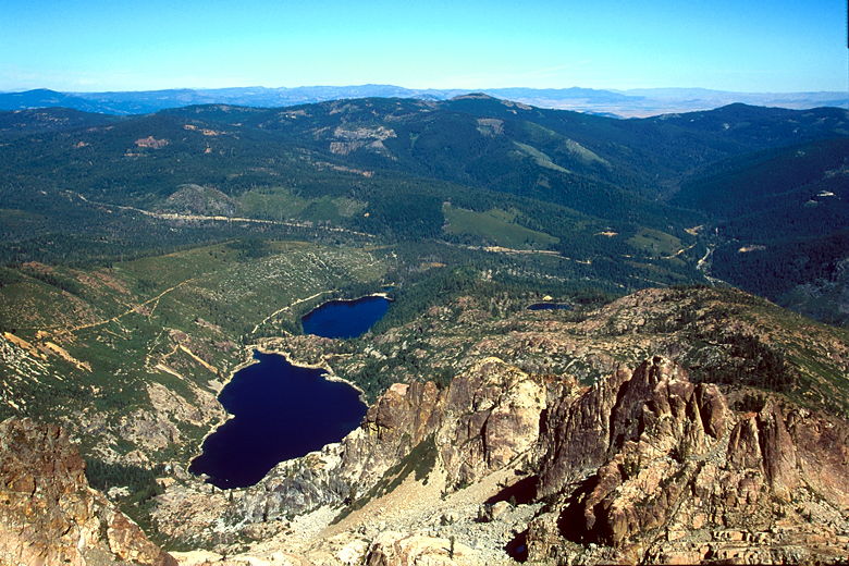
Sardine Lakes
Eventually I retreated to solid ground and we enjoyed the views while eating lunch.
Soon enough all the teenagers left and we had some peace and quiet. It was just us
and the howling wind. The views from Sierra Buttes (elevation 8591 feet) are nice,
with green hills sloping down on the south
western side, the rest of the rocky Sierra Buttes spreading south east, and
Sardine Lakes below us to the north east. There were even still patches of snow on
the slopes above the lakes. The rest of the Lakes Basin is visible stretching out beyond
the lakes.
Looking back down the way we came
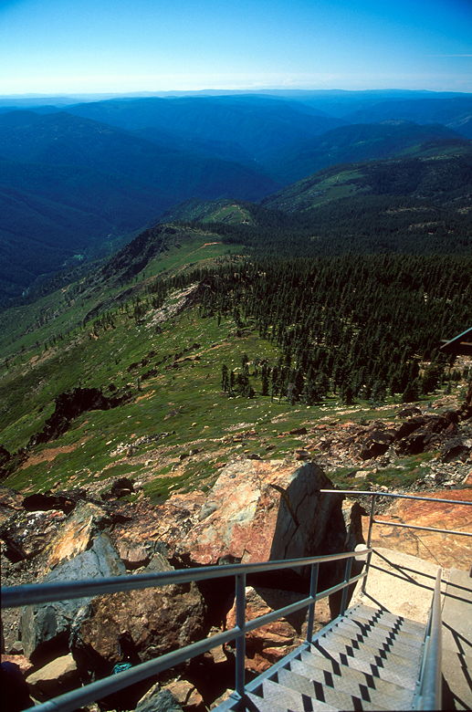
View from the top of the lookout steps
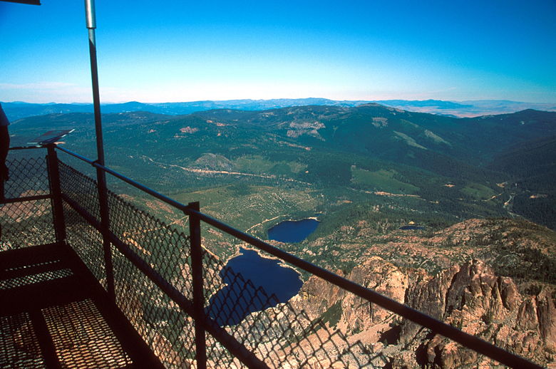
View from the lookout
Lunch view
After lunch we headed down the staircase. I freaked Jean out by descending with one
hand holding my camera, one hand holding the railing. I had a vise grip with that one
hand, though. After we reached the bottom we ran into some people who were planning
to rappel down one of the rock faces at the top.

View from halfway down the stairs
The three stair cases
The trip down was fast. We zipped down the switchbacks, passed a couple cars still
sitting in the dirt parking lot and continued past the now-empty spot where there'd been
a car with a mountain bike. It was nice having the trail to ourselves again. Soon
enough were were back at our car. The same mountain bikers we'd seen at the lot in the
morning were there now, back from their day of biking. Now that the sun wasn't shining
directly behind the Sierra Buttes, I took some photographs of it from the parking lot.
All in all, a good hike which would have been much better if it weren't for the 4WD road.
A nice hike, but as long as that road's still there, I don't think I'll do this hike
again (which isn't saying much, since the only hike I ever repeat is Mount Tallac).
Looking back after a good hike
| 

