|
If you want to go: Take Highway 1 south toward Big Sur. Garrapata State Park is
10 miles south of Carmel. There's no big sign telling you you're
there. There's a small sign behind a gate with a map of the park.
Signs at the start of the hike warned us that the Soberanes Canyon
trail had been damaged due to El Nino. Therefore, we figured we
would head up the Rocky Ridge Trail and head back down the same
way.
Unfortunately, we somehow managed to miss the turn for the Rocky
Ridge Trail and ended up on the Soberanes Canyon Trail instead.
But I'm glad we did. The trail starts out unpromising -- slogging
through sand under an unforgiving sun and little to look at. But
slowly, the scenery changes.
We passed a group of hikers who were resting alongside the Soberanes
Creek. We thought about turning around, since the trail was so
sandy and by this time we'd realized we were probably on the wrong
trail. But we never did turn around. Shortly after those hikers,
the trail became more vegetated, following the creek, and soon
we were hiking through a lush redwood stand. The next hour we
hiked alongside this beautiful creek underneath ample shade, with
lush ferns and redwoods surrounding us. The trail goes up and
down, up and down, and has a few unmarked side trails which could
lead hikers astray. There also was definite storm damage. We crossed
the creek several times, and the trail was almost completely washed
away in a few places. But we eventually made it to the switchbacked
stairs which led us up out of the canyon.
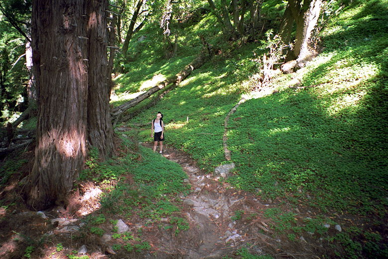
Jean looking up at a big redwood tree in Soberanes Canyon
After leaving the canyon, we joined the Rocky Ridge Trail and
hiked up, up, up, under the blazing sun amid golden fields. The
trail is narrow most of the way, and we didn't encounter many
people -- just a couple people coming the opposite direction.
Some parts of the trail are also very steep -- over 20% grade.
We eventually made it to the 1900 foot peak, where we were met
with great views all around -- the Carmel Valley to the east,
Soberanes Canyon to the south, and the Pacific Ocean to the west.
Most striking was the great disparity of the environment -- on
one side, the peak we were standing on and all the golden, dry
hills. But through it runs the Soberanes Creek, and the canyon
it lives in is full of rich vegetation.
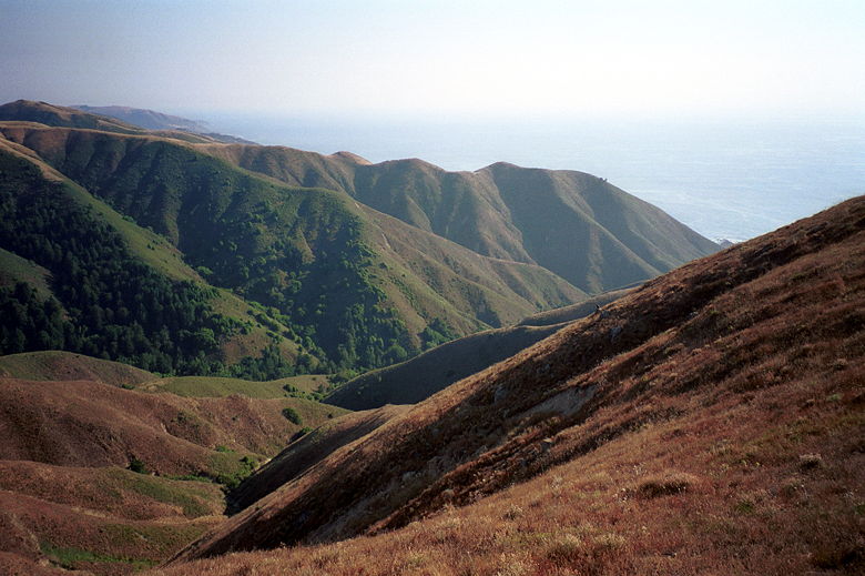
The view from the top. Look at how green it is in the Soberanes
Valley, and how barren it is elsewhere.
After enjoying the views we headed down the steep, dusty trail.
We saw a few people resting on a bench overlooking the ocean,
and passed one hiker coming up the hill. Near the bottom, we saw
a couple jackrabbits. I saw one dart out in front of us on the
trail, then disappear. We saw another duck into the bushes. We
could see him, sitting there. When I realized how frightened he
looked, we went on and left him alone.
Eventually we made it back to Highway 1 -- but a few dozen yards
north of where we'd started the hike. No matter. We crossed the
highway and enjoyed the coast before heading back to the car.
| 

