|
Nancy and I parked at Kirkwood Ski Resort, near Lift #6, the Cornice
lift. We prepared for the hike while construction workers worked
on a new condominium complex. A huge crane towered overhead, framing
the mountains above.
The hiking instructions in my book were somewhat vague, and it
was only later that we realized we should have started at lift
#7, not 6. Fortunately, they're pretty close.
There's no real trail. We went cross-country until we hooked up
to a maintenance road. The terrain was nothing special. We'd seen
golden aspens the entire day, but now we hiked in a ski area with
green forest, brown grasses, and dirt roads.
We followed the twisting roads until it veered off our intended
course. We struck off cross-country again, toward the obvious
goal of the top of lift #6. Nancy and I chose different routes.
The route I took was littered with garbage -- bottles, cans, and
fragments of ski poles to name just a little. The route was fine
until near the top, where I had to use my hands in places to make
sure I didn't fall. As I climbed up to the top, I hoped Nancy's
route had been better. But unfortunately she'd been thinking the
same thing.
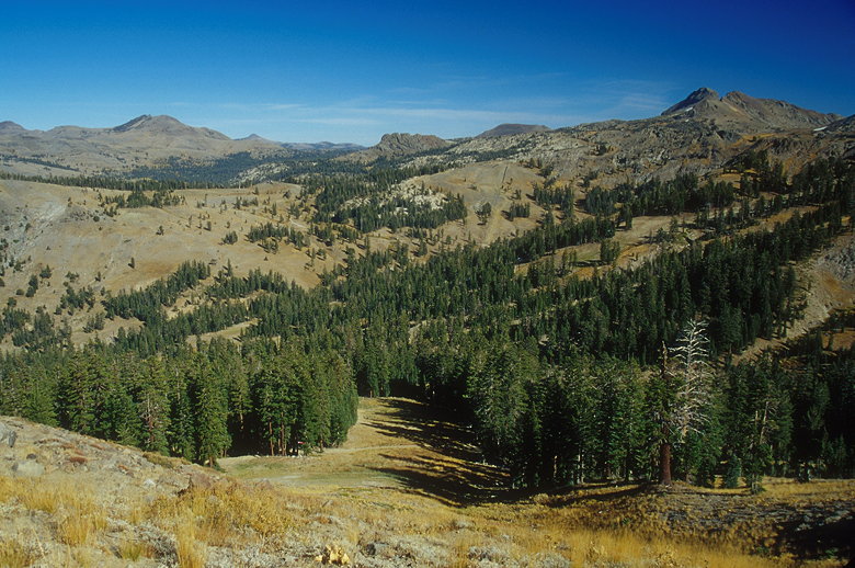
View looking northeast halfway up the main ascent
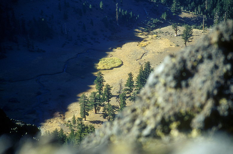
Now we had nice views of the surrounding area, including Thunder
Mountain itself, clearly visible a short distance to the west.
We hiked through grasses and shrubs, following the trail where
it was visible. There's a fairly steep drop-off on the right (northern)
side, but the way to the peak is wide and relatively flat.
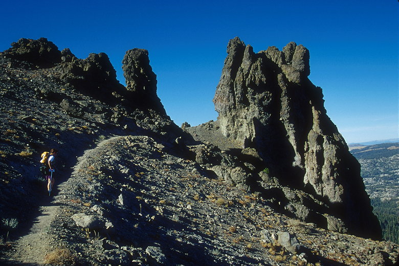
Pinnacles near the top
Pinnacles jut out a couple hundred yards north of the peak. We
passed through them to the other side of the mountain and were
met with a gusting wind which threatened to blow off my hat. We
were also treated to our first view of the other side, which included
Marin Point to the northwest. The mountain drops off steeply on
the western side, but there's actually a trail which leads down
that side, and then back up to Marin Point.
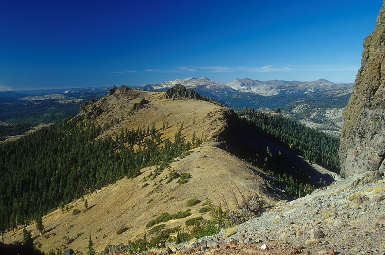
The view looking west from the other side of the pinnacles
The pinnacles at the top of Thunder Mountain are the same material
as that on Round Top. It has those same yellow and orange speckles
that signifies lichen growing on volcanic rock. Nancy decided
to use this rock as her own climbing gym, and started free-soloing
toward the peak itself. I, on the other hand, decided I'd take
the easy way out. I walked back through the wind tunnel, and then
up (south) toward the peak.
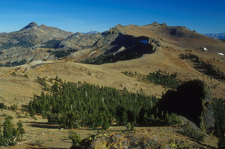
View looking east from the summit
The views from the peak are incredible, exceeding those of nearby
(and clearly visible) Round Top. Either that or I have a short
memory. Range upon range of mountains stretch out as far as the
eye can see. What Thunder Mountain (9410 feet) gives you that
Round Top doesn't is a better view to the west. It also gives
you a vertigo-inducing view of a nearly vertical drop-off. There's
a large western spur which rises like a freeway onramp (with sheer
vertical walls) from 8000 feet to just south of the peak. It definitely
reminded me of my fear of heights (which I think is a healthy
attribute).
Don't look down!
After pictures, food, and some more climbing for Nancy, we started
our descent. Instead of the paths we took up, we decided not to
go back via the top of the ski lift. Instead, we walked to the
saddle between the lift and the peak, and started down from there.
We traversed the steep slope on a use trail until Nancy saw some
unidentifiable prints which she thought could have been bear prints.
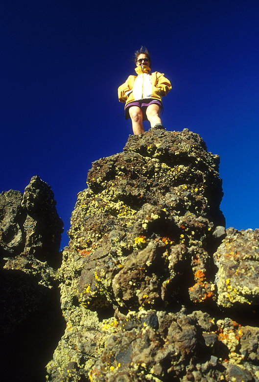
Notice the similarity of the rock with that on Round Top
Opting not to walk into the forest, we stayed in the open and
switchbacked our way down the slope, each falling once on the
sandy ground. I had to keep reminding myself to keep my weight
forward to prevent from falling backward. It was steep, but not
dangerously steep. It is, after all, a ski run (albeit a black
diamond run at a difficult resort).
We continued to find all sorts of trash on the way down. Usually
I pick up some trash and deposit it in a garbage can at the end
of the hike. But the trash was so plentiful and large that I decided
not to until the last few minutes of the hike. Then we managed
to fill our pockets and ziploc bags with wrappers, cans, assorted
plastic, PVC pipe, cold sore medication, etc., etc. It was, quite
honestly, disgusting. Certainly the most trash I've ever seen
on a hike. I literally couldn't take 5 steps without finding another
piece of trash on the ground. I venture to say that if you combed
the entire mountain and picked up all the garbage, you could easily
fill a garbage dumpster.
After spending 1 1/2 hours on the ascent of the steepest (21.5%
grade) hike I've done thus far, and an hour at the top, it took
us just an hour to descend. That includes the extra 5 minutes
bending over to pick up trash.
Return to Lake Tahoe Fall 1999 trip report.
| 

