|
Ben, Jay, Weihaw, and I hiked the West Rim Trail, from the Grotto
Picnic Area to Cabin Spring camp 3, at Zion National Park.
We parked at the Grotto Picnic Area. Parking here is sparse...we
had to circle a couple times to find a space. In the summer, it must
be a zoo.
The trail starts by crossing a bridge over the Virgin River, then
heading north and up, up, up. Switchbacks are the rule, heading up
with little shade, the river still visible for the first mile, until
it turns left into Refrigerator Canyon. Here, as you might expect,
it's a bit cooler, as there are walls on either side (hence the term
canyon!). The trail is flat for a while, heading roughly west,
before going east up numerous switchbacks along the face of the
canyon wall, including what are referred to as Walter's Wiggles,
named after Walter Ruesch, who supervised the building of the West
Rim Trail in 1924 (a few days later, in a gift shop at Bryce, I found
a bookmark with this information and a picture of the switchbacks).
These switchbacks are very short -- no more than 20 feet long each,
and zig-zag quickly up to Scout's Lookout.
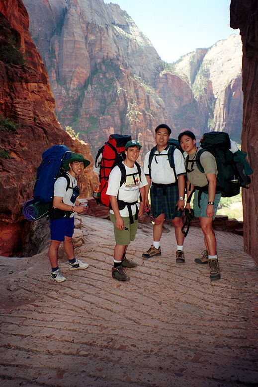
Weihaw, Jay, Ben, and I, turning the corner and going
toward Refrigerator Canyon.
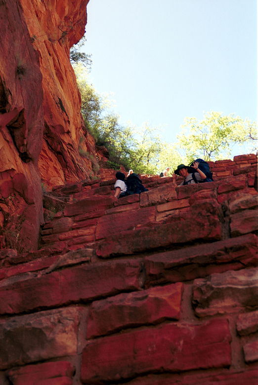
Weihaw heading up Walter's Wiggles
Scout's Lookout is at the intersection of the West Rim Trail and
the Angels Landing trail. It's a popular place for day hikers who are
making the Angels Landing hike to have lunch. While we were eating
there,we ran into a couple of backpackers coming the opposite
direction. In fact, they had done the exact same hike I had
originally planned -- Wildcat Canyon to West Rim in a southerly
direction. They said one ranger had told them it was snowed out, as
well, but another had told them it was okay. They went, and said
there were patches of snow, and a bit muddy in places, but nothing
that couldn't be tolerated. They said it was a great hike. At this
point, we were definitely upset at the rangers for misleading us, but
there wasn't much we could do. It was too late now to revert to our
original plan. We'd just have to deal with it and enjoy our hike.
Besides, most people we talked to said that the best part of the West
Rim trail was the part we were doing. The northern part of the trail
is mostly just flat, forested land. (side note: one of those
backpackers was wearing the same REI shorts I was, and in fact had
bought them in the same store and was from Los Altos!)
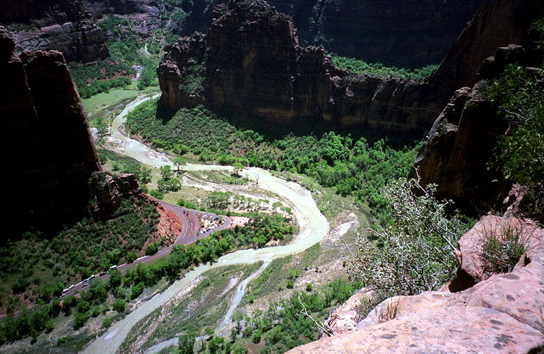
A view of the Virgin River from Scout's Lookout
We decided to press on without going to Angels Landing. We figured
we'd have time to see it on the way back down the next day. Angels
Landing and Scout's Lookout is a popular day hike. On our way up we
saw many other hikers. But once we went past the intersection, hikers
were few and far between.
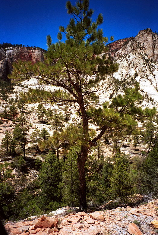
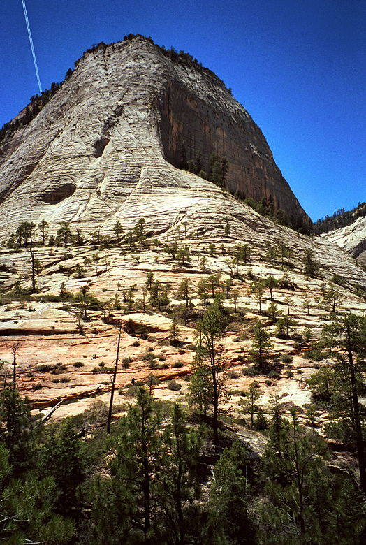
Higher up, the park almost looks Yosemite-like
Up we went again. The trail quickly changed from red rock sandstone,
to a white rocky path with normal soil -- more like the Mt. Tallac or
Half Dome trail. After going up a bit, the trail started descending.
Bad news -- what goes down must come up! It dropped down about 400
feet as we slowly rounded Cathedral Mountain and Mt. Majestic. After
crossing a bridge near the bottom, it was back to the uphill.
Lizards, the most prevalent wildlife we saw, darted across the trail
every so often. The temperature was mild -- high 70's maybe.
If you look closely, you can see Jay, Weihaw, and Ben
going up the trail (diagonally upward)
There were still patches of snow at 6000 feet when we did the hike in
mid-May. No snow on the trail itself, however. The trail was somewhat
routine for a while until it turned a corner and suddenly we were
hiking on the side of a mountain. The trail is blasted out of the
rock and one false step would lead to a fall of 200, 300, 400
feet...as we climbed higher. But the trail is fairly wide (4-5 feet),
so it wasn't too bad. And soon we were back on solid ground again,
crunching through a forest near the top. And then we were there. We
reached the trail junction with signs pointing toward Cabin Spring
itself 100 yards away, Telephone Canyon Trail, and West Rim Trail. We
weren't sure where camp 3 was (which is where we had reservations),
so after hiking up the West Rim Trail a bit more, I dropped my pack
and headed up to see while the others waited. After dropping my
nearly 50-pound pack, I felt completely liberated and started running
up the trail. Of course, given the thin air at 7000 feet, that
exuberance didn't last too long. After going a quarter mile (and up
100 feet), I found the sign for camp 3 and headed back to tell them.
Weihaw and Ben went on ahead to the camp while Jay and I retreated to
the spring to filter some water. The spring is just a trickle, but my
MSR Miniworks filter provided clear, great-tasting, cold
water!
After returning to our packs, we headed up to camp. The area near
Cabin Spring was burned when an illegal campfire went out of control
in 1992. Our campsite was set in a cleared-out section amongst
burned-down trees. Deer walked around us as we set up our camp,
peering through the leafless, dead trees.
Return to Zion/Bryce/Grand Canyon trip report.
|


