|
Jean, Jennie and I hiked in Windy Hill Open Space Preserve.
We started our hike at 5:45pm. The sun would set at about 7:45,
so we faced the prospect of doing the last bit of the hike after
sunset. Of course we had flashlights just in case, but it's always
preferable to finish without having to use them.
I'd been to Windy Hill before, but never hiked to the top from
the bottom. There's a parking lot at the top, but it's a bit of
a drive. It's a bit more accessible from the bottom.
There was ample parking. A 50-car lot had been completed the year
before, and there were only about 6-10 cars parked there. There's
an outhouse, but no water.
The trail is flat for the first 0.6 miles, shortly passing Sausal
Pond on the right. We then turned right onto the Spring Ridge
Trail for the hike up the hill. The trail at all times is a large
dirt fire trail. Small patches were muddy, but mainly it was dry,
hardened, and filled with lengthwise ruts. It's fairly popular
with mountain bikers. We encountered a handful of them on the trail,
and about an equal number of hikers and joggers. It was nowhere
near as crowded as Rancho San Antonio.
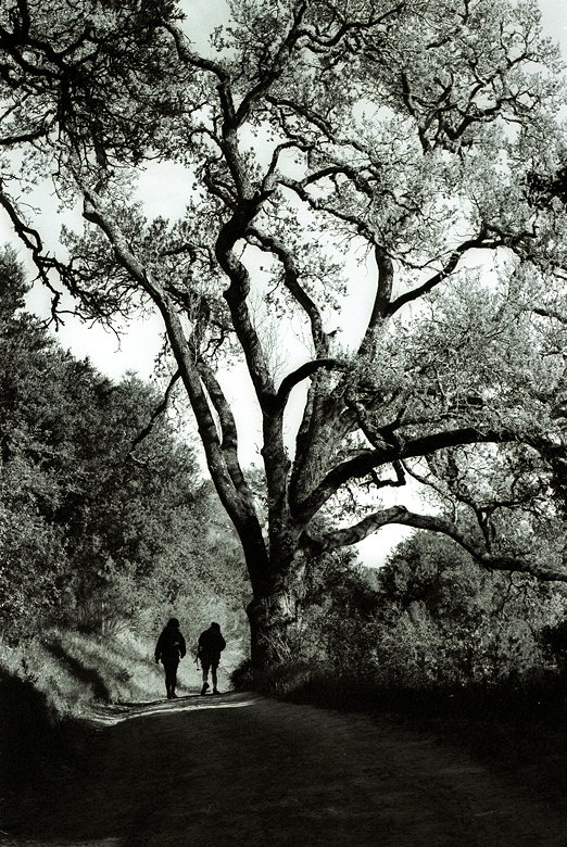
Jean and Jennie on the trail
As the trail climbs, the views get better. Soon we had a nice
view of the south bay and across to the Diablo range. It was completely
clear over the bay, but on either ridge, fog seeped threateningly
over the hills. As we hiked higher the wind picked up and the
tree cover disappeared.
There are no false summits -- Windy Hill was present before us
almost the entire time. Soon we were at the top. I was hoping
for a view of the ocean, but it was covered completely by fog.
Some cows grazed across Skyline Boulevard. Some cyclists pedaled
south on the road. And the wind was...well, very windy.
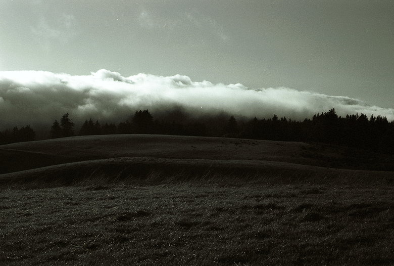
The fog rolls in
After a brief stop for some pictures, we retraced our steps down
the mountain. It took us 1 hour, 33 seconds to get to the top,
and just slightly longer to get back down. We were in no real
hurry, as we knew we would make it back before dark. And we did,
getting back to our cars just around sunset.
| 

