|
We left our hotel around 10am, immediately going to the REI in Spokane. We had to buy stove
fuel, since we couldn't take it on the plane. I hadn't even thought about shipping it with our
other camping gear; I doubt that would be kosher with UPS. In any case, we always enjoy
shopping at REI, of course. I wasn't sure if it'd be easy to buy fuel for our stoves on the
rest of the trip (especially in Canada), so I decided to buy everything at once. I erred on the
side of having too much fuel, buying 4 Coleman propane canisters, and 3 MSR IsoPro canisters for
our 11 days of camping.
Here's a map of our driving route.
We left REI a little before 11am, then headed north on Highway 395. Yes, Highway 395 goes all
the way from southern California, past the eastern Sierra, up to the Canadian border in
Washington. We stopped in Colville for lunch, then continued onto the US/Canadian border.
My car GPS suggested that I take Boulder Creek Road as a faster alternative, but I didn't want to
chance taking unknown side roads, so I stuck to the highway.
The border crossing at Highway 395 is actually not open 24 hours a day. It's only open from
8am to midnight. This was the middle of the day, so it was no problem for us. The Canadian
border agent asked us a few questions and admonished us for not signing our passports. This
was the first time we'd used ours since renewing them, and we'd both forgotten (and our kids
certainly couldn't sign theirs yet). By the way, did you know it's illegal for a Canadian to
rent a car in the US and drive it into Canada? I didn't until I read about it before this
trip.
I switched the GPS into metric mode since all the signs were now in kilometers. Our next
choice was whether to drive more directly to our B&B in Kelowna via Highway 33, or take the
slightly longer (about 40 minutes longer) route up Highway 97 through the Okanagan Valley.
Since we heard it was a nice drive, we decided on the scenic route. This seemed like a minor
decision at the time, but turned into a huge one.
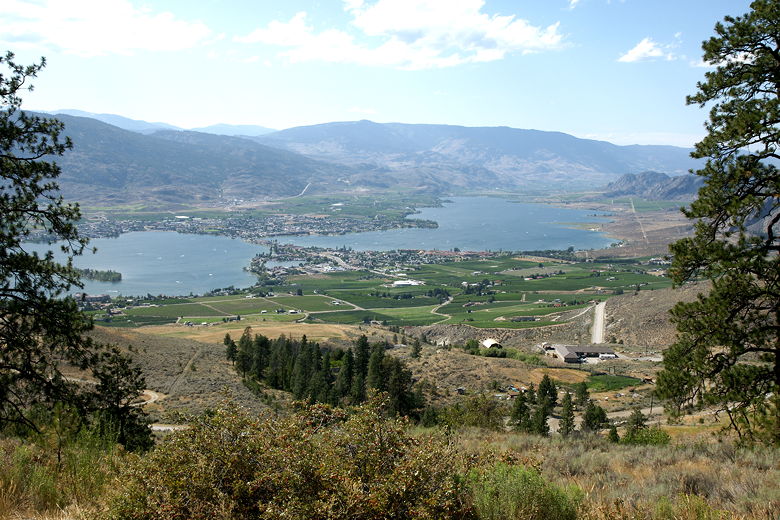
We started to see fruit orchards and stands, but had no Canadian money yet. So we stopped at
an ATM in Osoyoos, near the southern end of the Canadian side of Highway 97. It was quite
hot as we did so, not surprising since the Okanagan Valley is one of the warmest places in
Canada.

Lake Osoyoos
We now continued north along Highway 97. We soon stopped at a local fruit stand, then stopped at
Inniskillin winery just before they closed. We continued on Highway 97 past more orchards and
wineries. I noticed several signs saying "NO National Park", finding out later that there's a
proposal to create a new national park in the area (and obviously some of the residents are not
pleased with the idea).
We then came to one of the craziest-looking things I've ever seen. The Okanagan
River Channel is maybe 100 feet wide, between Okanagan Lake and Skaha Lake. As we drove past,
we saw people in inflatable rafts floating in the channel. That doesn't sound all that exciting,
but the number of people doing this was staggering. There were literally hundreds of rafts in
this channel, right next to the highway, stretching on for miles (er, kilometers). It was quite
a sight.
It was nearly 6pm and we were almost to our destination of Kelowna when we spotted smoke to
the north. Crossing our fingers, we drove on for another half hour until we got the bad news.
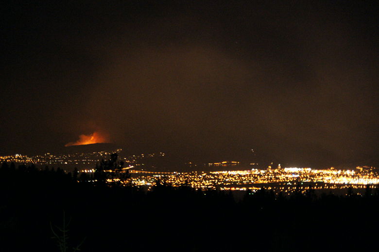
There was a forest fire that had crossed the highway in front of us; the highway was closed
with no estimate of when it would re-open. We were less than half an hour away from our B&B
in Kelowna if the road were open. Unfortunately, there was no decent alternate route. Because
of the lake and the mountains on the other side, we would have to drive all the way back down
to Osoyoos, then up Highway 33 -- the original road we would have taken if we hadn't wanted to
take the scenic route. Instead of being a half hour away from our B&B, we were now 3 1/2 hours
away, making a long day of driving even longer.
We turned on the radio trying to find out more about the fires in West Kelowna,
eventually settling on AM 1150,
which had continous coverage. They mentioned they had a Twitter page, and I followed that
using my Sidekick and it was very helpful.
We decided to stop in Penticton for dinner, finding a nice Thai restaurant. At dinner I scanned
the Twitter page, finding out that the road had closed just about an hour or so before we'd gotten
there.
After dinner, we continued on the long detour, made slightly longer by the fact that many other cars
were taking the detour, as well. It was nearly midnight by the time we reached our B&B.
We could see smoke on the other side of the lake, and the radio told us that highway 97 and 97C were
both still closed. We were just glad our long day of driving was finally over. We'd worry about
tomorrow when we woke up.

Forest fire in West Kelowna, from hills above Kelowna
| 


