|
It started raining in the middle of the night. I'm not sure when exactly, maybe
midnight or later, but it rained pretty much continuously. At one point I thought
that I should go out and cover the bear canisters, just in case they leaked, but
I was too tired.
I was hoping the rain would stop by sunrise, but no such luck. We waited and waited,
fearing that we would have to hike back in the rain today. Finally, around 8:30am,
the rain let up and we were able to go outside and have breakfast. I went down to
the lake and got some water to start filtering. After breakfast it immediately started
raining again. I sat out in the cold, filtering water until I couldn't take it any
more and retreated to the tent.
We packed away our sleeping bags and pads in the tent as we waited. We played cards
and waited. Incredibly, the kids seemed to be having a great time and
asked us if we could just stay an extra day. I had
to explain to them that we didn't have enough food.
Eventually we'd have to just leave to avoid hiking back in the dark, but
we still had time. Even though today would be over 9 miles, it was mostly downhill,
so I was pretty confident we'd make decent time.
Finally, at around 9:30am, the rain stopped again. We got out and started packing
everything away. The skies looked much better now, though it was still mostly
cloudy. By the time we finally got started hiking around 11am, a little bit of
sunshine even started showing.
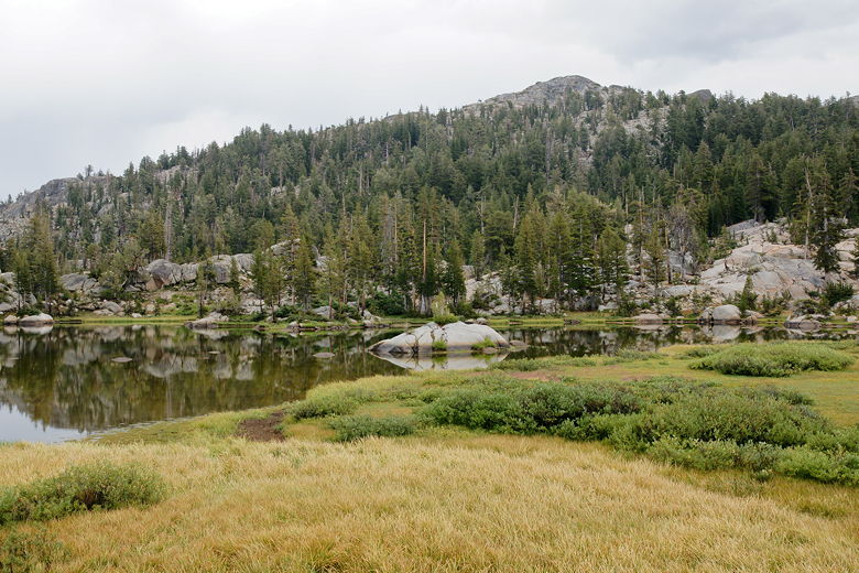
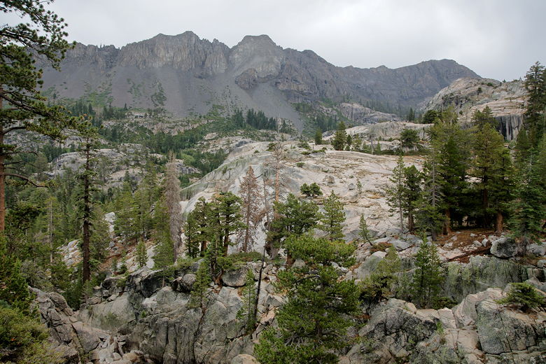
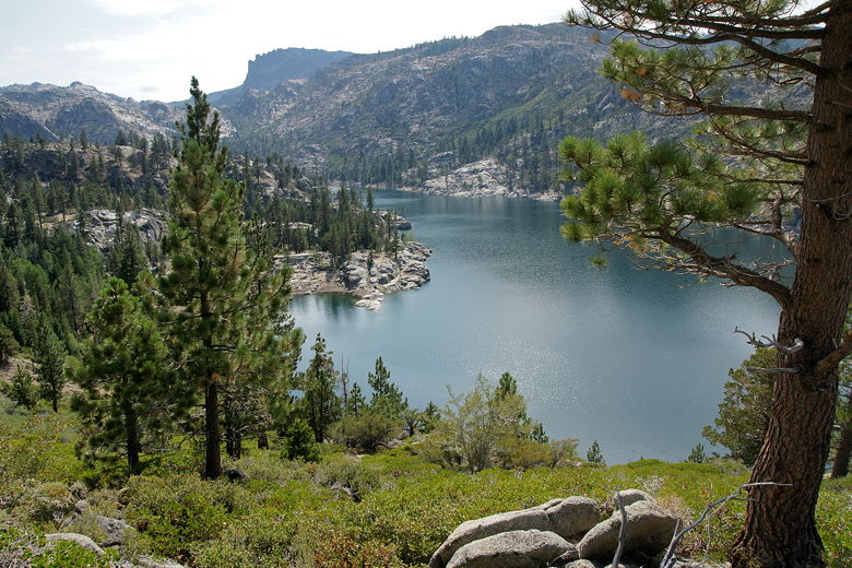
Upper Relief Lake
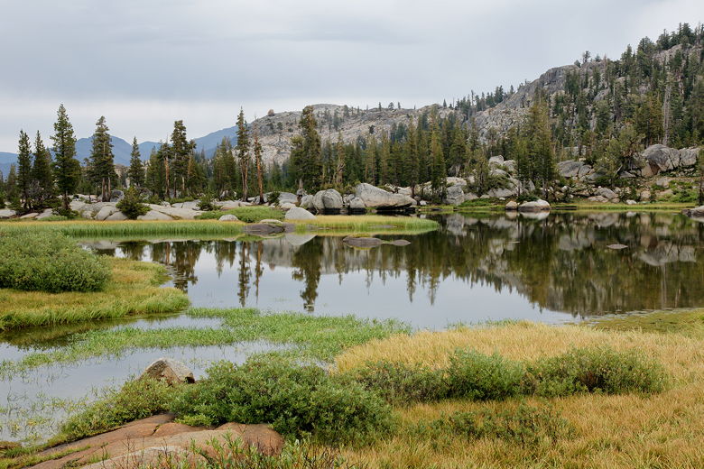
Upper Relief Lake
We made our way back to the main trail as we heard gunshots being fired in the
distance to round up the cows. Turning right onto the main trail, we started following
it through Upper Relief Canyon. Soon we reached the edge of the meadow and started a
steep downhill next to Relief Creek. It sprinkled on and off for the next hour or two,
but there was never any serious rain the rest of the day.
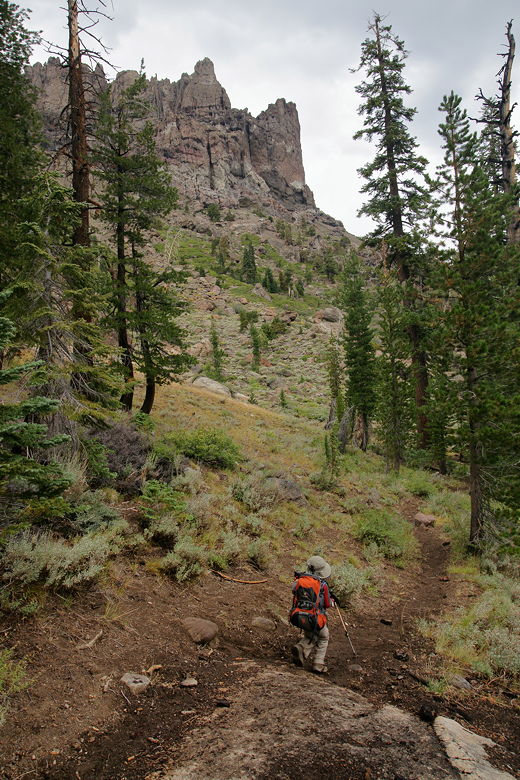
Hiking down toward Lower Relief Valley
We passed another cow gate, closing it carefully behind us. We ran into a couple of
backpackers coming up (they'd started out from Kennedy Meadows this morning). They
were surprised by all the rain, just as much as we were. They were headed out toward the
lakes near Granite Dome, which requires an off-trail journey southeast of
Upper Relief Valley. I guess that's one way to avoid the cows and horses.
We soon passed through Lower Relief Valley, then passed a large group of campers
(mostly teenage boys) just before reaching a crossing of Summit Creek. Despite the
relatively dry winter, the creek was no doubt swollen with the recent overnight rains.
There were a lot of large boulders that could be used to rock-hop across it, but the
water was swift and it would not be easy for our kids. I took off my pack and went
out into the middle with my trekking poles, guiding my kids across the rocks. First one,
then the other, then my wife. They all made it across safely.
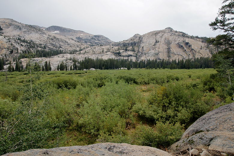
Lower Relief Valley
View from the trail
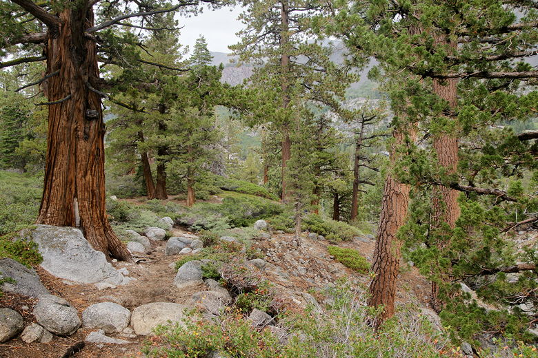
Heading down through the forest
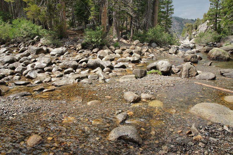
After crossing Summit Creek
Apparently the large group of campers had come down around this time and had been watching
for a little bit. They now all crossed, as well, and then I crossed behind them with my
pack. After this little delay we picked up the trail on the other side and started
climbing up for once. Thankfully the climb wasn't very long, and it was followed by
a descent down to the end of the loop section of our hike.
We were now back at the intersection where one fork goes toward Lunch Meadow. We turned
left to head to Kennedy Meadows, knowing we only had about 5 miles left and it was mostly
downhill. Well, mostly. There was still the uphill stretch next to the reservoir, and
the little uphill at the end up to the parking lot.
The sun was now out completely and it was getting warm. Since we'd seen this part of the
trail before, and it was mostly downhill, we didn't stop much the rest of the way.
In fact, I think we only had 3 food breaks, one before the river crossing and two afterwards.
After a food break we crossed the stream near the trail toward our first night's camp.
Then we started the brutal climb up next to Relief Reservoir. Of course the sun was now
beating relentlessly down on us as we climbed and climbed out in the open.
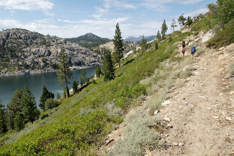
Hiking uphill next to Relief Reservoir
Looking back at Relief Reservoir
We saw the beach down below, where I'd gathered water. Then we could see the dam itself
to the north. Finally, we reached the end of the climb and could look forward to almost
all downhill the rest of the way. The sun went into hiding again as we walked downhill
past the old rusting equipment. Along the way we ran into a group of day hikers. They asked us how
far it was to get a view of the reservoir; when they found out it was more than half an
hour still, they decided to turn around.
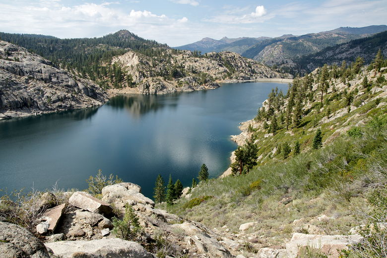
Relief Reservoir
We crossed the high bridge below the dam, then stopped for one final food break.
Then we continued the descent, past the pretty multi-step falls on the right, above the
creek far below, under and past the steep cliff walls above us. Down past the wilderness
sign, across another foot bridge, and finally onto the wide dirt road that signalled the
end of the wilderness.
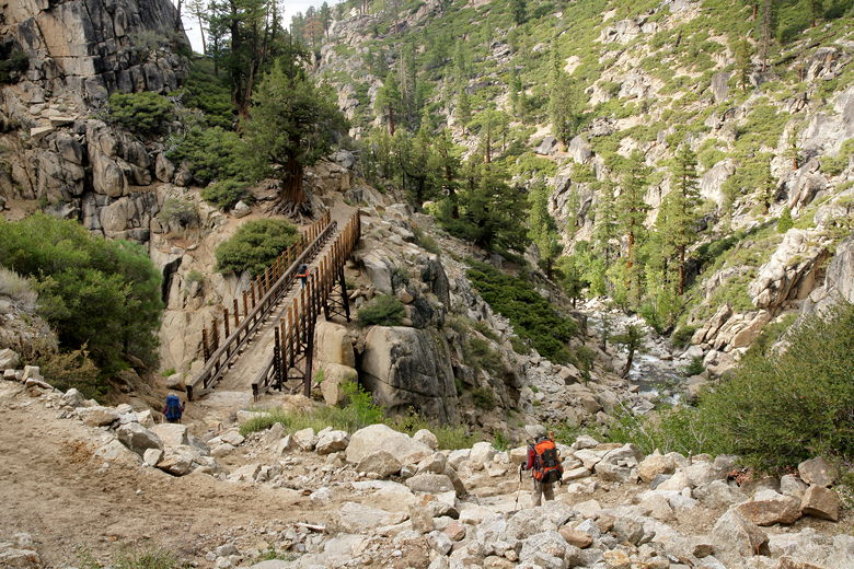
Crossing the bridge over Summit Creek
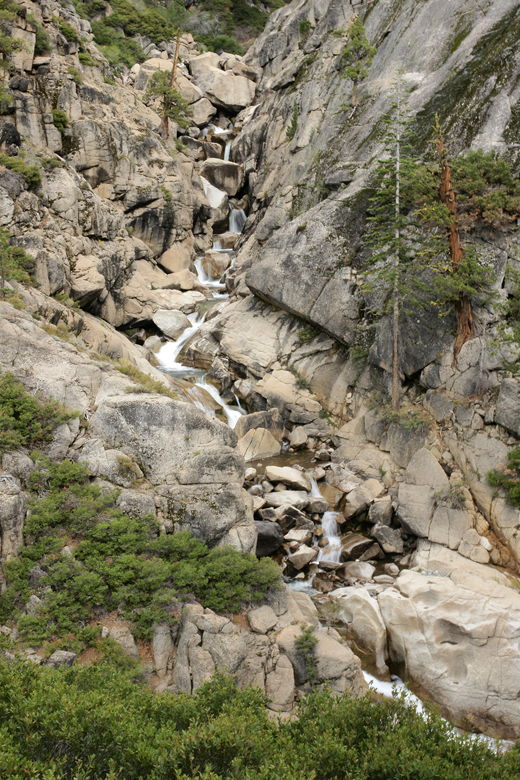
Multi-step falls to right of trail
As soon as we reached the dirt road, we started to hear loud thumping music blasting out
of cars next to the road. Apparently the resort lets people camp out along the road,
and they were doing so on a Saturday night (we hadn't noticed anyone camped along
the road here on Monday afternoon). It was quite a shock to the system, coming from
a wilderness area into this area with loud music.
We had to watch for cars as we walked along the dirt road. Then, to add insult to
injury, we had another small climb up to the water tower (I didn't remember this climb!),
before a final descent down to the resort area. Here there was even more loud music,
tons of people milling about, a bustling resort area where we almost felt like aliens with
our big backpacks. And we still had half a mile to go to the parking lot.
We walked right through the resort area, back along the paved road, and up the final hill
up to the parking lot. Whew! We'd made it, and it wasn't even 6pm yet. We cleaned up a
bit, put everything away,
and then drove back to Sonora for dinner. We were back in the Bay Area by 11pm, after
a great trip despite the rain. Now that I'm back, I'm already starting to think about
what trip(s) we want to do next year.
| 

