|
It was quite cold during the night, perhaps the coldest on the trip.
When I woke in the morning, my watch said 37 degrees *inside* the tent.
Some guys I talked to later said there was frost near their tent in
the morning. But it was sunny in the morning.
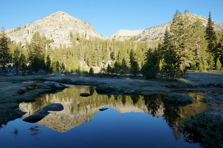
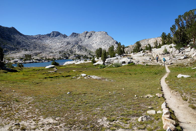
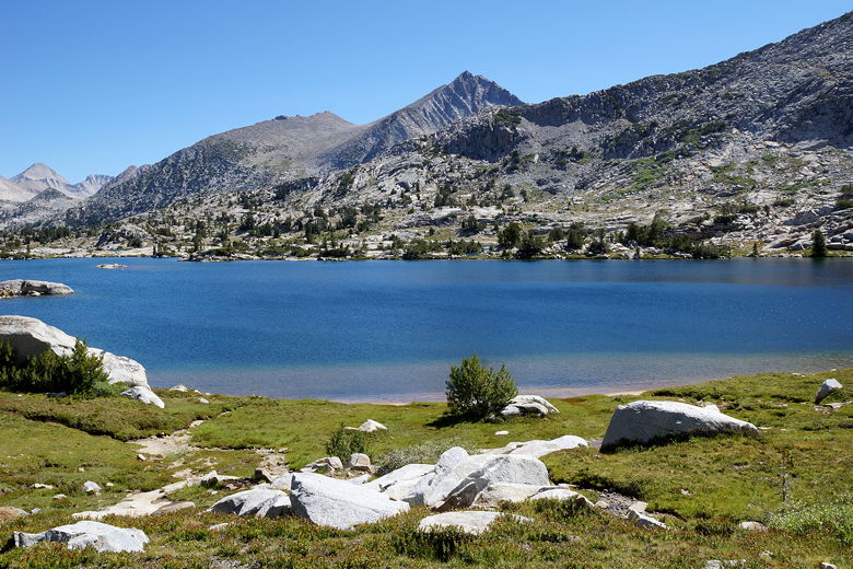
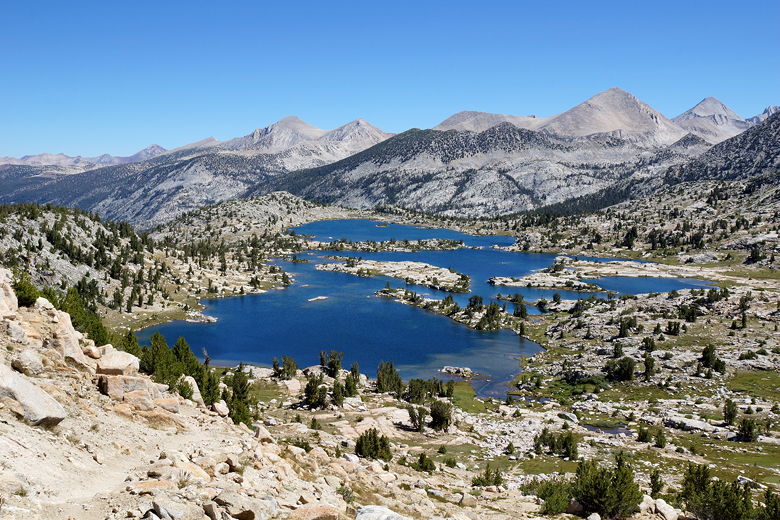
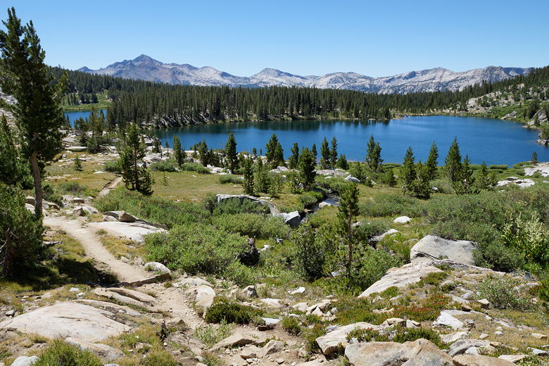
Reflections at Rosemarie Meadow
Rosemarie Meadow
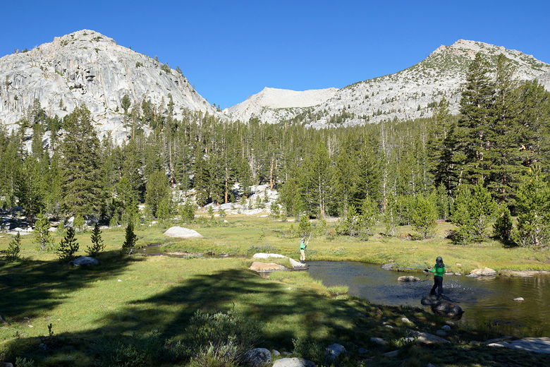
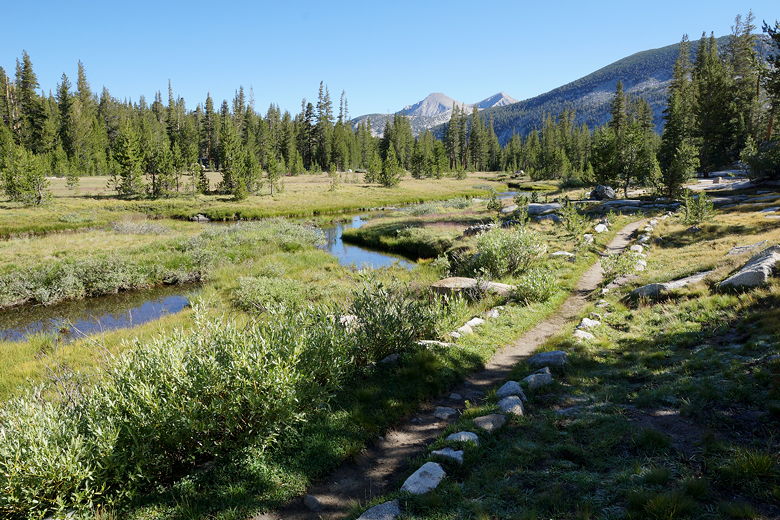
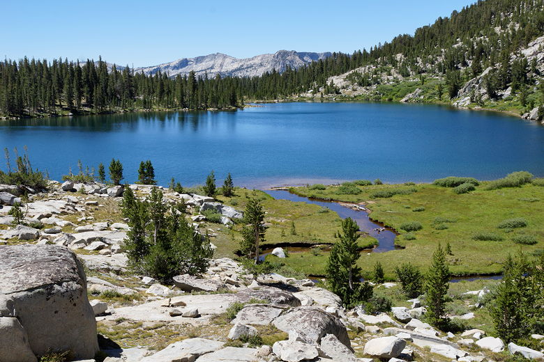
Playing in Bear Creek West Fork
We tried to get an earlier start because we were doing the resupply today,
but the cold made it hard. A few early risers passed by as we got ready.
We got started at 8:55am this morning, immediately starting a steady
climb up to Marie Lake. After about 550 feet of climbing in 1.4 miles,
we reached the shore of the lake at 9:50am.
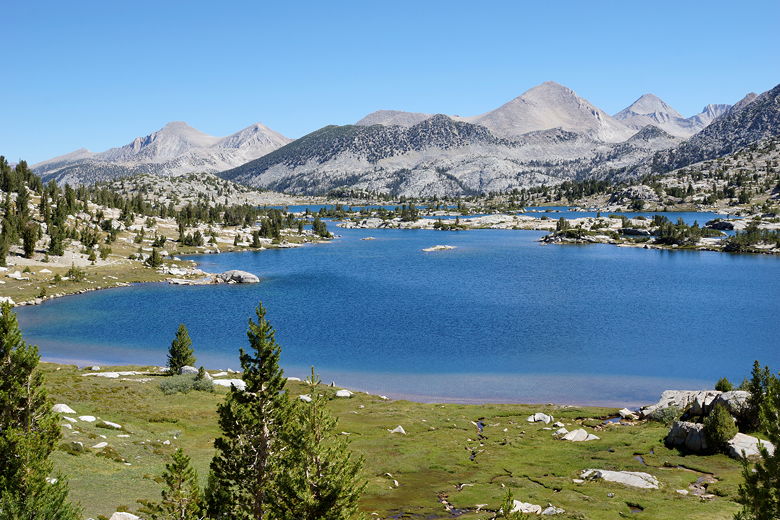
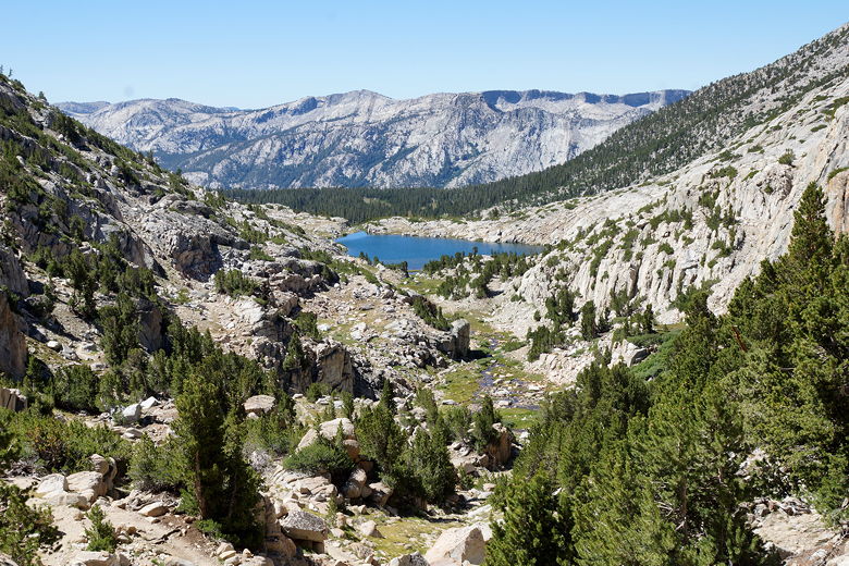
Mountain view
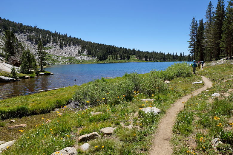
Approaching Marie Lake
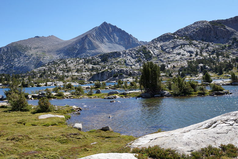
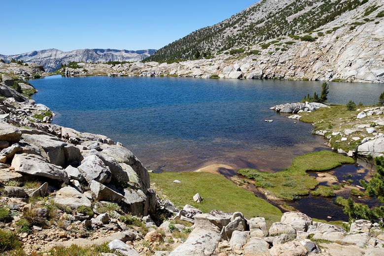
Marie Lake
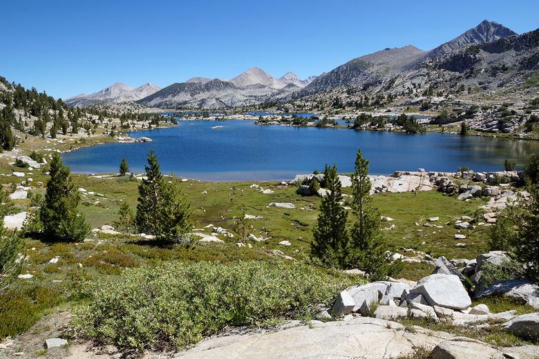
Marie Lake is beautiful, and I kind of wish we had been able to camp there.
While it's not quite above treeline, there aren't that many trees here and there
are lots of great views in all directions.
There were a couple campers still in the process of breaking camp. On
the other hand, it didn't look like there were a lot of campsites, at least
not obvious ones.
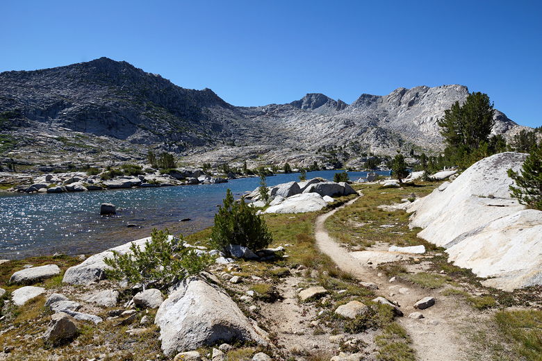
Marie Lake
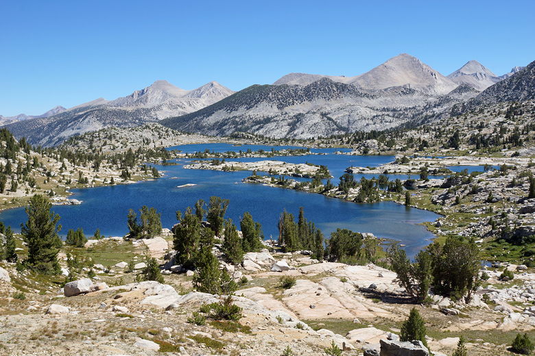
Looking northeast across Marie Lake
The lake was still and rimmed by granite shores. It looked like we could
walk right in, but we opted just to stop for second breakfast.
Then we continued on up, doing another 300 feet of fairly easy climbing up to the
top of Selden Pass. Along the way we got great views of the Marie Lake
area.
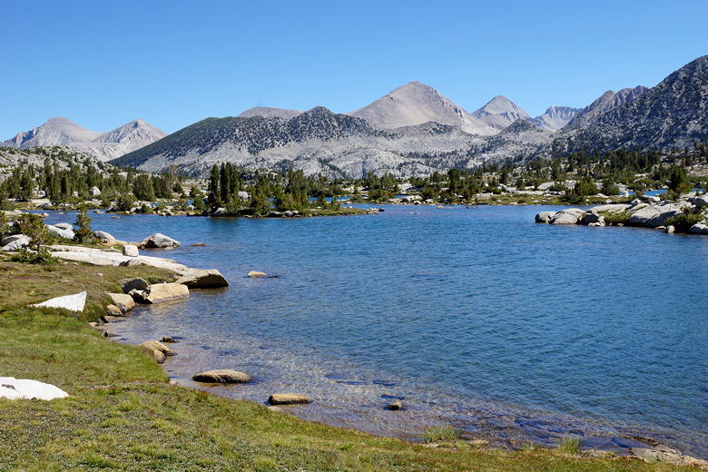
Looking north across Marie Lake
Marie Lake
Marie Lake
Marie Lake
Marie Lake from near the top of Selden Pass
At the top, we saw the two young men and their dad, who we'd seen yesterday.
They weren't resupplying at Muir Trail Ranch like we were, but they were
planning to visit and check out the hiker bins there. We reached the top
of Selden Pass at 11:45am and kept right on going (the views aren't substantially
better than on the climb).
View looking south from Selden Pass
From the pass, the trail descends easily toward Heart Lake. We could see
fish swimming in the lake and in the lake's outlet stream. We then
continued to descend down to Sallie Keyes Lakes. One hiker jumped into the
lake from a cliff (about 20 feet high) as we rested nearby.
Heart Lake
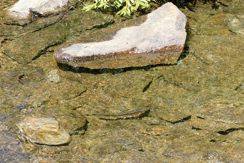
Fish in Heart Lake outlet stream
First Sallie Keyes Lake
First Sallie Keyes Lake
The trail levels off as it passes the second of the lakes. We saw a cabin
of some sort off in the forest near this second lake. After this, the
trail continues to descend through the forest. After crossing a stream, the
trail very briefly climbs (about 100 vertical feet) before leveling off and
crossing a small meadow.
Second Sallie Keyes Lake
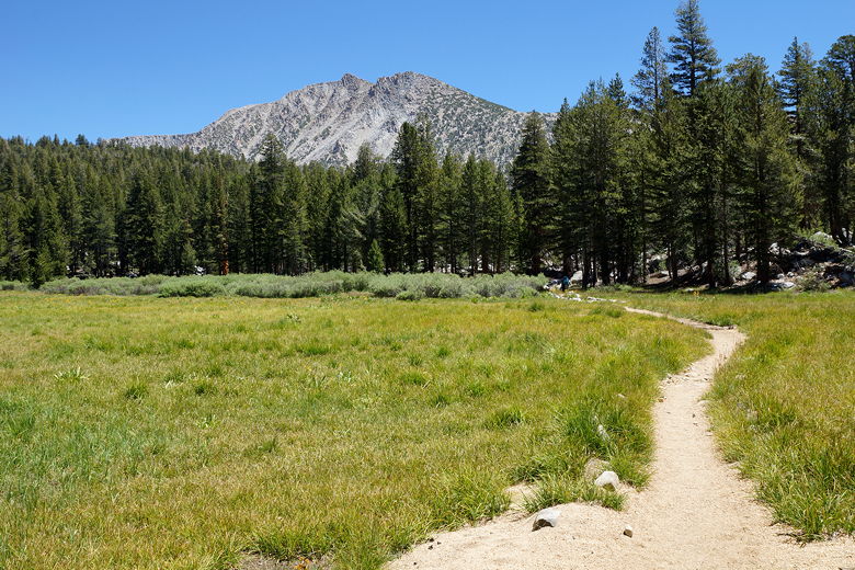
Meadow
After the meadow, the trail starts a steep descent through the forest. After
emerging out of the forest, the trail gets even steeper, switchbacking down
the side of the mountain, with great views of the surrounding area.
Unfortunately that view included smoke clearly visible in the valley to the
west. Apparently this was from the Willow Fire near Bass Lake. This fire,
which started the day before, would eventually burn close to 6000 acres. It
wouldn't cause any problems for us, though we could smell the smoke
all the way down.
Smoke seen on the descent to MTR
View to the south
The sun was hot as we continued the descent, which seemed to be one of the
steeper and faster descents we've done. We were descending more than 1500
feet per hour at one point. We wanted to get to the resupply, so we didn't
stop at all on this section. When we reached the intersection, we turned
right off the JMT to head toward Muir Trail Ranch (and Florence Lake).
And the trail got even steeper! It was almost comically steep from here
toward MTR. We reached another intersection and turned right to head
to the MTR gate. I did not look forward to climbing back up this hill
with a full pack, but it wouldn't be too bad.
We entered the gate and saw lots of backpackers (maybe a dozen) milling
about. Jean got in line to get our resupply buckets while I visited the
tiny store to get stove fuel. Since you're not supposed to ship fuel,
I had expected to be able to buy MSR fuel,
but they only had some other brand, and only small 3.75 ounce canisters at
that. I did some calculations and bought four of them to be safe,
testing one to make sure it was compatible with our stove (it was).
We got our 3 resupply buckets and sat on the grass under a shade to start
the process of transferring the contents to our bear canisters. We threw
away our trash, then filled a small box with stuff to ship back - things
we would no longer need (extra batteries, epi-pens, maps, guidebook pages, etc.)
We also searched through the hiker bins - a dozen buckets full of stuff other
hikers had left behind for others. We found some decent stuff -- some bars
that we added to our supply for variety. We left behind some candy and
dried pineapple that we had found too sweet to eat.
I paid to use the computer in the store for a few minutes, just to send out
an email to our friends to let them know we were on schedule (they were
planning to meet us at Rae Lakes). I have to say that it may have been
the slowest Internet connection I've used in years. It was so painful I
didn't even have time to check the weather. I asked the store employee and
he said there was a chance of rain on Thursday, so we made note of that.
I was glad to have shipped myself a nail clipper, which we all used here
(and I shipped it back). I also had shipped myself fresh socks, which I
changed into. There's a scale here where you can weigh your pack after
filling it up with your resupply. Jared's pack registered at 20 pounds,
Nathan 24, Jean 35, and mine about 55 (though I had already consumed most of
the water in the pack on this hot day).
While we were there, we saw the two young men and their dad come by. Later,
Tim and Michelle came by around 4pm. They looked a bit tired and frazzled,
as they had hoped to stay at MTR but there weren't any available rooms.
They'd have to hike a bit further to camp.
We had arrived at MTR at 2:30pm and didn't manage to leave until about 4:40pm.
We still had about 3.5 miles and 500 feet of climbing to go before our
camp for the night. We exited the MTR gate, climbed back up to the trail, then
turned right to head toward Piute Creek. After about 1.5 miles we
re-joined the JMT and continued on to the bridge over Piute Creek.
Heading east toward the Piute Creek bridge
Arriving at the Piute Creek intersection at about 6:40pm, there were already
lots of campers set up, but there were still plenty of campsites available.
We settled into one, then enjoyed a nice dinner after a long day. Thankfully
the smoke from the fire was no longer detectable.
| 

