|
Today was the big day. It wouldn't be the longest day in terms
of distance (that was the first day), but it would involve a fair
amount of distance (10 miles), climbing (over 3000 feet), and end up
between two glaciers. The following day would be mostly downhill,
so we expected that to be relatively easy.
We woke at 6am and left at 7:35am. Disturbingly, it was already
a little bit windy. Certainly noticeable compared to the
relative calm of yesterday. It was overcast and drizzling a bit,
but that wouldn't last.
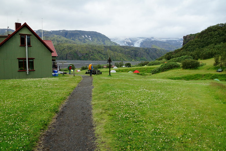
We returned to the trail on which we'd reached the Volcano huts,
retracing our steps past the yurts and then to the intersection.
Turning left would return us to the Laugavegur trail, so we
continued straight toward Langidalur.
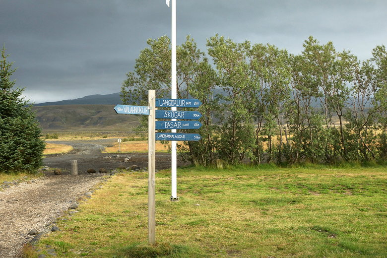
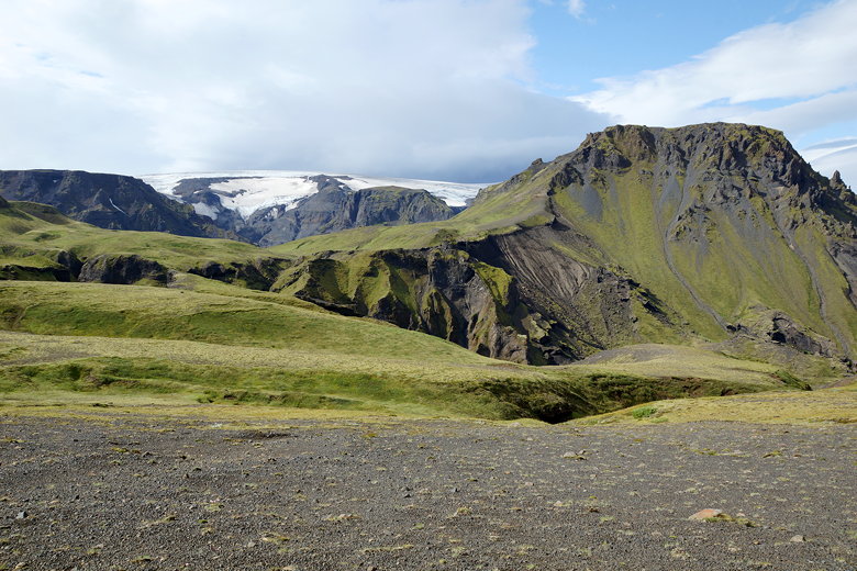
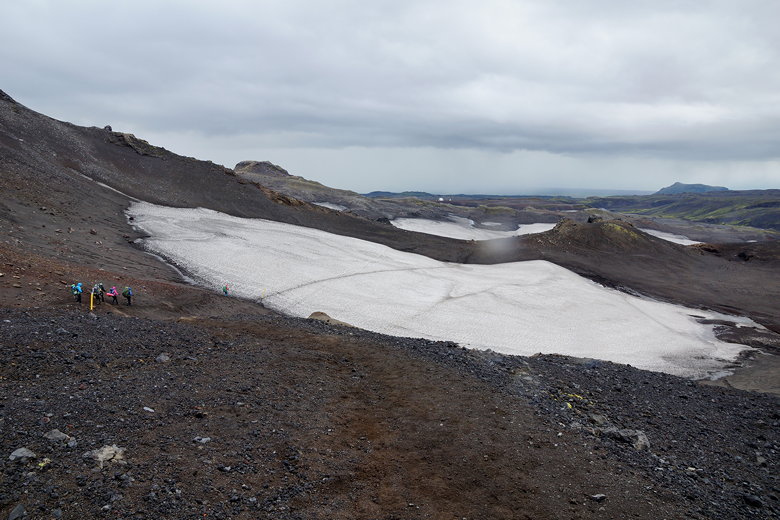
Distance signs at the Volcano Huts
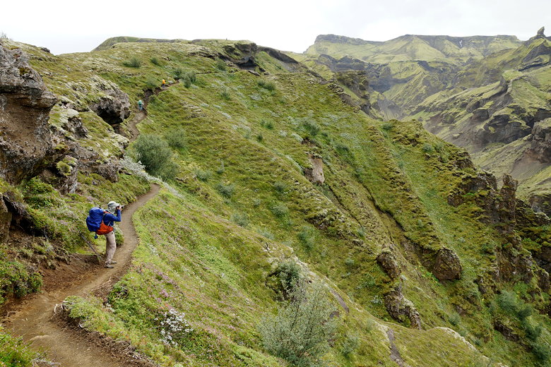
We reached something called Snorraríki, which apparently
is a famous cave.
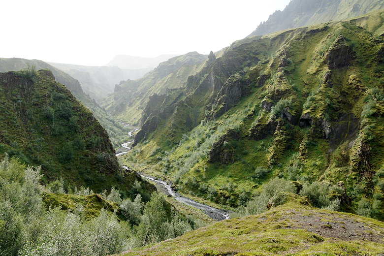
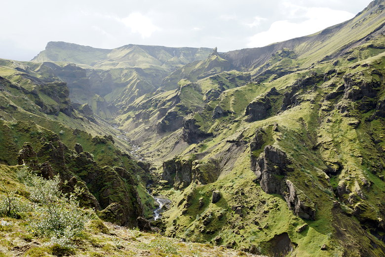
This part of the trail is
pretty flat, and we soon reached the Langidalur hut, sitting
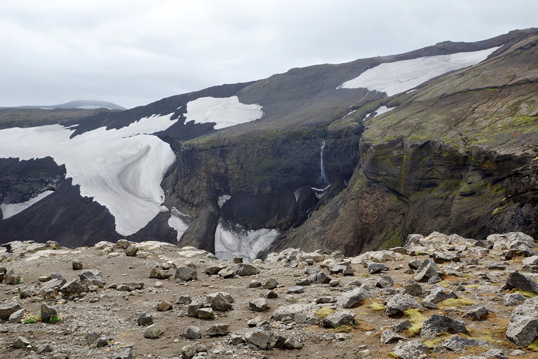
on the edge of the Krossa river valley. It was a beautiful
sight. Tents were situated on the grassy area near the hut,
with great views of the Krossa river valley and the glacier
above it. The hut looked well-stocked, with coolers outside
and even a rideable lawn mower. I kind of wished we'd
stayed here instead of the Volcano huts. Though I can't
remember if there were any reservations available at the time
we booked the Volcano huts.
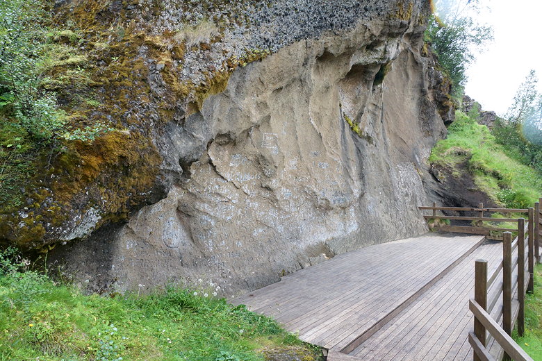
Snorraríki
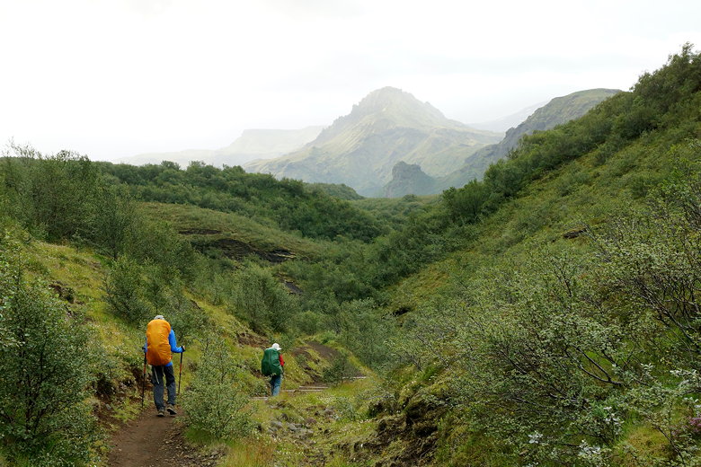
Hiking to Langidalur
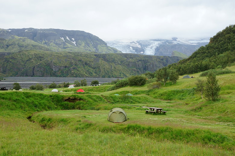
Tents at Langidalur
Langidalur Hut
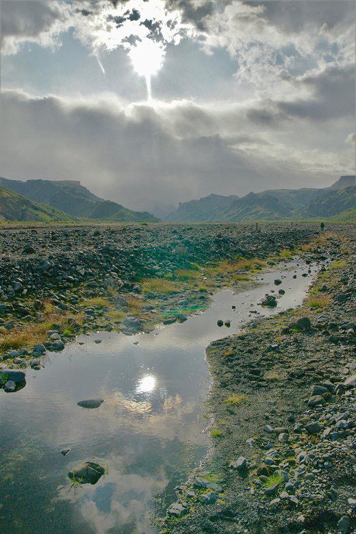
We passed the hut and started walking across the river
valley as the sun came out. The valley is strewn with rocks
but is almost pancake-flat, and blue/yellow posts mark the way
across the valley.
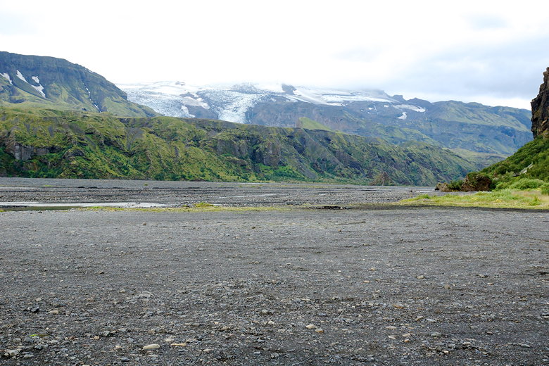
Krossa river valley
Krossa river valley
Krossa river valley
Reflection in a Krossa stream (photo credit: Nathan Gong)
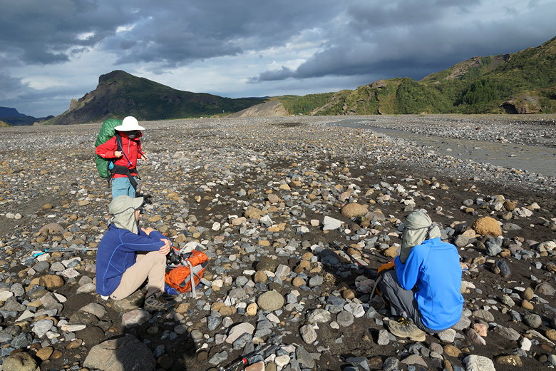
We did have to put on our water shoes for one small section,
which was a disappointment since we thought we were done
with wet crossings. But it was easy enough, and after that
we reached the portable bridge over the river proper. The
river was absolutely not crossable without the bridge. The
water was probably chest deep and rushing quickly by,
and wide as well. The bridge has wheels on either end, but
it was anchored (we hope) to the ground. We crossed one at
a time and then turned left toward the Básar hut.
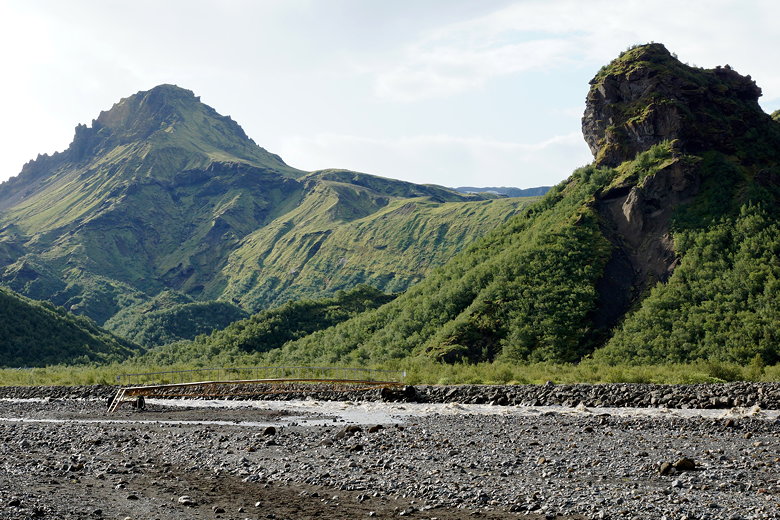
Bridge over the Krossa river
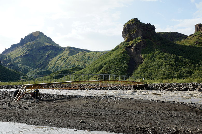
Bridge over the Krossa river
We could see the Icelandic flag above the Básar hut. Soon we
reached the Básar campground. You can actually drive
to the camp, so there were people car camping here.
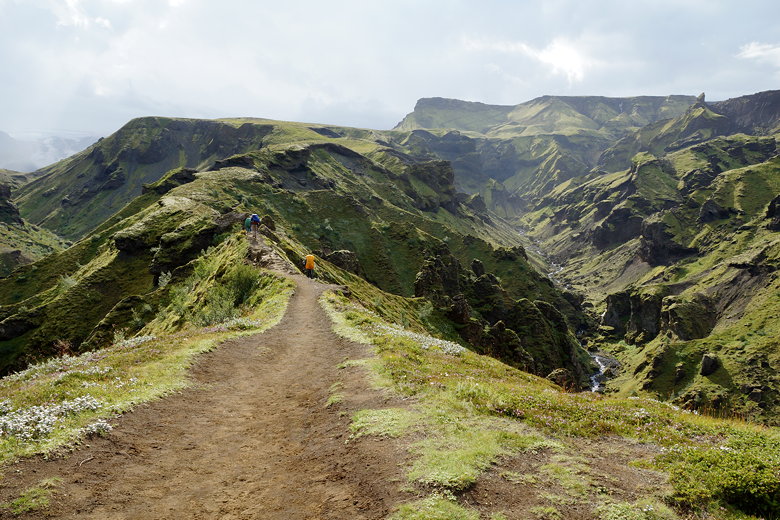
We walked through the camp, then followed the trail to a
map sign. From there, we turned right and started climbing
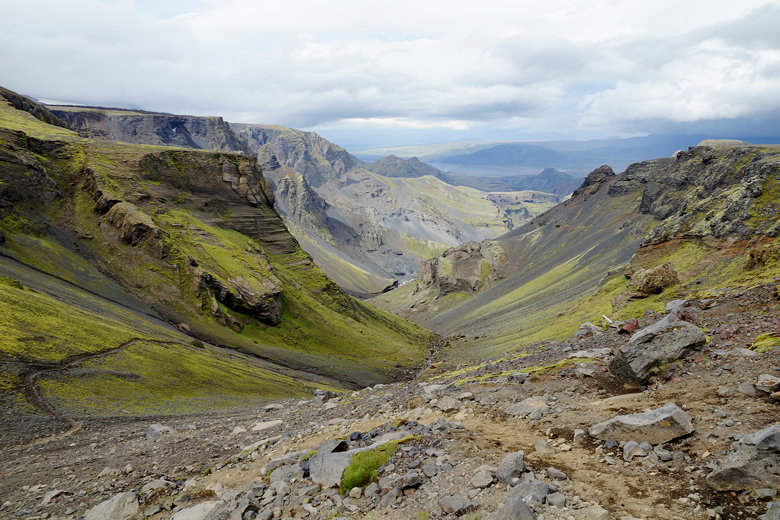
up. Soon we could turn around and look down on the Krossa
river valley that we'd crossed earlier in the day,
as well as Langidalur in the distance.
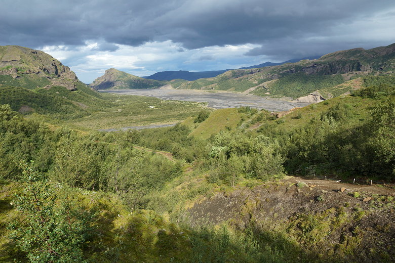
Looking back at the Krossa river valley
Mountain stream
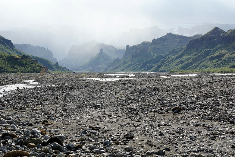
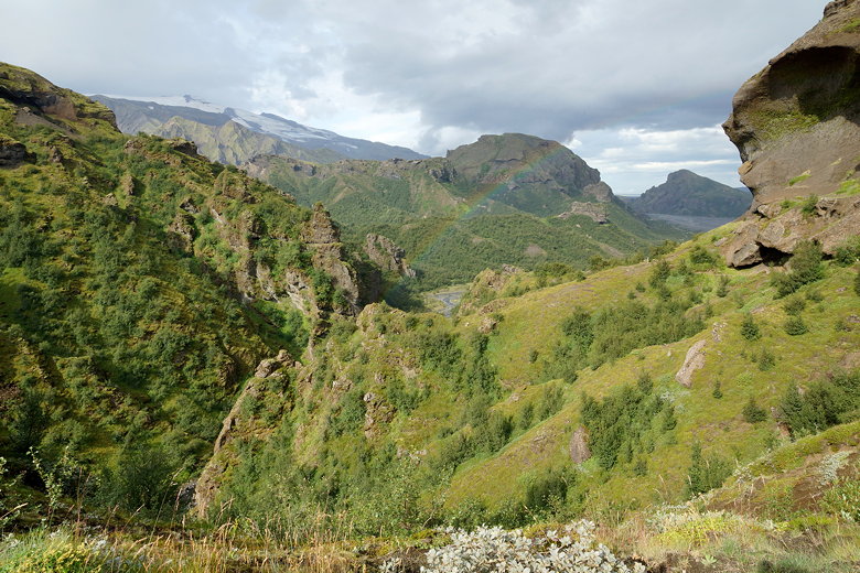
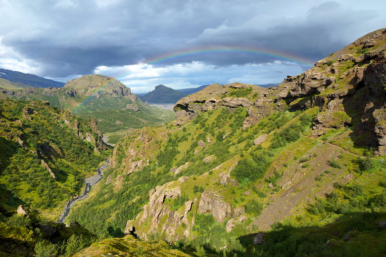
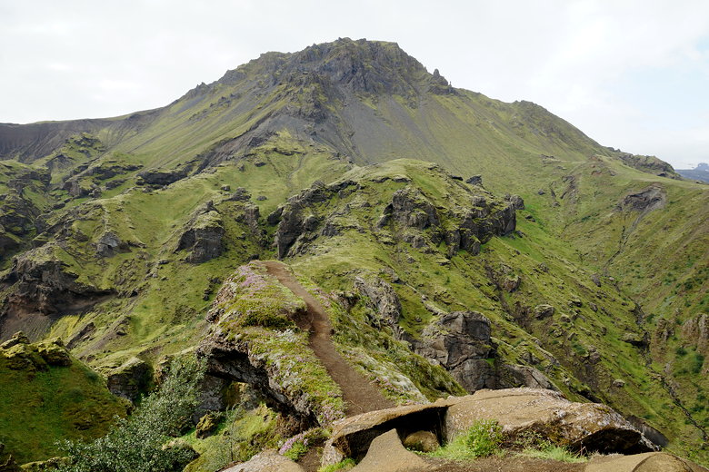
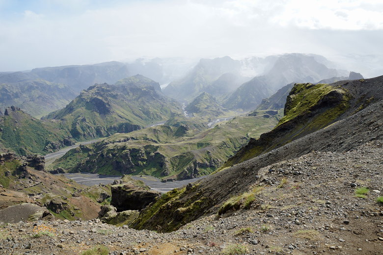
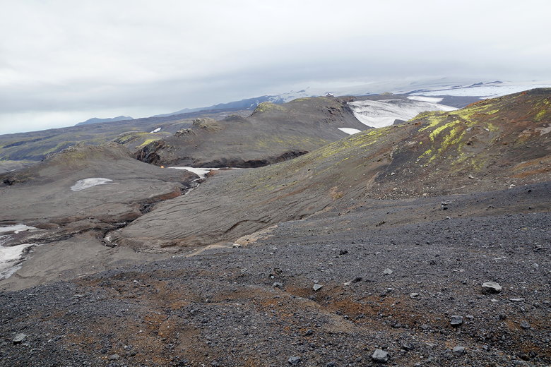
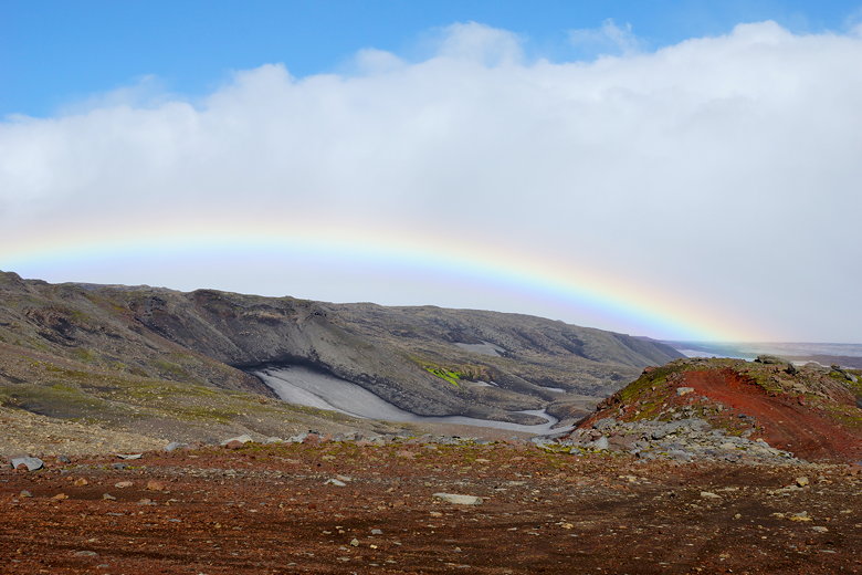
Next would be some of the prettiest stretches of trail on
the hike. We walked above sculpted green valleys, with
the occasional rainbow visible as the sky began to darken
a bit. The trail continues to climb, hugging the edges of the
hillsides.
Faint rainbow
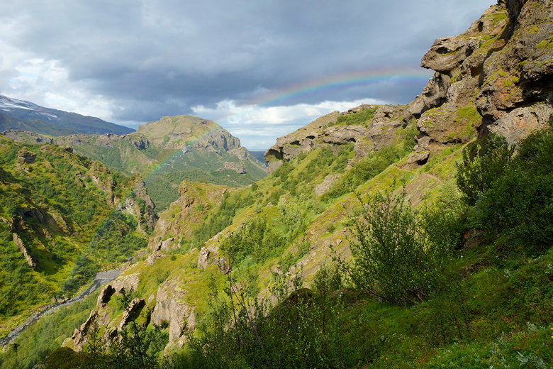
Rainbow
Rainbow near Básar
Mountain stream
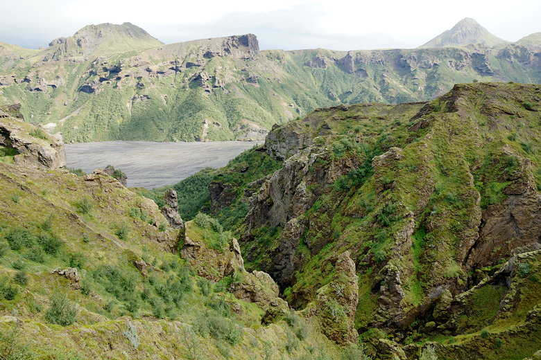
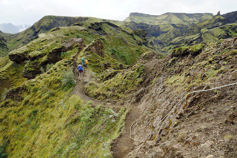
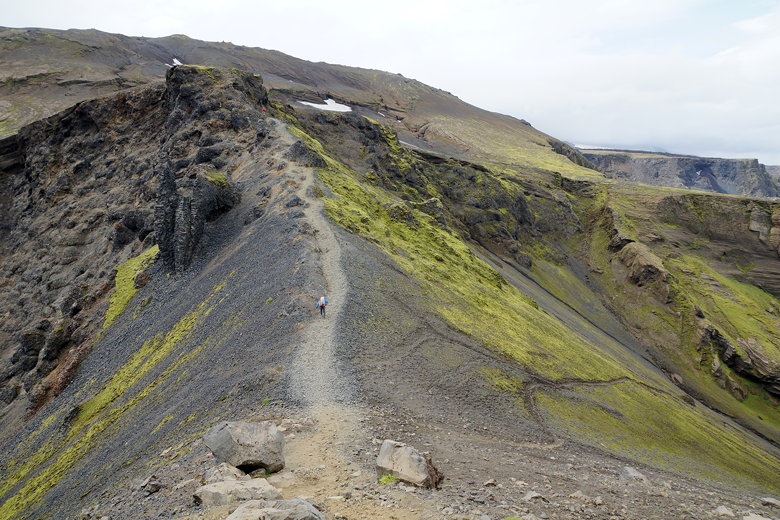
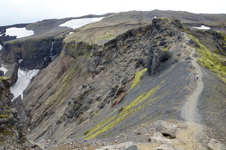
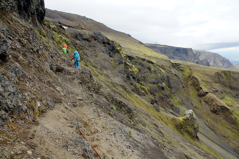
Next we reached the dreaded Cat's spine. As I had mentioned
before, I had seen some YouTube videos which made it look
really scary, but the Icelander we'd met at Emstrur hut
had assured us it really wasn't that bad. And when we got there,
I had to agree. I have a healthy fear of heights (at
one point I got down and crawled a section of the Angels Landing trail in Utah).
But I didn't have any qualms about walking over the Cat's
spine. Sure it's a bit narrow, and the terrain drops
down on either side, but it's not a sheer drop. Of course
if it's raining and muddy you'd want to be cautious. There's
also a roped section afterwards, though I didn't think that
holding onto the rope was really necessary when we
crossed.
Cat's spine
Krossa river valley
Cables after Cat's spine
Clinging to the hillside
View of the mountains
What you will find here are amazing views. Don't forget to enjoy them.
After crossing the Cat's spine, we continued to climb, reaching a plateau
where we took a brief break. A solo woman hiker (coincidentally also
from the Bay Area) caught up to us here
and chatted a bit. She was planning to stay at the Baldvinsskáli
hut as well, so we'd probably see her there, though she was toying
with the idea of hiking all the way to Skógar today.
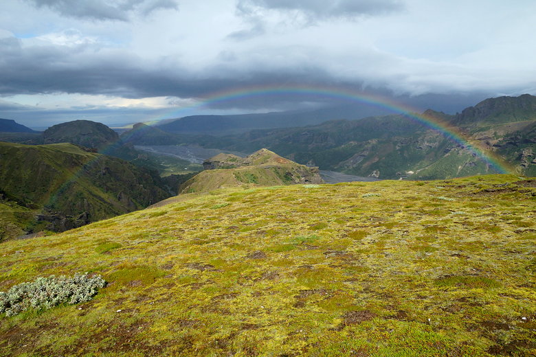
Rainbow and the Krossa river valley
Heading up
Mountains
Looking down at the Krossa river valley

Climbing up to the windy ridge
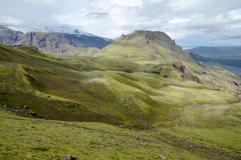
Mountain view
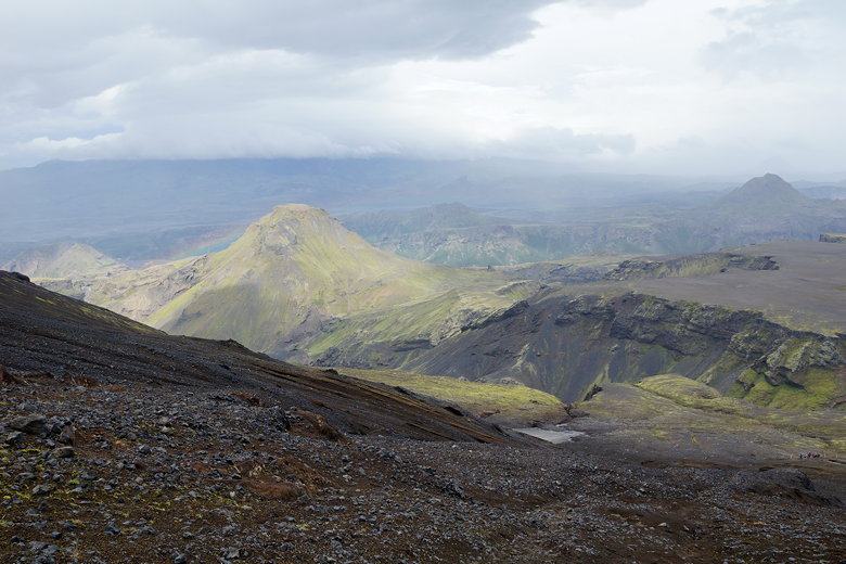
We continued climbing, and as we did so, the wind started to pick
up. At first it was just windy, nothing extraordinary, but the higher we got,
the worse it got. When we crested a ridge, the wind was so fierce that
I found it hard to make it fully to the top. A large group caught up
to us around this time, and many of them were sitting down to rest at the
top. I struggled taking a few steps before collapsing onto the ground,
hoping the wind would get better. It didn't, really, at least not here.
The trail reaches the ridge at a little notch and it probably accentuates
the wind. I rested a minute or two and then got up carefully and plowed
my way into the wind, trying to get away from the worst parts of the wind.
We now walked through the wind on a large plateau, the wind hounding us
the whole way. We stopped to rest at the edge of the plateau, where the
trail descends before climbing again. There are some nice views here of
the valleys and mountains around the plateau.
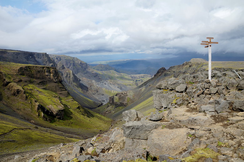
Sign at the edge of the plateau
Small waterfall
After a snack break, we descended and then started climbing again.
Some of the trail here is a bit narrow, and there's a section with
metal chains to hang onto. We could also see the glacier lurking
above us. Now the climb became steeper, and the trail turned to loose
dirt. The wind became problematic again. We struggled to the top.
To this point I had only been wearing my balaclava, sun glasses,
and fleece. But at some point here it started to rain. Combined with
the wind, this was getting uncomfortable quickly. When we came into
view of some snow fields, I stopped to change into my rain gear.
Off game the sun glasses and on went the pack cover, rain pants, and
rain jacket.
Valley view
Traversing the ridge
Traversing the ridge
Chains along the trail
Looking back at the plateau
Looking back down
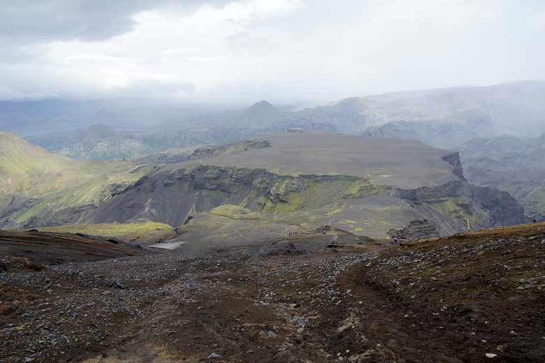
View of the whole plateau
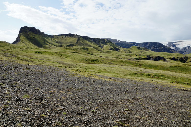
We started crossing hardened snow fields. It would have been fine except
for the rain and wind. The combination of both made my rain pants
mostly ineffective, as the rain pelted my legs from the side. We walked past
Magni and Móði, the craters created in the 2010 eruption that
disrupted air traffic all over Europe. Unfortunately I have no pictures
from here because of the elements.
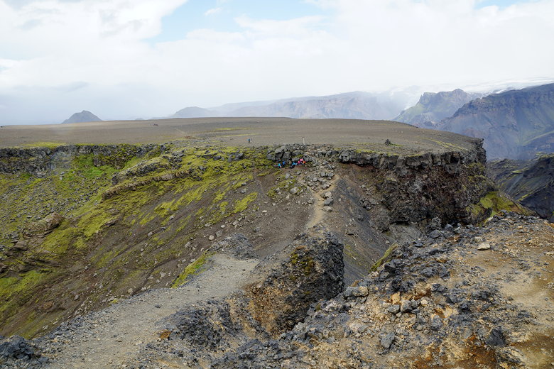
After the volcanoes, the rain started to subside. And then we could
see the two huts - the Fimmvörðuháls hut ahead to the right, and the
Baldvinsskáli hut (our destination) further to the left. But it
would take longer to get to the hut than the eye would make us think.
And though it wouldn't rain the rest of the way, the wind continued
and we had to pass over some steep icy sections of trail. I lost my
footing several times, but managed to avoid falling with the aid of
my trekking poles. Jean fell
several times and grew frustrated, but we eventually all made it
past the ice. I wouldn't call this part of the trail dangerous, as
there are no long steep drop-offs; falling mainly just hurts and delays
you, but having trekking poles is definitely helpful here.
Crossing snow fields
Fimmvörðuháls Hut in the distance (center, back)
We crossed over another couple ridges to reach the hut.
The large group that had passed us earlier were here, but they weren't
staying at the hut. They were just taking a break. Not sure if they
would be camping somewhere, or going all the way to Skógar. Camping
seemed questionable in this wind, but it was only about 3:15pm so they had time
to go further.
We entered the hut and took off our wet clothes and boots. The hut
warden told us the wet stuff would stay at the entry way, with backpacks
inside in the eating area on the first floor, with the sleeping area upstairs.
There were already a few others inside, including the woman we'd met
earlier.
We put out the sleeping mats upstairs (nice and thick and relatively new)
and laid out our sleeping bags, then went back downstairs. We tried to
dry out our things, and had dinner. The dining and kitchen area is all
one room. There's limited water, though no running water. I hadn't expected
any water at all, so we'd brought extra up with us. We ended up not having
to use any of the hut's water.
The warden said that today's winds were 60-70 kilometers per hour, but
tomorrow would be even worse - 80-90 kph, and rain as well. At
least it would be all downhill, but we weren't looking forward to it.
The clouds abated a bit and we could see some blue sky, but the winds
continued fiercely. We did see a rainbow, and I braved the wind to
take some pictures.
Rainbow near the Baldvinsskáli Hut
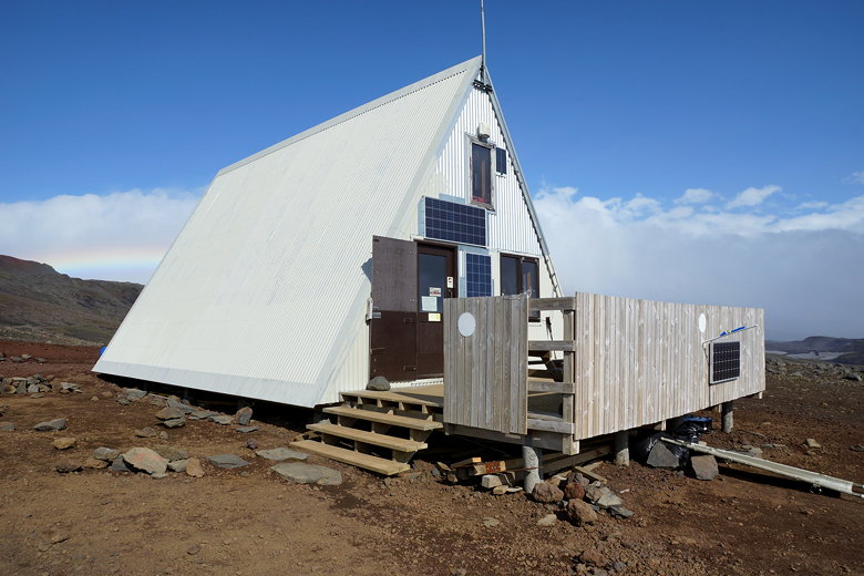
Baldvinsskáli Hut
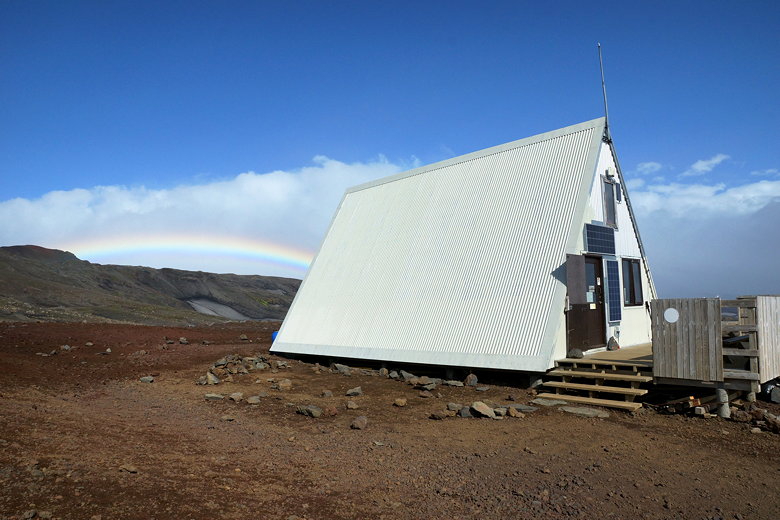
Rainbow and Baldvinsskáli Hut
The hut was completely booked (20 people), but I think there were only
14 of us so far. Some others came in around 5 or 6pm and wanted to stay
in the hut, but the warden told them they wouldn't be able to sleep
upstairs unless the others didn't arrive. They could probably sleep
downstairs in the kitchen/dining area, but it might be noisy. As it
was, the others never showed up, but most of them decided to sleep
downstairs anyway. There were also two tents set up outside next to the hut,
and I felt very sorry for them.
| 

