|

Smedberg Lake
Today would be a longer day, so we got started earlier, leaving camp at 9am.
It was sunny as usual when we started. First was a gradual climb up toward
Benson Pass. We crossed a meadow, then had a brief break before starting the
now steeper climb up to the pass. In total it's about a 900 foot climb
from Smedberg Lake to Benson Pass.
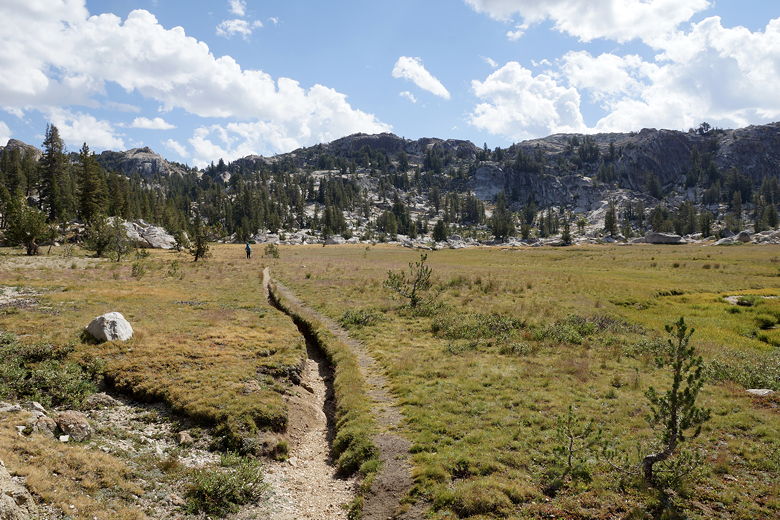
Heading toward Benson Pass
Two backpackers approached the pass from the opposite side just after we
did. Then a pack train, presumably 2 guides with about 10 mules carrying
lots of gear. Shortly after that came another 10 mules with 9 riders.
They continued down the other side toward Smedberg Lake.

Benson Pass
After a break at the top, we started the long descent toward Matterhorn
Canyon. The first part is sandy and easy to descend. The trail soon
enters open forest and then descends next to Wilson Creek.
As we descended, we encountered several hikers coming up in the opposite
direction, including I'm guessing the missing rider (she wasn't carrying
a pack, and asked about directions to Smedberg Lake). Maybe she got tired
of riding and just wanted to walk?
As we continued to descend, sometimes on rocky switchbacks now,
it started to drizzle a bit. We could
hear distant thunder again. I was just starting to think about
stopping and putting my pack cover on, but then it started to subside.
We continued the descent down to Matterhorn Canyon.

Heading down toward Matterhorn Canyon
After reaching the bottom, the trail is basically flat as it heads
through open forest upstream. Eventually we crossed Matterhorn Creek,
then came to an intersection. When we had done this part of the trail
6 years ago, we had camped on the other side of the creek before the
intersection, then taken the right fork up and exited via Virginia Lakes
2 days later. This time we took the left fork and continued on up
Matterhorn Canyon. Our goal was to get as far up as we could while still
finding a decent campsite, in order to make tomorrow easier.
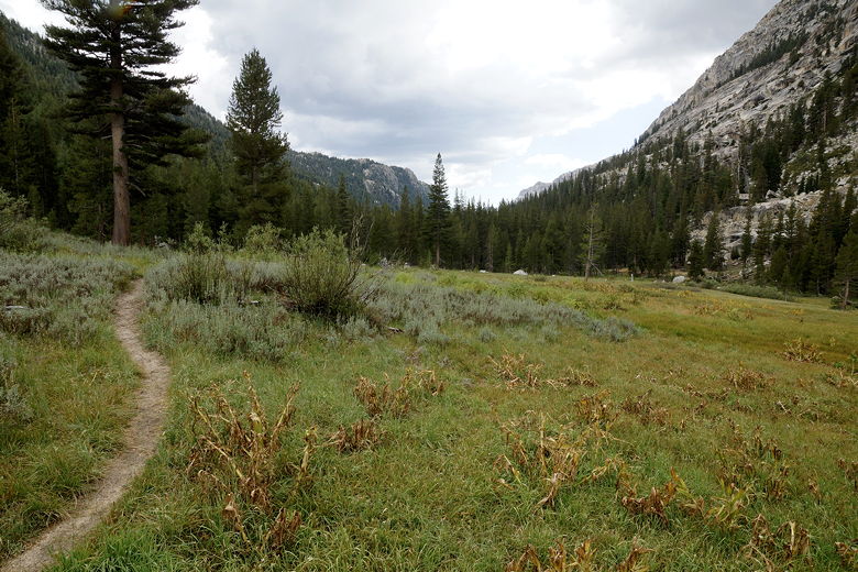
Heading up Matterhorn Canyon
This part of the trail is fairly easy, climbing through the forest fairly
gradually. We didn't see much in the way of campsites as we crossed the creek
back to the west side, and then again back to the east side. Both times were
fairly easy rock hops. After this we did see one potential campsite, but it
looked wet from the rains and we kept going.

Crossing Matterhorn Creek

Heading up Matterhorn Canyon

Matterhorn Canyon
We came to yet another creek crossing. Although this one was fairly narrow,
the water was flowing fast and we didn't see any good way to rock hop. We
decided to take the time to change into our water shoes and walk through the
creek. It was only maybe a foot deep here, and we crossed without incident.
Once on the other side, we started to look for campsites. The pickings were
slim, but we found a mostly level site next to some trees, with a rocky cooking
area nearby (it was obvious someone had camped here before). We were somewhat
far from the creek, but there was a little stream that actually crossed the trail
just up ahead, and it was easy to get to a place to get water from it for filtering.
I estimated we'd hiked a little over 2 miles with 600 feet of climbing from the
intersection, so that's hiking we wouldn't have to do tomorrow. Which was good since
we'd have to climb two passes tomorrow.
| 

