|
We met at the park headquarters at 9am. Kane and Lan arrived first
and got a camping permit for the Coit Lake area -- the last permit
available. Reservations are not allowed, and there is a limit
on the number of backcountry backpackers for each area. Visit
the Henry Coe web site for more details. Basically, you want to
arrive at park headquarters early in the morning to ensure yourself
of getting the area you want.
The fog which surrounded the area early in the morning lifted
quickly. By the time we started hiking at 10:15am, it was clear
blue sky. Forecasts looked good for today and the next day.
Since it was only a two day, one night trip, I was able to lighten
my load considerably. I'd also made a few modifications to my
pack list, perhaps the most notable of which was the use of lightweight
fuzzy slippers instead of Tevas -- a savings of over 1 1/4 pounds.
I'd also replaced my heavy Leatherman tool with a lightweight
Gerber knife. My pack for this trip would end up weighing just
41.0 pounds, versus 47.5 pounds for the Ohlone Wilderness trip.
Even though I was using my big camera this time. Jean's pack was
essentially the same -- 30.5 pounds this time, 31.0 before.
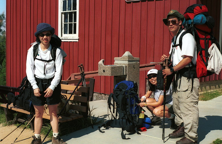
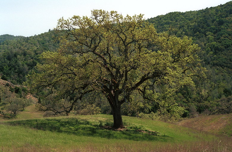
Getting ready for another adventure
We passed a group of boy scouts who were waiting at the trailhead.
Soon we were off on the Springs Trail. This is mostly shaded singletrack
and bypasses Manzanita Point Road, which is the main trail (a
fire trail). It's just a bit longer, but a pleasant alternative.
Shortly into this trail I encountered my first equipment problem.
I'd purchased a small Quantaray bag for my camera. I'd threaded
the back through my waist belt and it fit perfectly. But now I
noticed that the part of the bag I'd threaded it through was coming
off -- the seam was almost completely ripped off. I ripped the
last remaining shreds off and attached the bag to my waist belt
using one of Kane's carabiners. After less than a mile of this,
though, I could no longer stand the pounding of the camera on
my leg. So I threaded the top handle of the bag through my waist
belt. That seemed to work well enough and I continued like that
through the rest of the trip.
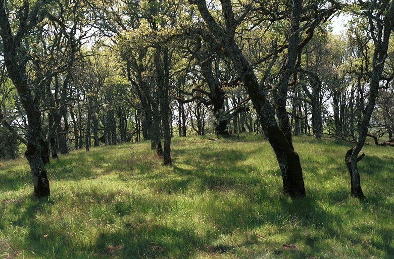
Forest along the Springs Trail
When we rejoined Manzanita Point Road, the boy scouts caught up
to us. We'd been having a relatively peaceful hike up to that
point, but now their constant talking overshadowed the natural
beauty around us. It was with great relief that we saw them head
toward the Manzanita Point Group Camps. We, on the other hand,
continued on the China Hole Trail.
Along the way we were met with great views of Coyote Creek twisting
its way through a beautiful canyon. We hiked through an exposed
area where there'd been a prescribed burn. Then we re-entered
the forest. Here there was dense brush, as opposed to the broader
oak trees we'd passed on the Springs Trail. We passed occasional
wildflowers as we winded our way down to China Hole (1160 feet).
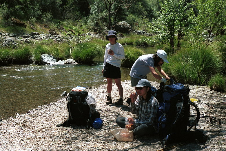
Lunch at China Hole
When we got there, we were not to be disappointed. Here the Coyote
Creek flowed gently passed a small sandy beach. We stopped here
for lunch. Two campers had set up their tents on the sand and
were standing in the water, talking. A series of rock formations
provided us great amusement. I made the short 4-foot jump to a
large rock across the relatively deep water (I would not have
wanted to fall in). After I jumped back and forth a few times,
Kane did the same. Jean tried to work up the nerve to do it, but
we were interrupted by the campers before she could. We'd been
there jumping around for a while, and they were starting to get
annoyed. It was getting late and we still had a long way to hike
to our camp, so we packed up and headed down the creek.
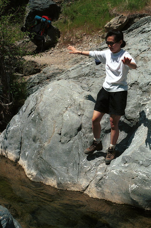
Jean preparing for a leap of faith
Unfortunately, we shouldn't have. Headed down the creek, that
is. The trail, if you could call it that, was narrow and dangerous
in places. In others, you simply crossed a bunch of rocks hoping
not to sprain an ankle. We continued on for a while before I suddenly
realized we were going the wrong way. We hadn't crossed the creek
yet, but we should have crossed it at China Hole. Instead, we
were headed toward our old friend Poverty Flat.
In fact, we were already at the crossing point to Poverty Flat
Road. We crossed the creek to the main trail and had to decide
what to do. Lan had seen a trail signpost on the other side of
the creek, but hadn't said anything since she thought we knew
where we were going. At this point, going back to China Hole and
continuing that way would take too long. So we decided we would
continue on toward Los Cruzeros, then take the Willow Ridge Trail
toward Coit Lake.
After starting east on Poverty Flat Road, we encountered our first
climb of the day -- past Jackass Peak (1805 feet). But soon we
were at the Poverty Flat Road/Mahoney Meadows Road intersection.
We had a great view of the canyon into which we would descend.
We turned right and descended down Mahoney Meadows Road to Los
Cruzeros (1220 feet). Here we met the east fork of the Coyote
Creek. An interesting trip sometime would be to go cross-country
through "The Narrows" which connects China Hole to Los Cruzeros.
There's no official trail there, but the ranger at headquarters
suggested it so it must be okay, right?
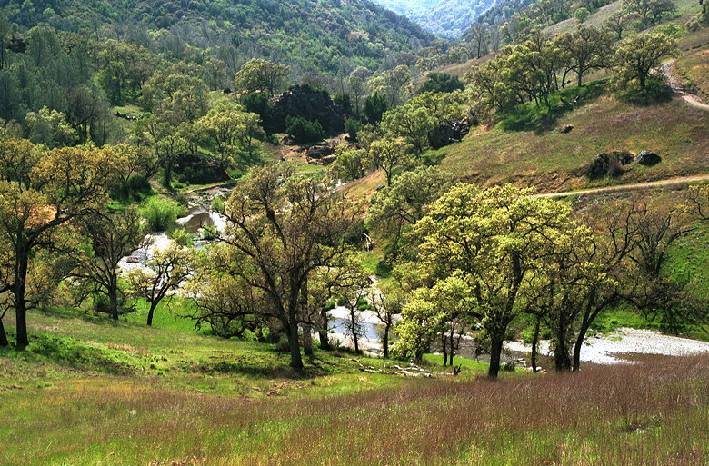
A tree seen on the descent toward Los Cruzeros
After crossing the creek we started heading up Willow Ridge Trail.
We didn't see a signpost identifying it as such, however. There's
only a sign saying "Mississippi Lake," which is not necessarily
a good sign since Mississippi Lake and Coit Lake are in somewhat
opposite directions, although Willow Ridge Trail goes toward both
of them.
Los Cruzeros as seen from the Willow Ridge Trail
Willow Ridge Trail starts out exposed. It's also a tough climb.
Soon we had a great view of Los Cruzeros below and behind us.
But then we entered dense brush as we climbed higher still. The
brush completely enveloped us, closing in on the narrow singletrack
trail, brushing our arms and legs. Poison oak is prevalent here,
as it is in most of the park, and we had to be careful. The brush
also seemed to trap the afternoon heat, as the temperature rose
and we started to sweat. Indeed, when we got to exposed portions
of the trail -- even in the sun, it was noticeably cooler. Welcome
cool breezes dried us, but the breezes couldn't penetrate the
brush.
When we finally popped out onto Willow Ridge Crest Trail (a fire
trail), we were at 2420 feet elevation. A pair of hikers followed
us closely and turned left onto the road, toward Mississippi Lake.
We turned right toward Coit Lake.
Here the trail is open again, with scattered trees on either side.
We had views of the surrounding area. We could see for miles in
either direction -- and no signs of civilization. Only the gentle
hum of an rare occasional airplane reminded us of the outside
world. Turkey vultures soared over the ridge tops and down into
the canyons on either side.
The trail it generally flat, but goes up and down a little. It
seemed to go on forever. It was starting to get relatively late.
I wanted to get to camp as soon as possible to filter water and
start cooking before dark. So I left Jean and Jennie, making sure
Jean turned on her radio. While I was off on my own, I saw a deer
jump into the bushes ahead of me -- my first big animal sighting
of the trip. I probably make too much noise with my trekking poles
and scare most animals off before I see them.
I met up with Kane and Lan at a signpost for Hoover Lake. Kane
and I continued on the main trail toward Coit Lake, which we could
see in the distance from the signpost. Along the way we encountered
a headless lizard being devoured by ants. After perhaps an hour,
maybe less, we finally arrived at the turnoff for Coit Lake. We
turned left and were shortly at the lake shore (2080 feet elevation).
Across from us we could see a pair of tents. To the right, more
campers. It looked like most of the good spots were taken. We
chose a campsite closest to the trailhead, with a view of the
northern portion of the lake.
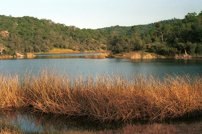
Coit Lake
Lan arrived shortly after us, and the three of us began to filter
water with my MSR pump and Kane's SweetWater pump. I'd never seen
a side-by-side comparison of pumps. I'd never had any reason to
complain about mine. But now that I've seen how much faster the
SweetWater pump is, I'll have to look into getting a different
one. After getting enough water for cooking, we turned our attention
to making dinner and setting up camp.
By this time, Jean and Jennie had arrived. We managed to set up
camp and cook and eat before it got dark -- always a good thing.
Jennie and I did filter some water for drinking after dark, but
amazingly we didn't get bombarded with mosquitoes.
My allergies were acting up at full strength, and I took an antihistamine
just before dinner for fear of keeping everyone around the lake
awake with my sneezing. By the time I was in my tent and washed
up, the drowsing effect of the antihistamine hit me and I was
out like a light -- at 9pm.
| 

