|
I woke up at 1am. I went outside the tent to relieve myself, and
took a picture of the moon peeking through the clouds. Then it
was back into the tent until almost 8am.
Usually, I'm up before sunrise. It was warm enough inside the
tent, though, and the antihistamine was still making me groggy.
It didn't help that the sky was almost completely overcast and
it was blocking out the sun. I had to drag myself out of my sleeping
bag and outside. Lan was already up, but everyone else was still
asleep. I'd found that our little detour had turned an 11.5 mile
trip into a 13.5 mile session.
As I started to get ready, a rabbit at the top of the hill captured
my attention. I tried to take a picture of it, but to no avail.
Eventually I gave up and started making breakfast. By this time
everyone was climbing out of their sleeping bags. Soon we were
having a hot breakfast -- mine consisting of oatmeal, a pop-tart,
and two cups of hot chocolate.
The other camping groups at the lake were already gone by the
time we started to pack. Lan and Kane were done packing quickly
(no tent or bivy sacks), so they started filtering water for us
for the day's hike. The rest of us continued to pack.
Suddenly, as I was clearing the rest of the stuff out of the tent,
I started to hear an unbelievable sound. Yes, it was raining.
Not hard, but consistently. The forecasts hadn't called for it,
but here it was. Strange as it may seem, I'd backpacked in hail
and snow (see Ohlone Wilderness) before, but never rain. And rain
worried me more, because it meant things would get wet.
We finished packing up as quickly as we could. Some of my stuff
did get a little wet, but nothing too bad. I put my poncho on
and put the back of it over my pack to keep it dry. Everyone had
some sort of rain gear, so we weren't completely unprepared. One
thing I noticed quickly, however, is that my convertible pants
I'd just bought aren't waterproof. The shell pants I normally
bring backpacking are somewhat waterproof, so I was a bit disappointed
with the new pants. My calves were soon wet. Once we started hiking,
however, it wasn't too bad.
We started off at 9:55am. We headed back up to the Willow Ridge
Crest Trail. Here we decided to split up. I wanted to take the
Cross Canyon Trail back, since it was different and the ranger
said it was a really nice trail. However, Jean and Jennie weren't
up to the longer hike it entailed, so they headed back the same
way we came -- Willow Ridge Crest Trail to Willow Ridge to Los
Cruzeros. Kane and Lan joined me; we would meet at Los Cruzeros,
probably at 1pm.
So Kane, Lan, and I headed south along the Willow Ridge Crest
Trail. Just a few dozen yards down the road we found the turnoff
for Cross Canyon Trail. We turned right and headed down. The rain
continued to fall as we headed down into the canyon. The trail
really is beautiful, with great views of the canyon during the
descent.
We soon passed a pair of mountain bikers coming in the opposite
direction, but those were the only other people we would see until
we approached Los Cruzeros. The trail was muddy in places, but
not easily passable. Downed trees interrupted the trail here and
there, and we had to make small detours to avoid them.
After a long descent we made our first creek crossing. This creek
runs through Kelly Cabin Canyon from Kelly Lake to Los Cruzeros.
The trail follows the creek for over a mile, crossing it countless
times back and forth; trekking poles came in very handy during
all these crossings. The trail is mostly self-evident, but at
one point Kane ran into a dead-end. He had to retrace his steps
on a muddy, narrow, steep trail; unfortunately the trail slid
away and he slid with it, down the hill about 12-15 feet. He was
okay, though, save for a bunch of dirt which he would find in
his pocket 2 hours later.
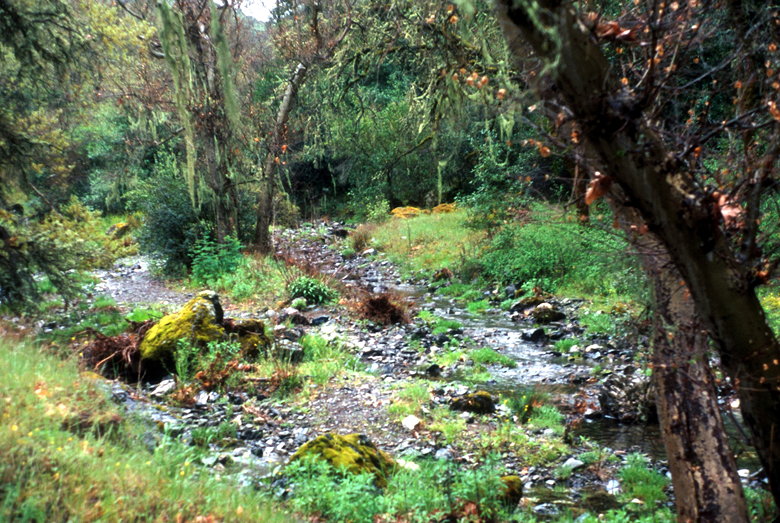
I know it's a little fuzzy, but this is what Cross Canyon looks
like
While we were criss-crossing the creek, the rain finally stopped.
By this time, my decidedly non-waterproof hiking boots were soaked.
They'd performed admirably in a downpour at Cathedral Lake the
previous year, but this time was different. This time, the trail
was narrow in places; my legs would hit 8-10 inch high grasses
on either side, and the grasses would shed their water directly
onto my hiking boots. This is how my boots, socks, and feet got
wet -- not directly from the rain itself.
Despite my foot misery, the trail was beautiful. I would definitely
do this trail again, preferably in better weather. But, alas,
all good things must come to an end. We left the creek and started
ascending out of the canyon. At least we could say goodbye to
the time-consuming creek crossings.
After descending to an elevation of 1420 feet, we climbed back
up to Mahoney Ridge at 2000 feet. Near the top the mud was so
deep it started to attach itself to our boots. It was like walking
with bricks attached to either foot.
While Kane and I waited for Lan to reach the ridge, I spotted
what Kane would identify as a boar -- a black four-legged creature
about 3 feet high -- and a baby boar, too. They trotted off through
the high grass before we could whip out our cameras.
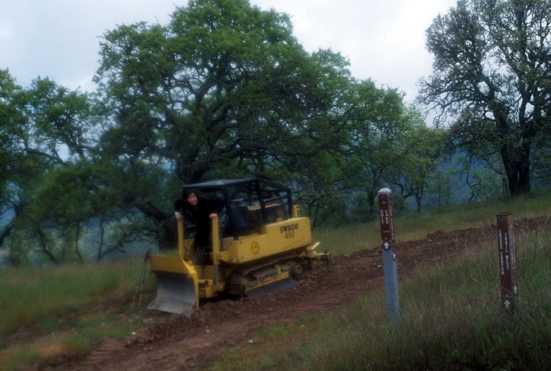
Lan doing some trail-building
We still had 3 miles to go to reach Los Cruzeros. At this point
I knew we would be later than 1pm. Unfortunately, we were still
out of radio range. I told myself to try the radio as we got closer.
The Mahoney Meadows Road is another fire trail, similar in nature
to the Willow Ridge Crest Trail we'd hiked on the previous day.
Rolling hills, oak trees and grasses. At 12:50pm I figured we'd
be in radio range (2 miles) so I tried contacting Jean and Jennie
to tell them we'd be late, but I didn't get a response. I kept
trying every 5-10 minutes. Finally, at about 1:25pm Jennie's voice
came over the radio and I told them we were about 15 minutes away.
Soon we were all at Los Cruzeros enjoying a rest. Jean and Jennie
had been there since about 1pm and were enjoying themselves in
the sun, which had shown itself for the past hour or so. I changed
into some dry clothes (luckily, most of my pack was dry because
of my poncho). While we were there, Lan noticed a couple ticks.
Soon after she flicked one off her sock, I flicked one which I
saw crawling up my right leg. I saw another one going after my
pack. We decided it would be a good idea to get up and leave.
Ticks are numerous in Henry Coe State Park. Fortunately, only
a small percentage (about 1 percent) actually carry Lyme disease.
But still, the prospect of getting bitten didn't sound too appealing.
So we examined each other and got back on the trail.
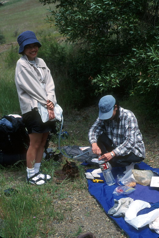
Um...what's Jennie refilling her water bottle with?
We retraced our steps up the trail to Poverty Flat Road and down
to the place where we'd crossed the creek near China Hole the
day before. I saw a bunch of hikers going along the creek toward
China Hole. They looked like they were out for a leisurely day
hike -- no equipment other than their cameras. We, only the other
hand, still had to lug our packs a few more miles.
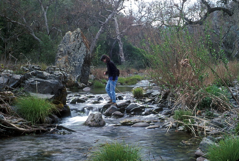
Unidentified hiker crossing the creek near Poverty Flat
We passed Poverty Flat, crossed the creek one last time, and headed
up, up, up. The good thing about fire trails is that they're wide
and in generally good condition. Getting poison oak or getting
cut up by brush is not a problem. Unfortunately, the bad thing
about fire trails is that they're machine-made; the operators
of the tractors apparently have no concept of switchbacks. The
machine has no problem making the grade, so they just go straight
up.
As we headed along Manzanita Point road toward the finish, the
wind picked up and it started to get very cold. We kept going,
past the day hikers and nature walkers. We saw a lot fewer people
on Sunday than we did Saturday. I'm guessing the weather probably
has something to do with that.
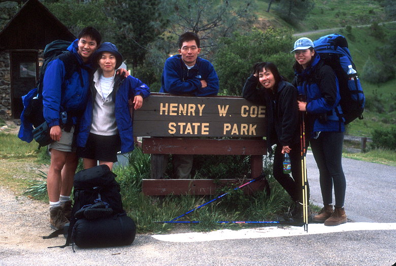
Whew!
Soon we were back at the headquarters, hugs and pictures all around.
Then a post-trip dinner at Max's. And dessert, of course. After
27.6 miles in 2 days, I think we deserve that.
| 

