|
The ranger who gave me the permit had mentioned bears at Huckleberry Lake, but we
didn't have a problem. The bear canisters were untouched in the morning. As I took
some sunrise pictures, I heard the sound of the horse bells. They were coming toward us.
Later, we'd see the horses walking slowly along the trail past us, though we didn't actually
see any riders.
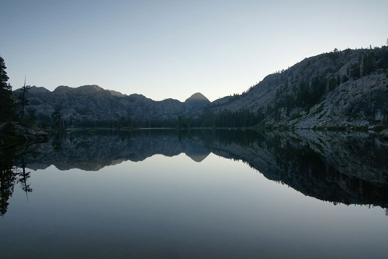
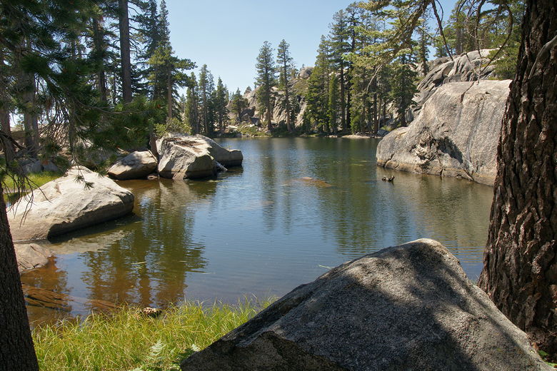
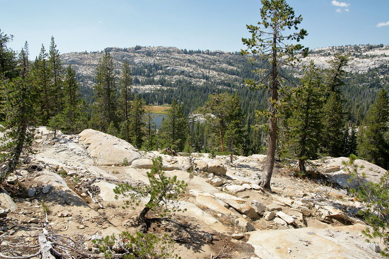
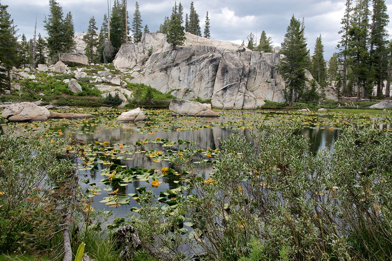
Huckleberry Lake sunrise
Huckleberry Lake sunrise
After pondering the map, we decided to backtrack to the T-intersection and follow the trail
along the northern shore of the lake, rather than continuing along the southeast shore
to the end of the lake and then heading north. It looked like continuing would be a bit
longer, so we took the other option, even though it meant we would probably have to do
a bit more climbing.
So we packed up and headed back toward the intersection. It took us 23 minutes to reach
it, and then we kept to the left to head toward the north shore of the lake. Soon, we
reached an unexpected obstacle. In front of us was the Huckleberry Lake inlet stream,
about 25 feet wide and a foot deep, with no possible way to rock hop across. It looked
suspiciously easy for horses.
Before putting on our sandals, we looked upstream to see if there was another way across.
As we were doing so, we heard barking from across the stream. Suddenly, my kids started
screaming. By this time
I was about 50 feet away from my kids. I turned around in time to find two dogs barking,
chasing after my youngest son who was running in terror. I ran at the dogs to scare them
away, and they ran back across the stream.
Shaken and mad that the dogs were not leashed (which they're supposed to be), we put
on our sandals and crossed the stream. We saw the dog owner and let's just say
tempers flared on both sides before he later settled down and offered us to stay and
have a beer or
coffee, though we didn't have the time. Having to double back and then cross the
stream put us behind schedule, and we didn't want to race against sunset again.
The camping area on the north side of the lake is relatively compact, so if we had camped
here we almost certainly would have been within earshot of the horse campers. We
were glad we stayed on the other side of the lake. We clambored up onto the rocks above
the lake and started the climb up toward Lertora Lake. (I have no definitive answer for
whether it's Letora, Lertora, or Lertoria; I've seen it written all three ways, sometimes
multiple ways on the same web site; I'm going with Lertora).
We passed through a livestock gate, then continued the climb. We ran into a few day
hikers near the lake (probably people staying at the horse camp), but didn't see anyone
else after that. We made the climb under the hot mid-day sun, with a few views (none
of them that dramatic) of Huckleberry Lake below.
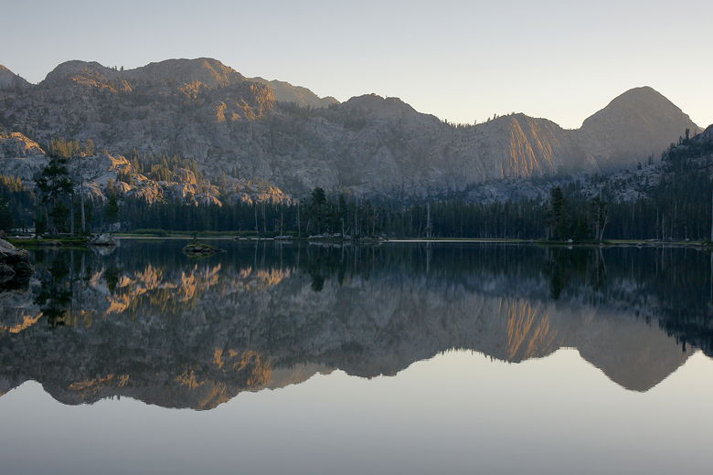
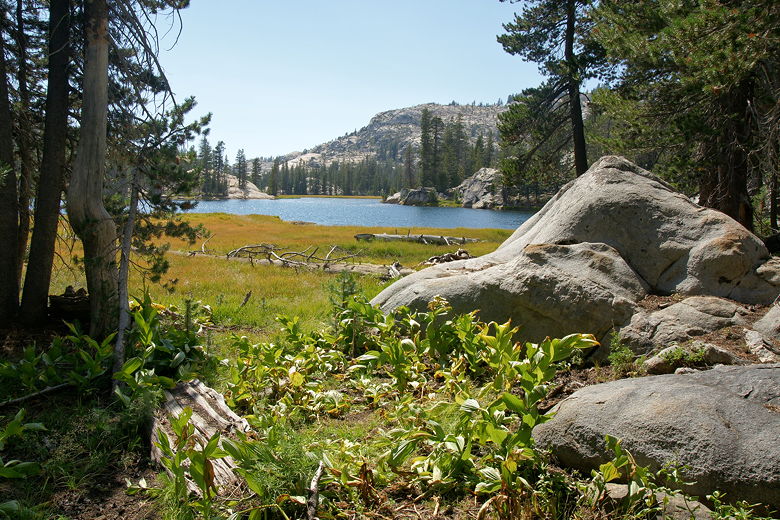
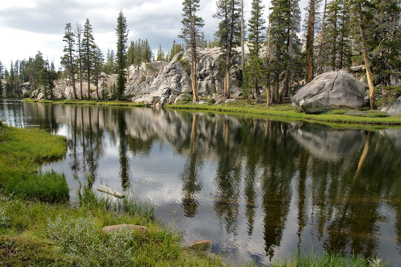
Huckleberry Lake from the northern trail
Huckleberry Lake from the north
After a long climb, we turned the corner and started a downhill section. After passing
a pond and climbing up some rock steps, we soon found ourselves at beautiful Lertora Lake.
The trail only skirts the southwest corner of the lake. This would be a great place to
explore further and camp (though I'm not sure of the availability of good campsites here).
Pond next to the trail
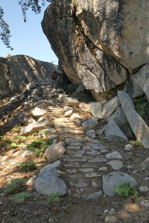
Rock steps on the trail
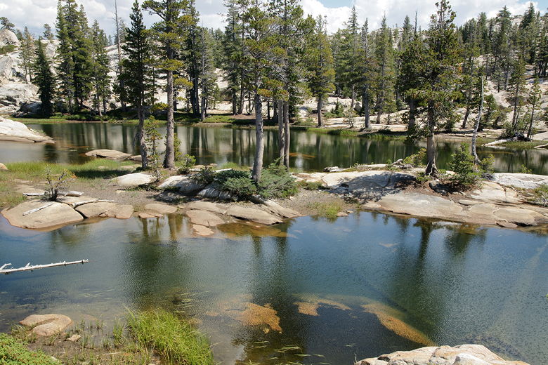
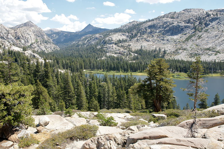
Ponds just before Lertora Lake
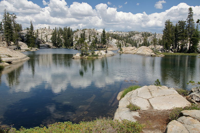
Lertora Lake
We had a nice lunch break at Lertora Lake. Afterwards, we continued along the trail,
almost immediately finding an intersection, with a faint trail leading to the left down
to the southwest end of Huckleberry Lake. We took the right fork, leading down a 400-500
foot descent toward Cow Meadow Lake.
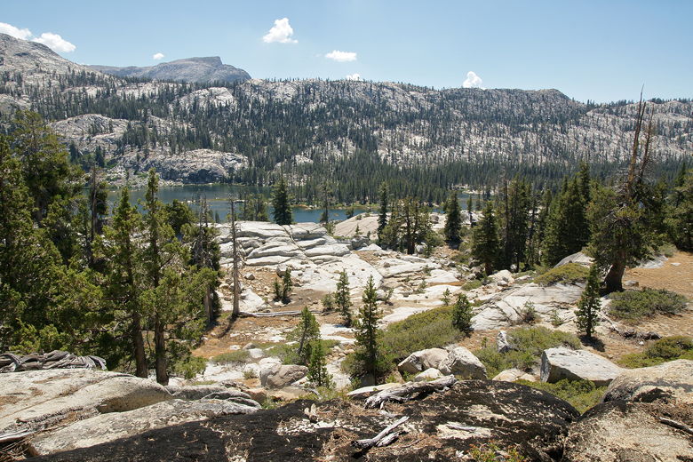
Cow Meadow Lake from above
Along the way, I brought up the possibility of staying at Wood Lake tonight instead of
Long Lake. Wood Lake was about 2 miles closer, which would mean a longer hike the next
day, but I thought it would be manageable. Wood Lake was on the way, so we could make
up our minds then, anyway.
After passing Cow Meadow Lake, we came to a crossing of the North Fork of Cherry
Creek. It was a wide crossing, but very shallow (less than a foot), and fairly easily
done via rock-hopping. However, Jean slipped on an unstable rock and splashed into the
water, submersing the bottom of her pack. She was fine, but was wet and worried about
the contents of her pack.
Cow Meadow Lake
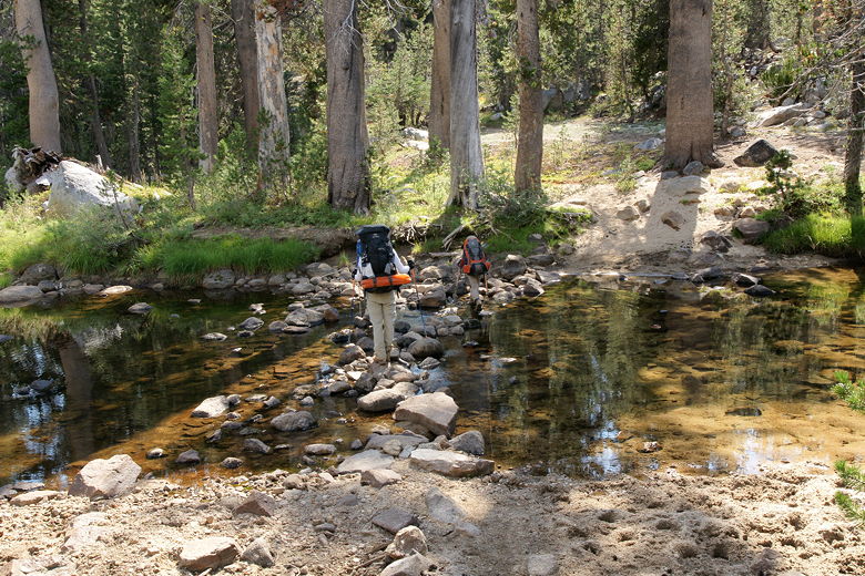
Crossing the North Fork of Cherry Creek
From there, we started a 500 foot climb up to the next intersection. I was a bit
confused at this point because I never saw a trail intersection for a trail
following the creek. We weren't going to take that trail, but I saw it on my map.
On the other hand, my map was about 11 years old, so I guessed that perhaps the trail
was no longer maintained. In fact, I got a newer map after the trip and it doesn't appear on it.
This should provide a lesson to me to not rely on old maps. The terrain doesn't
generally change, but trails can get re-routed due to erosion or other factors,
or fall into disuse because of lack of maintenance.
As we climbed, we could see dark clouds starting to move in from the east. It was still
bright and sunny, with blue skies to the west, but the view looking east was starting
to turn ominous. The temperature started to drop as we climbed and the clouds moved in
more. I was a bit worried, but hopeful that we'd be spared any rain since it was
getting late in the afternoon.
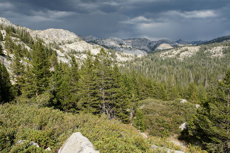
Looking back (east) at approaching clouds
We topped out on the climb, then reached an intersection. To the right was the
path to Buck Lakes; we could have taken this as an alternative to Wood Lake, but we
decided to take the left fork to Wood Lake.
Pond before Wood Lake
We easily crossed over a small section of the lake on some logs, then continued along
the trail next to the long south shore of Wood Lake. This is a beautiful section of
trail. The lake itself is not that wide here, perhaps 100 feet. The sun fought through
the clouds and the afternoon light on the lake made for some pretty reflections.
Because the lake is so narrow here, it seemed intimate.
Wood Lake
Hiking next to Wood Lake
Partly because it was getting late (around 5:30pm), and partly because we were worried
about Jean's pack being wet, we decided to camp at Wood Lake rather than continue on
to Long Lake. In retrospect, this was probably a good decision because the trail to the
south end of Long Lake doesn't even appear at all on the newer
trail map. So it's unclear if we even would have made it to the south end of Long Lake or
would have had to make the much longer hike up to the north end of Long Lake.
We found a great campsite at Wood Lake, high above the lake near the west end of the lake.
By this time, the clouds had pulled back and the sun was winning. It was a bit windy
now, but there was no immediate threat of rain. We checked the contents of Jean's pack
and were treated to good news. Most everything was dry. One sleeping bag was slightly
moist, but quickly dried after being exposed to the afternoon sun.
The one downside to camping here was that there wasn't really a good spot to get water.
The edge of the lake was shallow and occupied by grasses in many places. I found a few
rocks from which to gather some water, but I had to make several trips since the lake
was so shallow here. Still, the scenery was beautiful, so I can't complain.
We were below 9000 feet, so campfires are allowed. In fact there was a campfire ring
near our site, but we decided not to use it -- partly because of the wind, partly
because we didn't want our clothes to get smoky, and partly because we were just
tired. After watching a pretty sunset, we did see two campfires on the opposite shore.
While we hadn't seen anyone on the trail since Huckleberry Lake, we weren't completely
alone at Wood Lake.
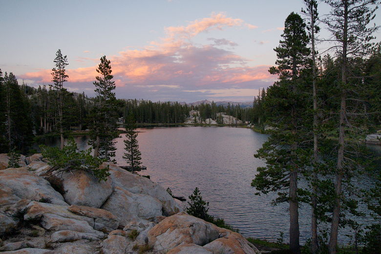
Wood Lake sunset
| 

