|
Today was the big day, the climb up Mt. Whitney, the highest peak
in the United States outside of Alaska. Jean and I had attempted and
failed to reach the top on a day hike back in 1999 due to altitude
sickness. This time, we were as acclimatized as we'd ever be, so
I wasn't too concerned about that.
Many people get up very early to climb Whitney, even from Guitar Lake.
I would say many had already left by the time I poked my head outside
the tent at 6:10am. Most of the people around Guitar Lake were gone by 7:30am,
though some remained. Perhaps many of those people who left early would be hiking
all the way to Whitney Portal today, so they needed the head start. We
would be camping at Trail Camp, so we weren't quite so pressed for time.
Still, we wanted to get to the top before any thunderstorms, so we got
up a little earlier than usual, but not much.
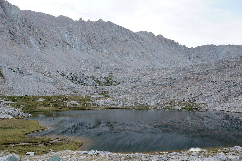
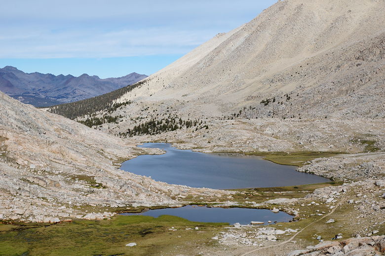
Guitar Lake
Mount Hitchcock over Guitar Lake
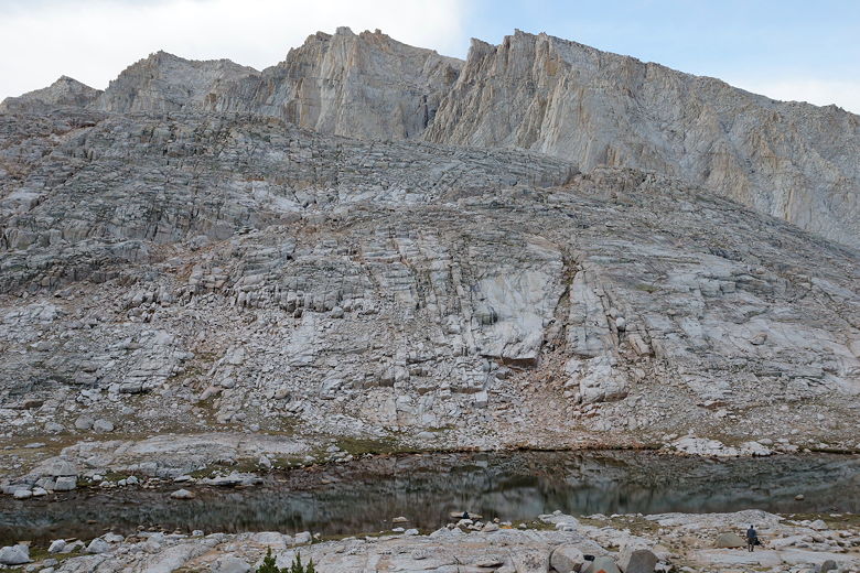
We left Guitar Lake at 8:20am. We returned to the main trail and
followed the trail as it climbed up past Guitar Lake. Today we'd be
climbing about 3000 feet to the top of Whitney. But we didn't think of it
that way. Our immediate goal was to get to the Trail Crest junction, about 2000 feet up.
Mount Hitchcock over Guitar Lake
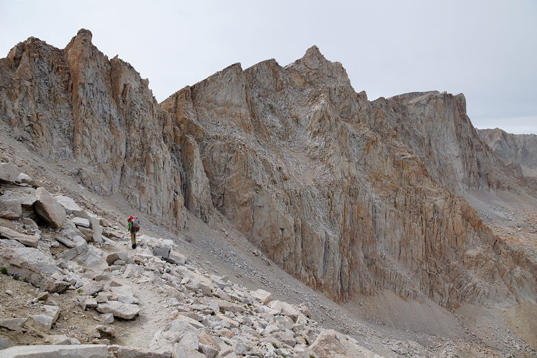
Climbing up toward the switchbacks
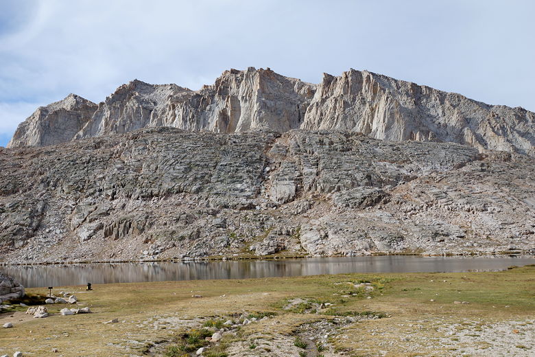
After passing Guitar Lake, we passed a pond. After about 1 hour,
we stopped near the base of the switchbacks for a food break. We still had about
1400 feet of climbing to go. Our plan was to do it all in one push, so we fueled
up as we watched many hikers on the switchbacks above us.
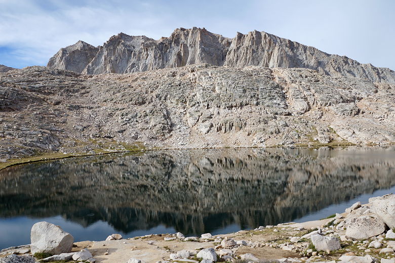
Mount Hitchcock over Guitar Lake
Guitar Lake
Guitar Lake
Mount Hitchcock over pond
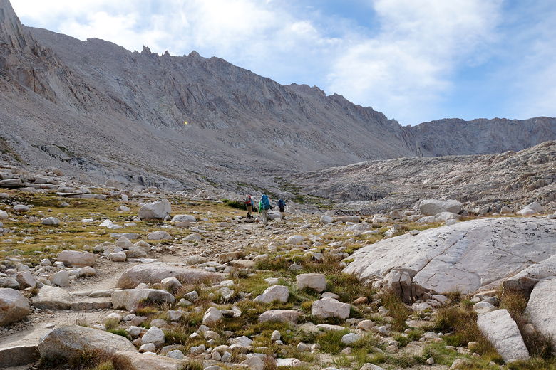
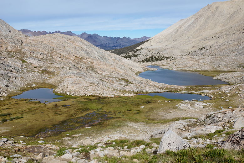
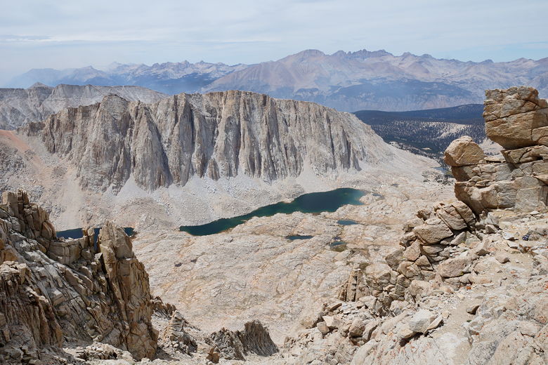
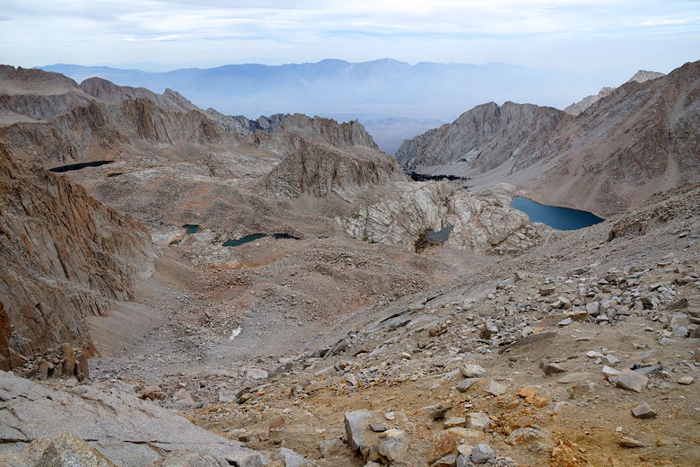
We made steady progress up the switchbacks, gaining impressive
views of Hitchcock Lakes and the mountains beyond them. After about an hour and a
half, we reached the Trail Crest junction at 11am. We could see more than a dozen
packs here - backpackers who dropped their packs before doing
Whitney (it's a 2 mile out and back to Whitney from here). We still needed our water,
food, jackets, etc. So we compromised. Jared dropped his entire pack, while
the rest of us emptied ours of bear canisters, sleeping bags, and the tent. So the rest
of us still had our packs, but they were much lighter. While we were here we saw
Patrick come down from Whitney. He had started early (from the unnamed lake above
Guitar Lake) and was hiking all the way out today. We wished him well, but I knew that
my old knees couldn't handle the 6000 feet of descent he'd have to endure today. We
also saw the woman with the injured foot here; she had just finished coming down
from Whitney, as well.
Pond and Guitar Lake
Ponds and Guitar Lake
View of mountains to the west
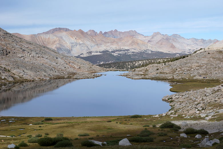
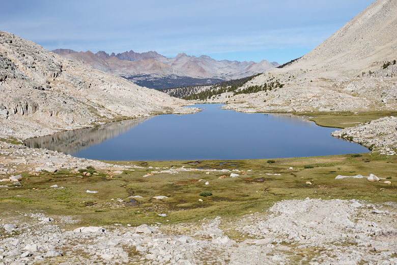
View of Mount Hitchcock and Hitchcock Lakes from switchbacks
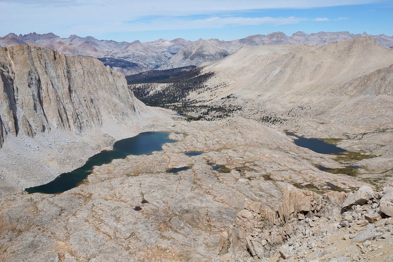
Hitchcock Lake and Guitar Lake
Mount Hitchcock and Hitchcock Lakes
After sorting out our packs and having a bite to eat, we were back on the trail at 11:30am,
on the way to Whitney. It's a deceptively long two miles. The trail starts out by
switchbacking up, but then levels off. At this point, around noon, we ran into Todd.
Todd would be driving us back to our car tomorrow. Today, he was doing a day hike of
Mount Whitney, so I had thought we might see him. He had gotten an early 2-3am start
like the rest of the day hikers,
and had already been to the summit. He looked very beat right now, but was on his
way back down to Whitney Portal. We changed our plan slightly; originally, we were going
to meet him around 1pm, but I thought we could make it earlier so I now told him we'd
see him around noon tomorrow. He told us we actually had some downhill ahead of us,
and then we parted ways for now.
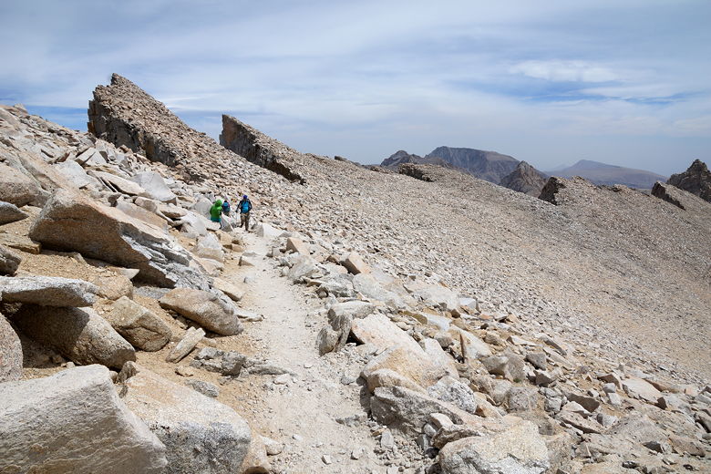
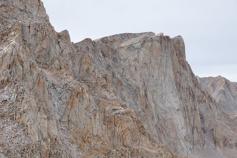
As Todd had warned us, the trail did actually go down a little bit. It's also very narrow
and rocky at this point. We started to see steep chutes to our left with dramatic views.
Soon enough the trail starts climbing again, though it's still
pretty narrow and rocky for a while. We now started to see these "windows" on the
right - notches in the
mountain where we could see all the way to the Owens Valley and the mountains beyond.
I tried not to dwell on how long of a drop it was down there.
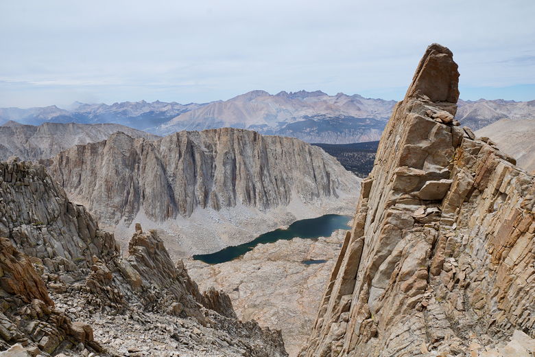
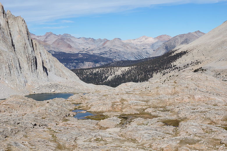
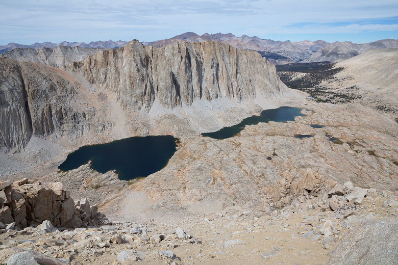
Mount Hitchcock and Hitchcock Lake from Whitney trail
Trail to the summit
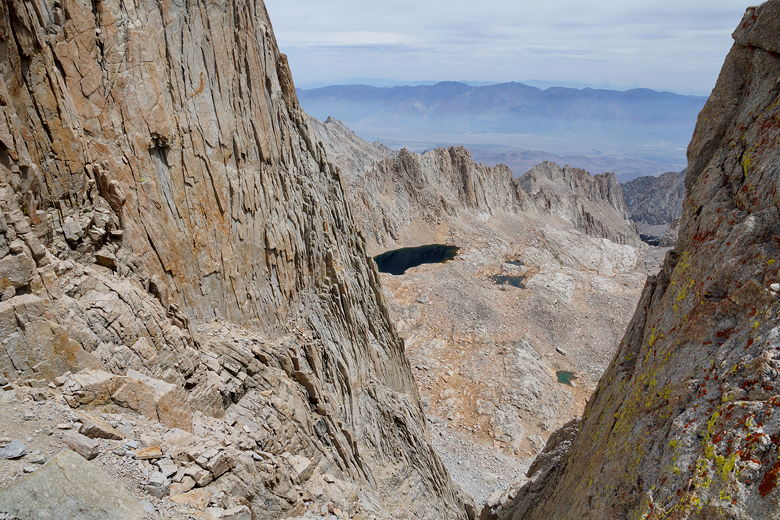
Looking through a notch toward Owens Valley
Mount Hitchcock over Hitchcock Lake
Looking down at Owens Valley
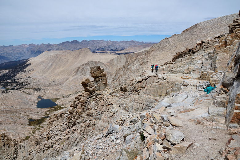
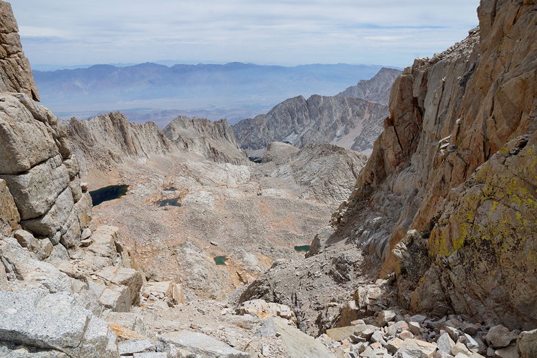
We climbed past 3 or 4 peaks, all the while having to stop occasionally to let someone
pass in the opposite direction. There were a lot of people on the trail, some backpackers,
some day hikers. Sometimes, we could see the summit hut ahead of us. So we could tell
where we were headed, but the path to get there was long. After passing the last
peak, the trail loops around to the left, and then up the backside of Whitney.
This last part of the trail is fairly gradual and easy, good trail compared to the narrow
rocky trail before it. The only downside is that the summit hut disappears from view.
I kept climbing and climbing, and then suddenly I could see the hut in front of me.
A smile crept across my face as I knew the rest was easy. A couple minutes later,
at about 1:15pm, I was at the top. Nathan was already there, and Jean and Jared would
soon join us. While it hadn't really bothered us before, it turns out that reaching
the top, given that Jean had gotten altitude sickness before, meant something to us. It
was nice to put that failure to rest, 16 years later. We made it!
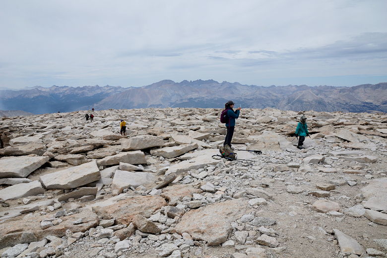
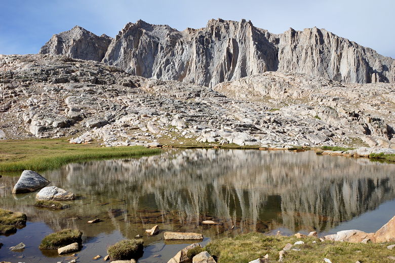
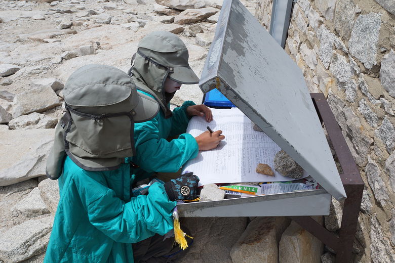
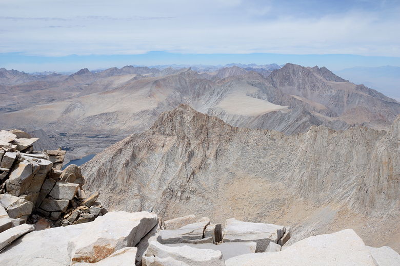
Mount Whitney summit plateau
There were probably 20 other people on the summit with us. The summit hut has prayer
flags around it, a small barren closet-sized room you can visit, and is fronted by
a large summit register. I searched for Todd's name, but so many people had already
signed it since his arrival that someone had started a new page. We signed the
register, then went out to the rocks near the edge. Of course there were great views
all around, but I'll admit it's not my favorite summit (still Mt. Tallac, I think).
But more than anything, the reality was setting in that we had finished the John
Muir Trail! Of course we still had one more night to go and we still had to go
down, but the hard part was over. We could hardly believe it.
Signing the summit register
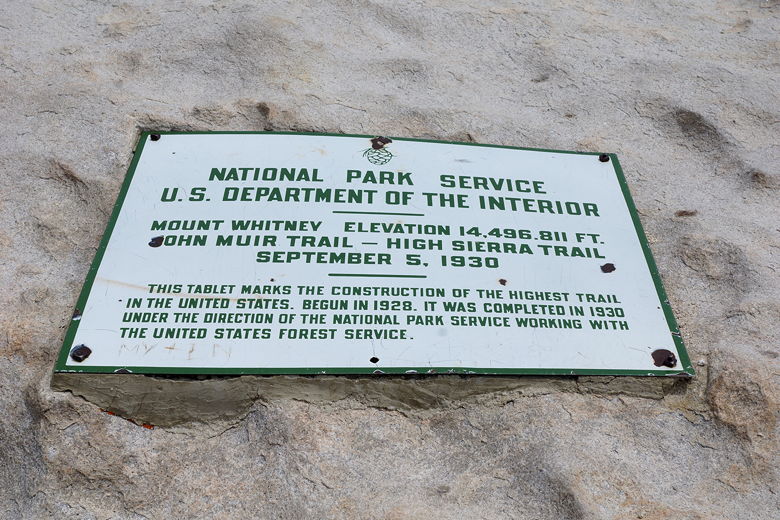
Sign on rock (elevation has since been calculated as 14,505)
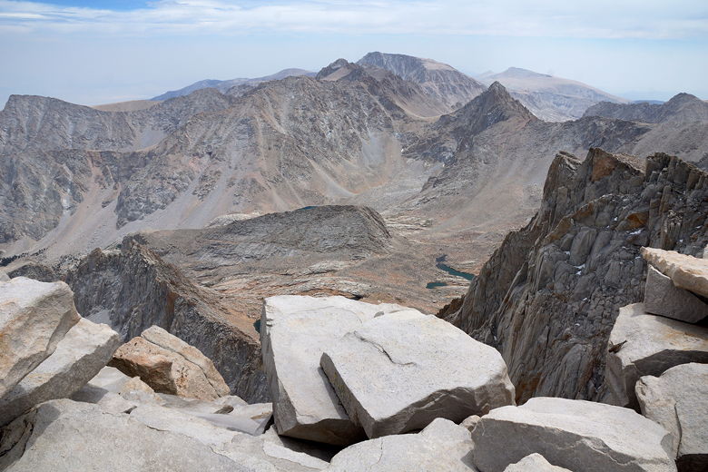
Whitney summit view
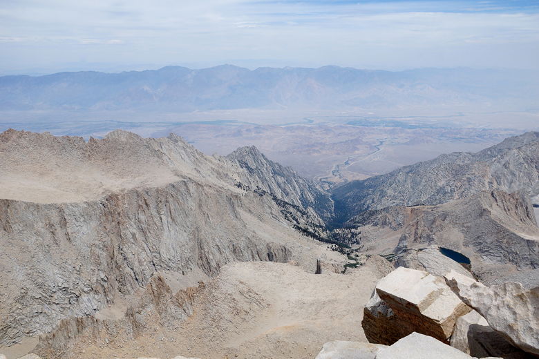
Whitney summit view (to the east)
We met another family at the top with two boys, ages 5 and 10. They weren't doing
the whole JMT (they'd started at Tuolumne Meadows, exited somewhere, then re-entered at
Onion Valley), but it was impressive nonetheless. I mentioned that we were
camping down at Trail Camp, but the father said they were planning to camp on
the summit! I thought to myself that it didn't sound like a great idea, but I guess
he really wanted to see the sunrise.
Whitney summit view
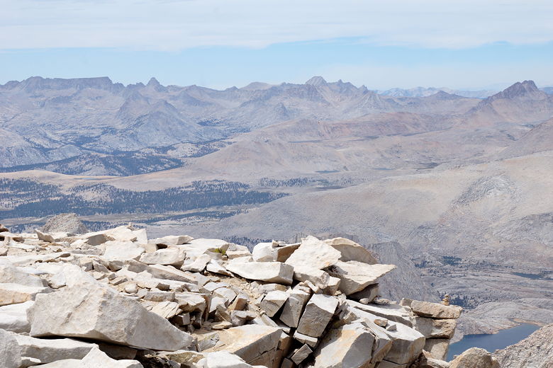
Whitney summit view
After enjoying the summit, we started heading back a little after 2pm. It was now
quite cold and windy. This was the only time on the trip when I hiked with my
hiking shirt, down jacket, rain jacket, and gloves, all at the same time. The return
trip to the Trail Crest junction was pretty easy, though we still had that little
uphill to contend with. We arrived at the junction at 3:15pm, then retrieved all
our stuff (it was still there).
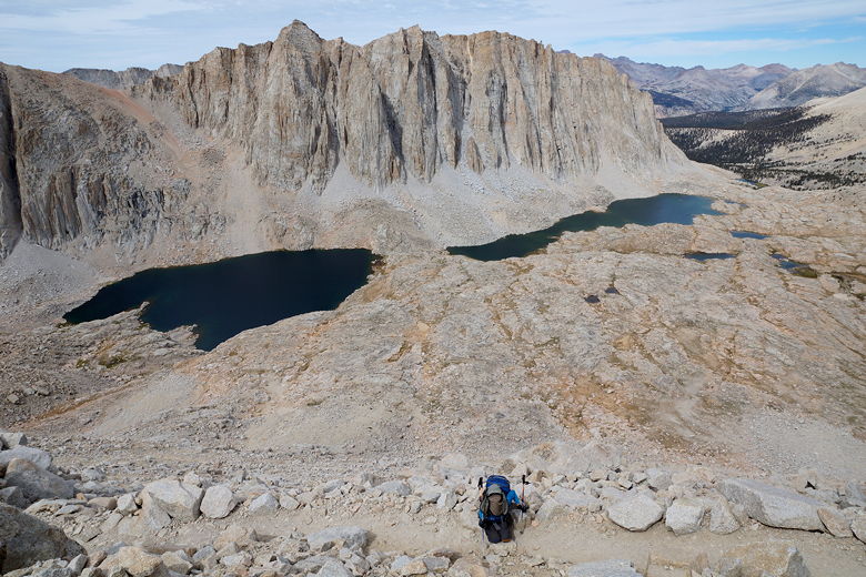
Heading back toward Trail Crest junction
Now with our full packs, we headed...uphill! Almost cruelly, there's about a 150
foot climb from the junction to Trail Crest, and it's actually fairly steep.
We briefly took in the views before getting to the task of descending the 99
switchbacks. I started to count, but I lost count around 15. Jared said he counted
and confirmed there were 99. However many there are, I have to say they seemed
much more well constructed than when we hiked the trail in 1999. I seem to recall
a lot more sandy, loose sections of trail. Now, there are a lot of rock walls
and the trail seems well built.
Looking east from Trail Crest
Mount Whitney (far right) from the switchbacks
Mount Whitney (flat top in center, back; I am sure because I can see the hut)
One thing we definitely noticed was that it was much less windy and cold on this
side of the mountain. As we got closer we could see lots of tents set up near
the small lake at Trail Camp. I still thought we'd find a decent site on the right,
though. We got to the bottom at 5pm. The boys almost immediately spotted a
campsite on the left, to the west of the lake and far away from everyone else.
It was a great site, and we took it.
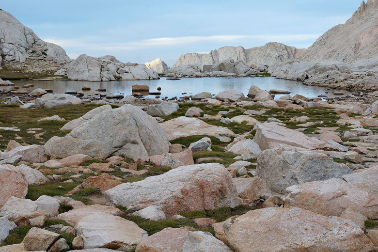
Lake at Trail Camp
Later, I found that the lake had tons of algae in it - more than I think I've
seen in any other lake. Eventually I figured out that the lake's inlet
streams (which our camp was not too far from) had very clear water, so I filtered
from there instead.
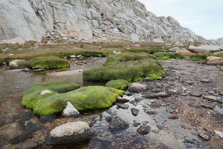
Lake inlet stream
There were lots of marmot and pika near our site. Or maybe it was the same pika
and marmot moving around a lot. We enjoyed a nice sunset, with great views
looking across the lake and also up toward the switchbacks in the opposite
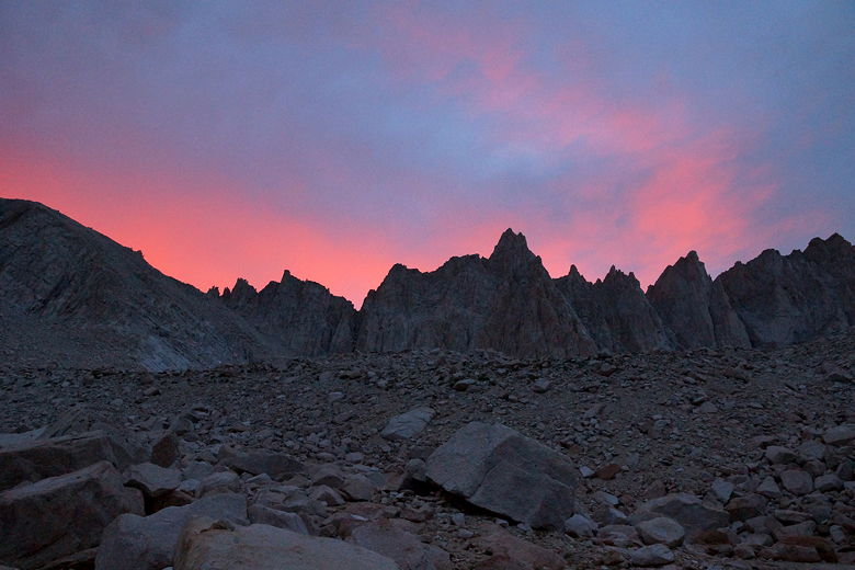
direction. We went to sleep knowing that tomorrow would be easy. It
was a bit windy that night at Trail Camp; I can only imagine how cold and windy
it was on the summit.
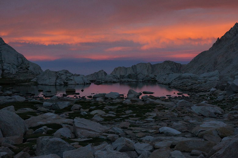
Trail Camp sunset
Sunset, looking west from Trail Camp
| 

