|
In the morning, the mosquitoes were still a problem, so we tried to
pack up our camp as quickly as we could, starting off before 9am.
We continued on the trail around the lake, crossing the outlet stream.
We passed a couple of campers near the southeastern shore, then continued
as the trail climbs away from the lake.
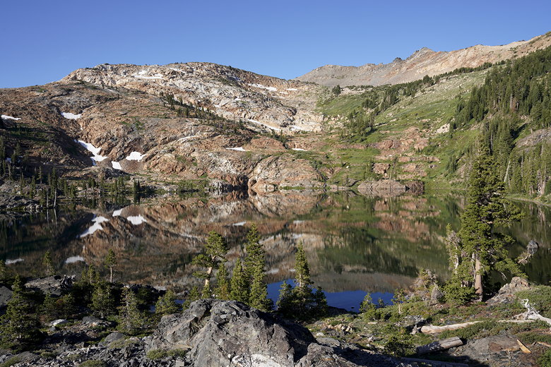
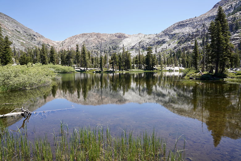
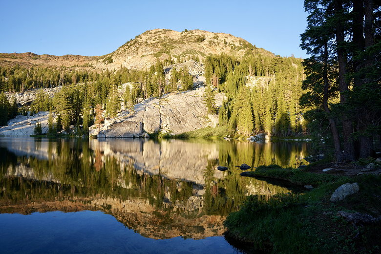
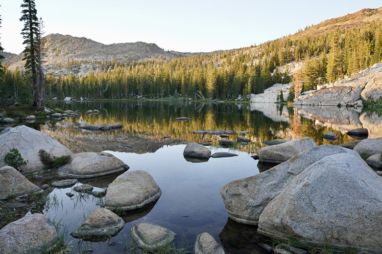
Reflections in Lake Lois
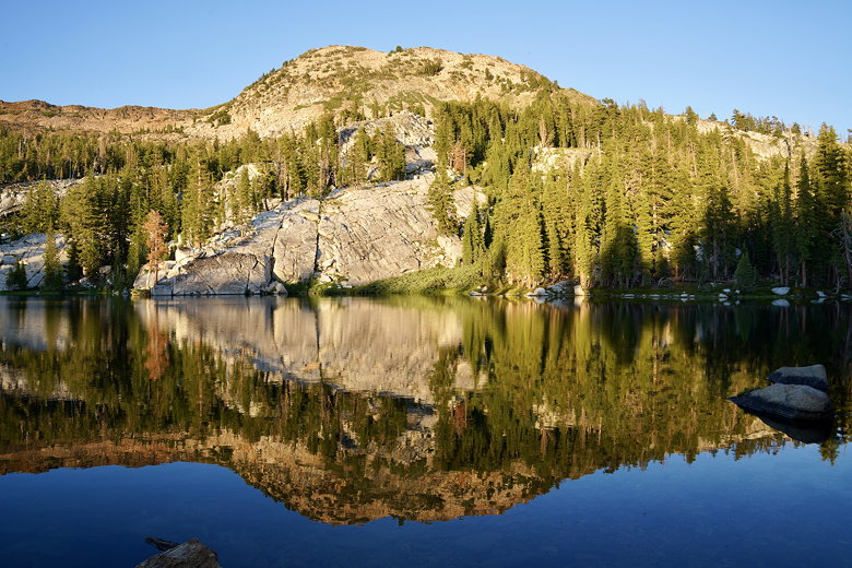
Rocky terrain above our campsite at Lake Lois

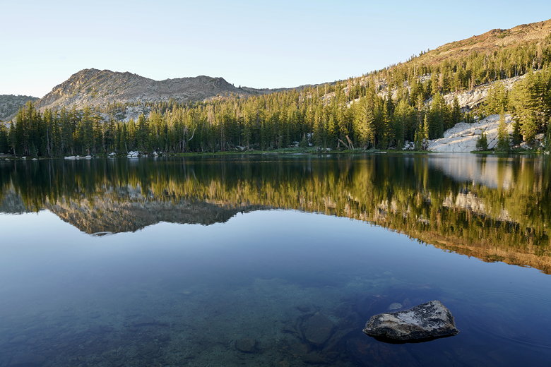
Lake Lois from the outlet stream

Lake Lois reflections
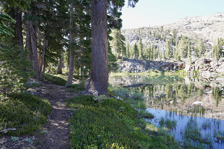
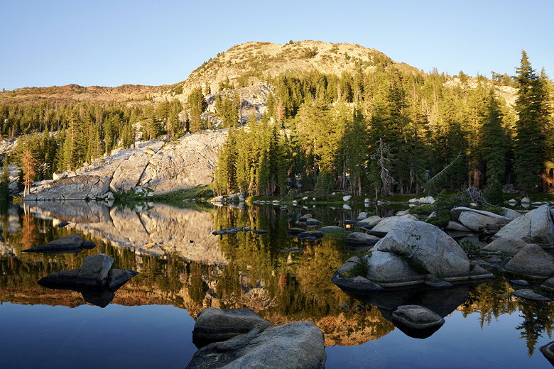
Trail next to Lake Lois
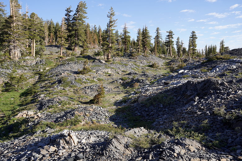
Soon the lake was behind us and we continued to climb, with views to
the east across Rockbound Valley. There were lots of wildflowers
along the trail as we climbed up toward an intersection. 10 years
ago we took the left fork to descend into the valley and continue on
to Clyde Lake. This time, we rook the right fork, climbing briefly
before reaching Lake Doris.
Lake Doris
It didn't look like anyone was camping at Lake Doris. We took a brief
break here in the shade above the shore. Then we continued uphill
toward Rockbound Pass. From the lake it's only about a 200 foot climb,
partly shaded and not too bad. We enjoyed the view from the pass
briefly before continuing down the other side. Here, we saw many
hikers coming uphill - mostly backpackers, but also some day hikers,
probably all of them coming from Wrights Lake. I felt a little
sorry for some of them, as the hike up this side of the pass is much
more difficult than the one we had come up.
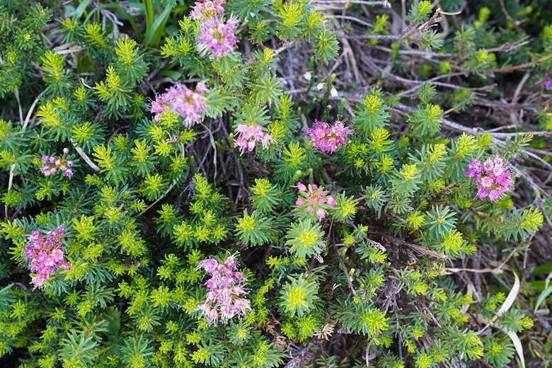
Flowers near Lake Doris
Lake Doris from the climb up to the pass
For us, it was a steep rocky descent. It was marred at one point by a large tree
completely covering the trail lengthwise. It was hard to decide whether to
go over or around. We decided to go over, though that meant we had to
perform the difficult maneuver of coming down from the tree at the end.
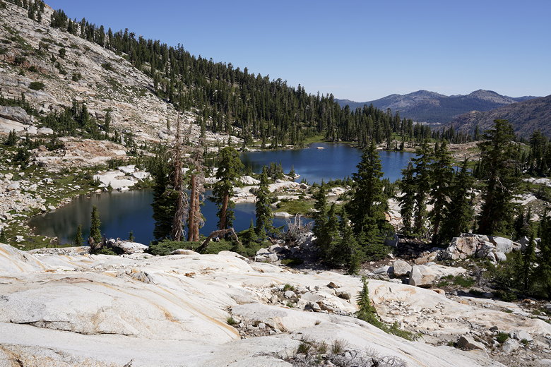
On most of the mostly unshaded descent we had a clear view of Maud Lake below.
We eventually made it there and settled down for a break. A solitary duck
swam past us as we ate our lunch. The lake was busy with day hikers and people
resting on their way up.

Descending from Rockbound Pass
Maud Lake
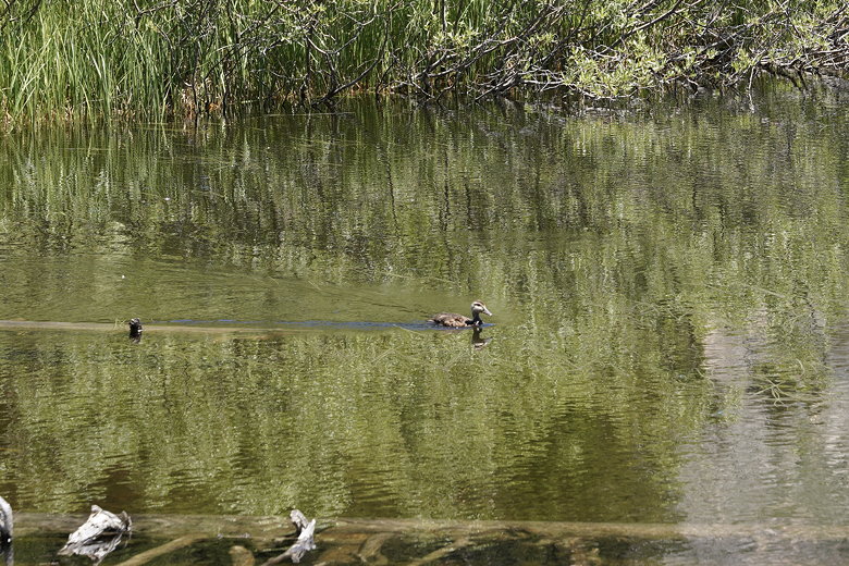
Duck at Maud Lake
Maud Lake (Rockbound pass behind on the left)
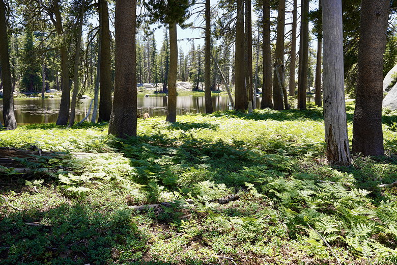
After our break we continued on, descending steeply to the edge of a forest.
We were looking for the intersection with a trail that would lead us to
the Red Peak Stock Trail, but didn't see it. I checked the GPS and it said
we should have seen it. Eventually I found an unmarked (not even a rock stack)
gravel path on the edge of the forest. I followed it briefly while the others
waited, seeing that it looked mostly ok, but was blocked by a tree a little
further on (though we'd experienced many downed trees on our trip already).
I was concerned that the trail was unmarked and perhaps decommissioned.
Admittedly, my trail map was over 20 years old, so when a couple of hikers
came by we asked them if they had a more recent map. They were using a phone
app which also showed the trail, though it said "unmaintained".
I don't know if the trail was ever really maintained, but the fact that the trail
was still on their map gave us some confidence to continue. We headed along
the gravel path, walked around the downed tree, and continued on the trail.
Despite the fact that it was "unmaintained", it may have been in better shape
than many of the "maintained" trails we had already used on this trip.
Rock stacks marked the way when the path wasn't otherwise clear, but we were
never in danger of losing the trail, and none of it was overgrown.
Soon enough we reached an unnamed lake, then continued through the forest to
the end of the trail. At this intersection there was at least a rock stack
marking the trail (though no sign). After a brief break here we turned left
onto the Red Peak Stock Trail and reached the Barrett Lake OHV road.
We turned right onto the road, which I would say is a road for crazy people.
I mean, we could tell it was a road of some sort, but there were so many
boulders sticking out from the ground that it seemed crazy that anyone
would drive it. We did not see anyone drive on the road while we hiked
it, though I imagine some people must have during the past long weekend.

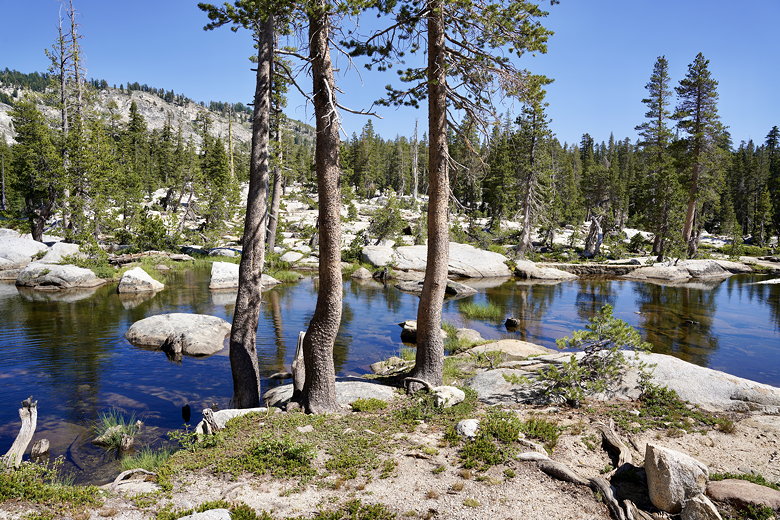
Unnamed lake
Unnamed lake
It felt like cheating at one point, with easy downhill hiking on a good
surface, in stark contrast to the narrow, rocky, hard-to-follow trails
we'd been on earlier. It was a bit short-lived, however, as the trail
soon started climbing again, though at least it was still wide and easy
to follow.
After a stiff climb we reached Barrett Lake. There are large campsites
here, even a toilet, but no one else was here. We found a nice spot next
to the lake to take a break and filter water. I again dunked my hat in
the water and drenched myself with it (and again it dried in minutes).
Barrett Lake

Barrett Lake
After a nice break, we walked to the end of the road to find the trail.
Except we ran into a dead end. We backtracked and found the trail,
which was unmarked and easy to miss. The trail climbs steeply away
from the lake, then reaches an almost imperceptible intersection.
There's a sign high up on a tree that simply says something about the
wilderness, with no mention of a fork. If you weren't paying attention
you'd stay on the right fork and end up at Lawrence Lake. I was paying
attention, though, and took the left fork through the forest.
It was starting to get a bit late (around 5pm I think), and we considered
camping at Lake No. 5 instead of continuing to our planned destination.
But when we reached Lake No. 5 we saw that it was a marshy uninviting
place and just kept going.
We exited the forest and reached a phantom intersection. What I mean is
we found a stack of rocks and what looked to be a trail going left and one
going right. Except my map didn't show any such intersection. I knew the
trail we wanted had to go up to the right, so that's what we took.
Now that I look at the map, I suspect that other trail goes to Lake No. 4.
We followed the rock stacks up a steep climb before reaching a surprisingly
signed intersection. It was the first sign we'd seen since the intersection
before Lake Doris so long ago this morning. In the meantime we had seen so
many unsigned or unmarked intersections that it seemed almost laughable that
this one was signed. Like, if you made this far, now we'll finally tell you
where you are.
In any case, we turned right and headed on the easy trail to Lake No. 3.
It's flat to the outlet stream. We crossed over the stream and then made
a brief climb through the forest to reach the lake.
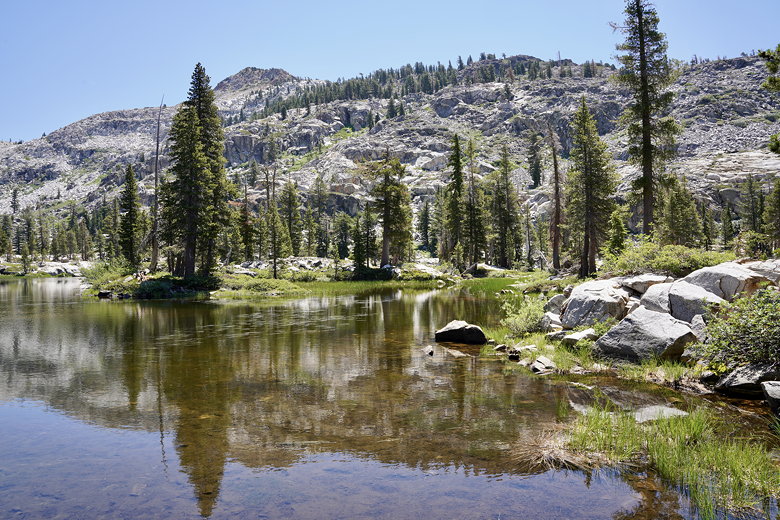
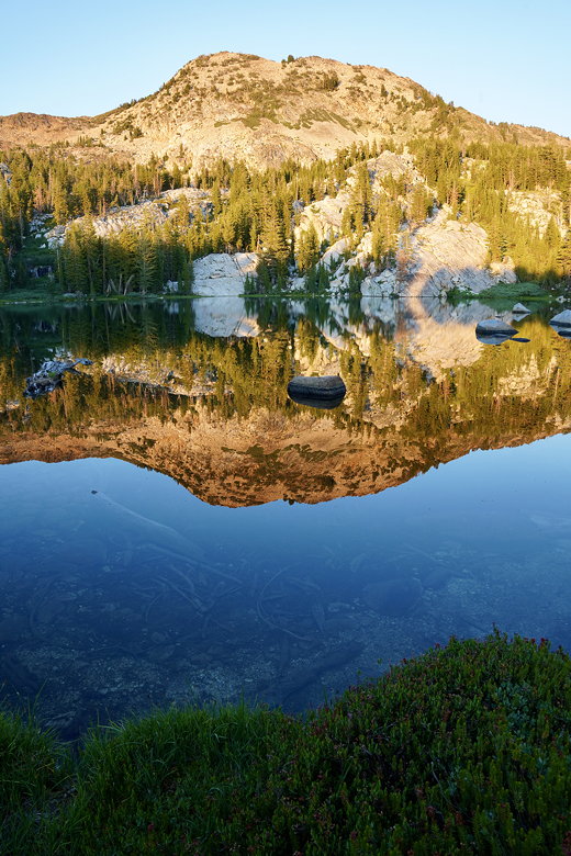
I have to say, Lake No. 3 exceeded my expectations. It was a beautiful lake
with plentiful campsites, and absolutely no one else was there. Mountains
rise above the eastern and northeastern shores. Forest lines the rest. There
are several good campsites in the forest on the western side, and we picked
one. And, to top it off, mosquitoes were not much of a problem.

Lake No. 3
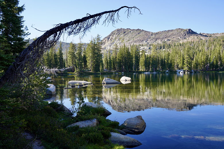
Lake No. 3

Lake No. 3
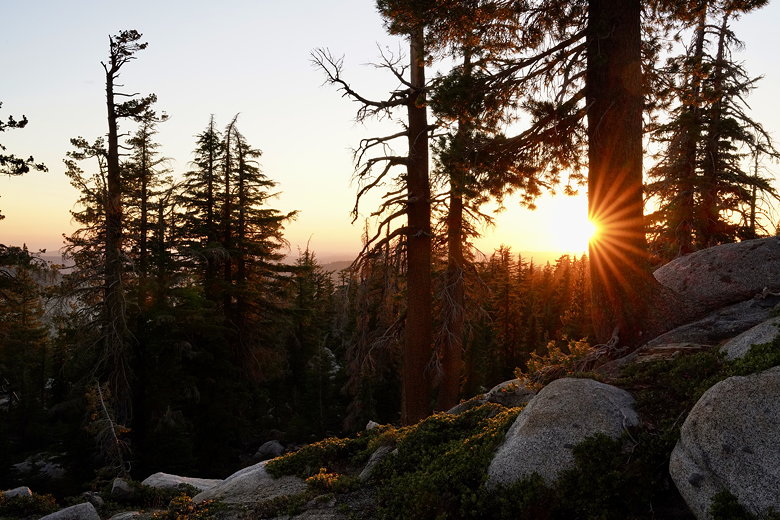
We had time to clean up and enjoy the lake. After dinner the reflections
in the lake were gorgeous. After taking pictures of the lake, we turned
around and looked west out at the sunset. All in all, a great last night of
our trip.
Sunset at Lake No. 3
Sunset at Lake No. 3
Sunset at Lake No. 3
Sunset at Lake No. 3
Sunset at Lake No. 3

Sunset at Lake No. 3

Sunset at Lake No. 3
Sunset at Lake No. 3
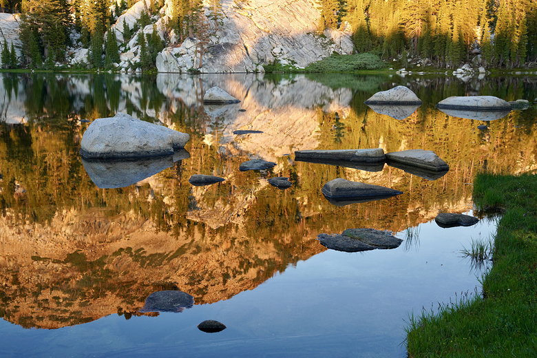
Sunset at Lake No. 3
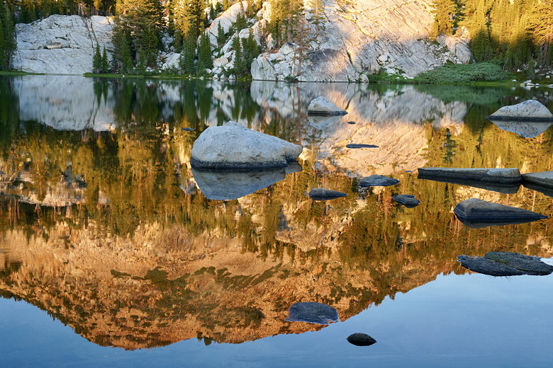
Sunset at Lake No. 3
Sunset
| 

