|
I had originally planned to do the Wonderland Trail around Mount Rainier this year.
However, in late March the park service sent out a message that no reservations
would be offered in 2016. Instead, it would be first-come, first served (they
are moving to a new reservation system for 2017). There was no way we'd plan
and fly up there on the hopes of getting a permit, so I had to scramble to find
alternative plans.
I snagged a 9-day permit beginning and ending at the Wolverton trailhead in the hopes of
planning some loop trip in Sequoia/Kings Canyon. Hiking out of Crescent Meadow
may have been a better option, but all those permits were already taken for the
days I was looking at. My original plan was to hike part of the High Sierra
Trail, down to the Kern River canyon, then head south and return via Mineral King. After I
saw how much distance and climbing that involved, and the fact that I couldn't
get my family to train much, I thought better of it.
So in the final weeks leading up to this trip, I was still trying to figure out a
route. Meanwhile, I had booked us for a 2-night stay in the Wuksachi Lodge, not
far from the trailhead. Friday we did some last-minute packing (and shopping at
REI). I had wanted to leave by 2pm to avoid most traffic, but we didn't
leave until just after 3pm and ran into heavy traffic in Gilroy. I had made
8:30pm dinner reservations at the lodge, but it didn't look like we'd make it.
We called to cancel.
Later, traffic started flowing better and we decided we'd chance it and go to
the lodge for dinner. I knew they had their last seating at 9:30pm, and we should
get there around 9pm. Of course that was before we got stuck behind a car going
up the mountain at 29 mph in a 45-50mph zone. We arrived at the lodge at 9:15pm,
just in time for dinner. After dinner and checking in, I returned to the task of
packing and finalizing
our route.
On Saturday, after breakfast at the lodge, I returned to our room to finalize our route.
I didn't particularly enjoy staying inside during the day while in a National
Park, but it had to be done. I'll spare you all the details, but the gist of it
was that I considered visiting Columbine Lake (and going over Sawtooth Pass)
and Franklin Lake, but eventually settled on the route that we mostly ended
up with: a figure eight route going to Bearpaw Meadow, over Kaweah Gap, Black Rock Pass,
back to Bearpaw, over Elizabeth Pass, then over Silliman Pass and returning to
Lodgepole where we could either hike another 2 miles to Wolverton or take the
shuttle. Well, at least that was the plan if we could fit our 9 days worth of food
into our four bear canisters.
After lunch, having mostly made up our minds, we drove over to the Lodgepole Visitor Center
to pick up our permit. When you reserve the permit, you still have to pick it
up in person from a ranger between 1pm the day before and 9am the day of your
hike. There was no one else at the wilderness desk when we arrived at the
crowded Lodgepole area. After talking to the ranger, we decided that since
there were bear boxes at many of the campsites we were planning to stay at
(including the first 4), we would go for the 9 day trip (since we didn't have to worry
about cramming everything into the bear canisters). He asked us for
all our planned campsites for search and rescue purposes: Ninemile Creek,
Hamilton Lake, Little Five Lakes, Timber Gap Creek, Tamarack Lake, Upper
Deadman Canyon, Sugarloaf Meadow, and Ranger Lake.
Originally I had planned to camp in Ranger Meadow in Deadman Canyon, but
he suggested stopping at the first stand of trees, near the Big Bird Lake
outlet. I said I was a little worried about mosquitoes, and he admitted
that the mosquitoes in Deadman had been the worst he'd seen, but we
were hoping that as long as we camped in the upper (rather than lower)
part of the canyon, it wouldn't be too bad.
After a brief stop in the Lodgepole store, we drove over to the General
Sherman tree. The first thing I noticed was that we had to park far away
from the General Sherman tree - about a half mile and 250 feet above it.
I don't recall having to park here when we did the Congress Trail 17 years ago.
I think that since then they've turned the near parking lot into a
handicapped-only parking area and created a huge parking lot further away.
The next thing we noticed was that while the trail is paved the whole
way to General Sherman, that didn't stop people from going off the trail.
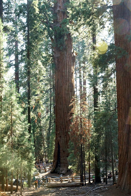
General Sherman
It felt like we were at Disneyland; there were so many people here. When we
got down to the General Sherman tree (supposedly the largest tree in the world
by volume), we saw a line of people waiting patiently to take pictures in front
of the tree. We still enjoyed the views of the sequoias, knowing we'd
leave all the crowds behind starting tomorrow.
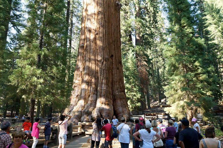
Crowd around General Sherman
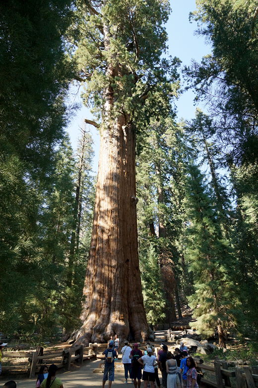
General Sherman
After dinner at Wuksachi Lodge, we returned to our lodge room, watched some
Olympics, and prepared ourselves for a 9-day trip; this would be our longest
segment ever without resupply.
|


